

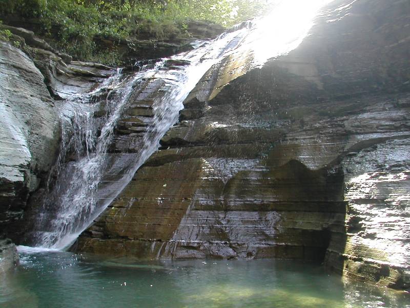
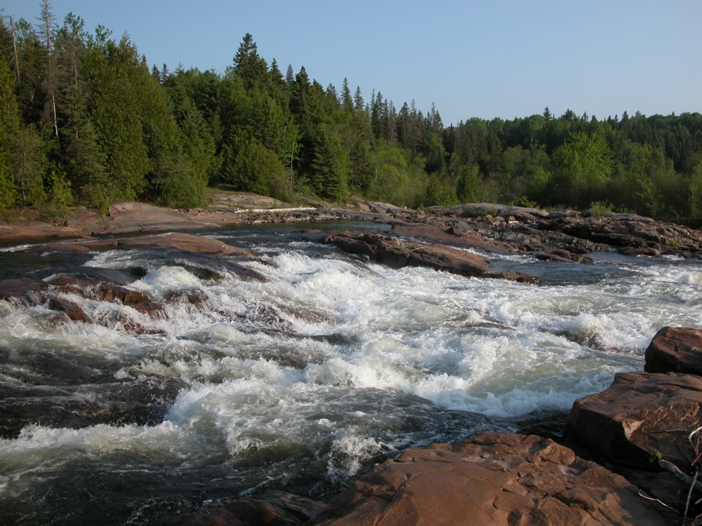
This is a list of minor waterfalls that I have visited. These falls do not get a page of their own because they are either relatively small, isolated, difficult to get to, and/or not overly photogenic. There is no exact science to this. Some of these falls are nice secluded hang outs for the locals, and I am sure that each of these waterfalls is someone's favorite waterfall in all the world, but you have to be more than a little obsessive to go seeking them all out. Another reason for listing many of these falls is that they show up as names in web searches or on maps with little or no additional information. Hopefully this page will let you make a more informed decision about trying to visit these waterfalls.
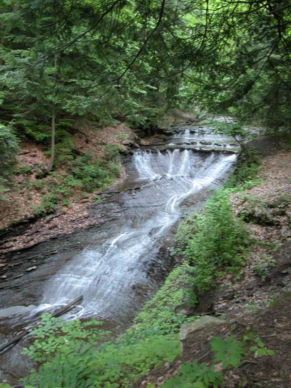
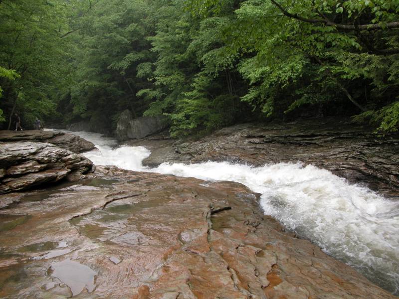
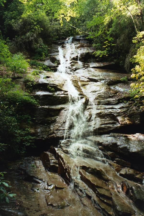
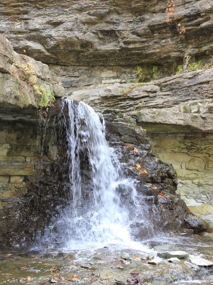
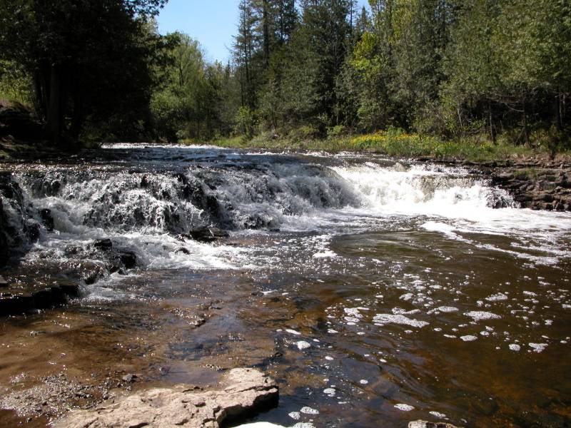
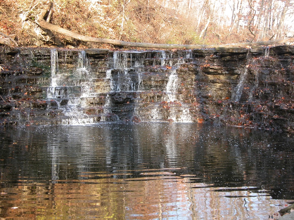
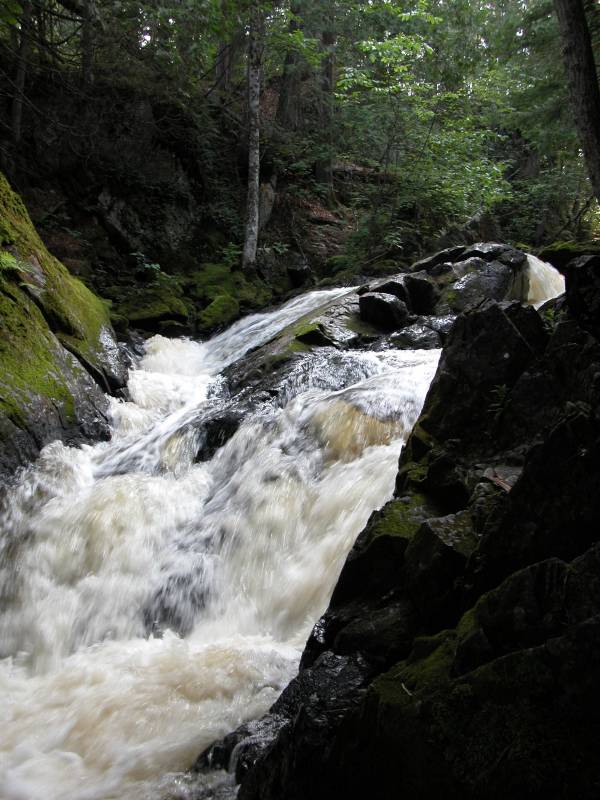
Angel Falls
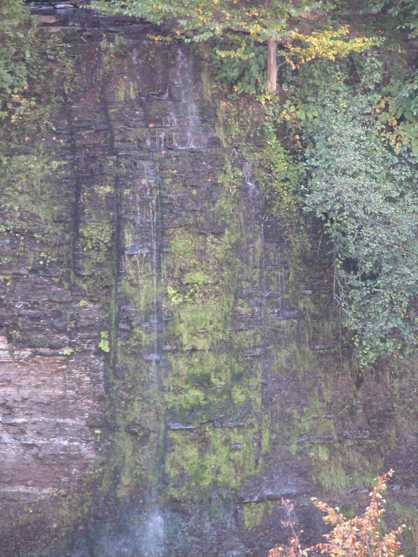
Angel Falls, zoomed in, September 2006

The view from across the gorge.
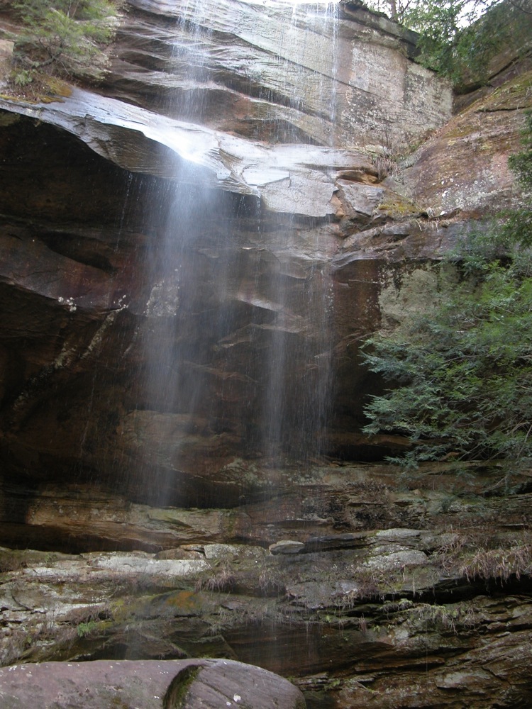
Angel Falls is a 120' foot waterfall located near Naples New York in the High Tor Wildlife Management Area. It falls into Conklin Gully. A 120' foot waterfall sounds pretty exciting, but height is not everything. The waterfall can only be easily seen from across the gorge, from several hundred feet away, and even after a good rain the night before, there was not much water going over the cliff. The falls also faces north, which makes for some difficult lighting on a sunny day.
To see the falls, start at the parking area for Conklin Gully. There is unmarked, steep trail that climbs up the side of the gorge. This is on the left hand side of the gorge, facing upstream. The trail is steep, but you do not have to ever actually climb. Eventually the trail levels out and you can see across the gorge and have a look at Angel Falls, assuming any water is flowing. To reach the base of the falls you would have to climb up Conklin Gully past the big falls. In the winter people climb the frozen falls. They reach the base by rappelling down the cliff.
There are at least two other Angel Falls in New York. The USGS lists the falls in Java Village as Angel Falls. There is also an Angel Falls downstream of Carpenter Falls on Bear Swamp Creek near Skaneatles Lake. A picture of this pretty falls can be found here.
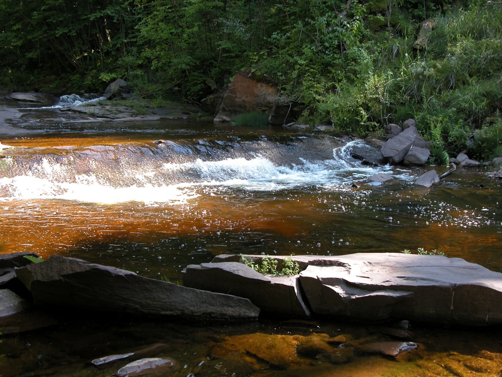
Arkwright Falls
The Main Waterfall, 15', August 2002

A Fall on the left (north) fork
Arwright Falls is near the town of Arkwright, New York. There are several falls in this gorge, the main one being about 15 feet tall. Unfortunately the area is closed to the public. The land is privately owned, and the owners got tired of people trashing the area.
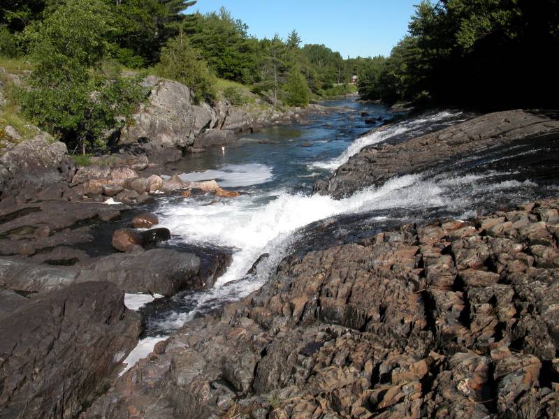
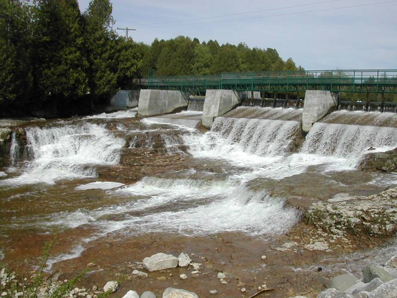
Bala Falls
May 2011
Bala Falls is a long low falls on the outlet of Lake Muskoka. There is a dam at the crest of the falls, concrete embankments line part of the falls, and multiple bridges cross it, so this is by no means a wild waterfall. It is easy to visit however, and quite fierce when the water levels are up.
The falls is located in the town of Bala, and Route 169 spans the falls. There is a large parking area on the south side of the falls and multiple vantage points from which to view them.
There are plans to develop the falls further for power generation.
Bells Falls
May 2010
Bells Falls is a long, low and wide rapids on the Little White River. The falls width can vary depending on water levels, but it is around 30m wide. The river drops about 5m over a 50m stretch. You can easily walk around the bare bedrock alongside the falls.
This is an easy waterfall to visit. It is located in Bellingham, which is located about 10km from Hwy 17. From Hwy 17 head north on Route 546 from Iron Bridge. Turn left on to Route 544. Follow this to Bellingham. The road crosses the Little White River above the falls. Just past the bridge there is a short dirt road on the left. Park at the end of this road, and walk down to the falls.
This is not the sort of waterfall you are likely to go out of your way to see. Both this falls, and Little Rapids can be visited while on your way to the very impressive Aubrey Falls.
Big Eric's Falls
May 2006
Big Eric's Falls is located on the Huron River east of Skanee. The falls consists of a series of drops, each of which are only a few feet high, but around 100 feet wide. It is named for Big Eric Erickson, a logger from the 20's. In addition to the falls, he also has a road, a bridge and a campground named for him (although sometimes the name is spelled 'Erick', so maybe they were named for his father?). Big Eric's Bridge Campground is right next to the falls. The falls are just below the bridge.
To reach the falls head east on Skanee Road until it ends. This is also the end of the pavement. Head right on Erick road for a mile until you reach the bridge. Beyond the bridge are rough, unpaved road, and some wild waterfalls such as Forty Foot Falls. Big Falls, a much larger drop on the Huron River, is several miles upstream.
Big Pup Falls
June 2015
Big Pup Falls is a roadside series of small drops on Big Pup Creek north of Marquette. No individual drop is more than 5 feet, but it is a very pretty little waterfall. A rough trail starts at the road and follows the creek downstream.
The falls is located off of county road 510, just downstream of the bridge that crosses Big Pup Creek. There is room to park on the east side of the road. To reach the falls from US 41 you could head north on country road 502. After .6 miles turn right onto 510, and follow it for 17.5 miles. A longer, but less wild route, is to head north from Marquette on Big Bay Road. After 25 miles turn left on to road 510. After 2.5 miles you will reach the intersection with AAA road and 510. Turn left here, to stay on 510. From here on the roads are no longer paved. Follow this for 7 miles to reach the falls.
Yellow Dog Falls, which is also off of 510, is just a few miles to the north.
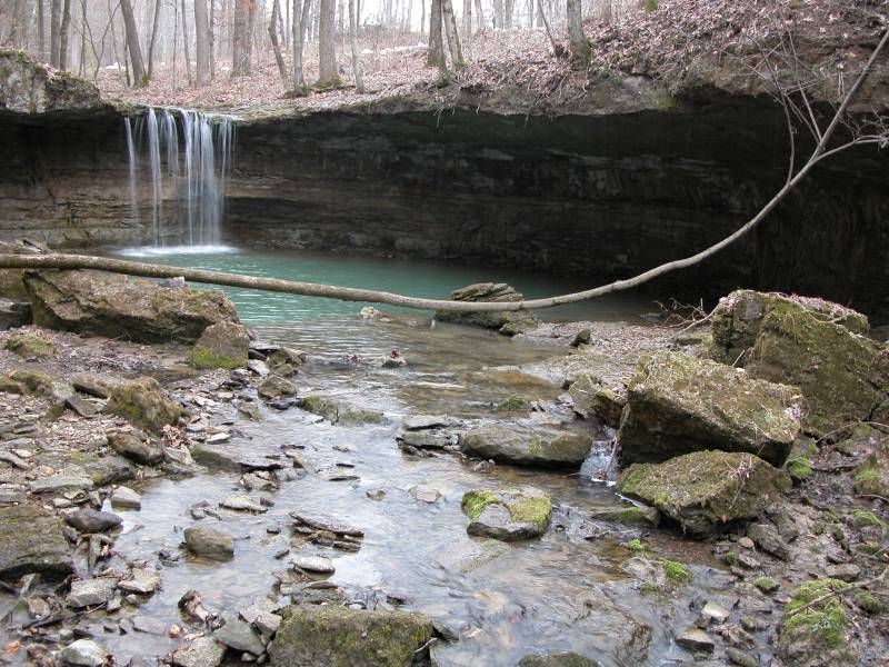
Big Spring Hollow Falls
March 2010
At over 100', Big Spring Hollow Falls is one of the highest, if not the highest waterfall in the Hocking Hills area. If it had more water, this would be a very impressive waterfall, but when I saw it it was a wispy curtain of spray. It is at least 10' wide, which makes it all the wispier.
Reaching this waterfall takes a bit of work. The trailhead for the falls is located off of Big Pine Road east of route 374. There is the parking lot for the climbing and rappelling area of Hocking Hills on the north side of the road. The trail to Big Spring Hollow Falls is on the south side of the road. Head straight towards the hills, taking the first right. The trail basically follows the base of the cliffs, with lots of up and downs. You will quickly pass a seasonal falls, which was nothing but a trickle when I was there. After about a 1/2 mile, you will reach the big falls.
There is a large rock house here, and you can easily walk behind the falls. This is not an easy waterfall to photograph, especially when the sun is behind it, which happened to be the case when I visited. More pictures can be found here.
Blackjack Falls
March 2010
Blackjack Falls is a small roadside falls in the Hocking Hills area. The falls drops just a few feet and is easily viewed from the bridge that crosses the creek just below the falls. The falls is located on Blackjack Road, about a mile northwest of where Blackjack Road meets Route 664. I believe the creek is also named Blackjack. Of the numerous minor falls in the area, this is more likely to have water than most.
This waterfall is listed in the USGS data without a waypoint.
Black River Falls
June 2005
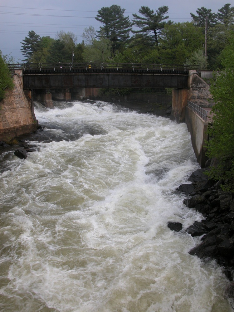
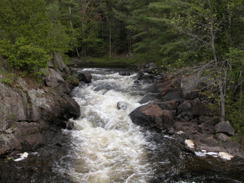
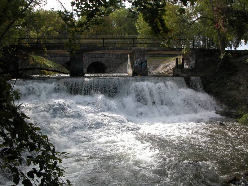
The community of Black River Falls is in western Wisconsin just off of I-94. There are lots of cities and towns with "Falls" in their name, and you just know that there must be, or have been, a waterfall of some sort in the area, and any waterfall hunter is always tempted to go explore these places. More often than not what you will find is a dam, as is the case at Black River Falls. Here the rapids of the Black River, which is a good size river, once dropped 10-20 feet. A large dam now sits on the site, providing power to the town. When water is being released you get a sense of what the falls might have looked like.
I believe this waterfall is also known as Ni-ho-kha-wa-ne-ey-ja. This is the name that shows up at this location in the USGS data.
Bonanza Falls
September 2009
Bonanza Falls is a wide, low falls on the Big Iron River. The falls is at most 10 feet high, but in the spring the falls is 100 feet wide. In summer it is broken up into a number of segments. The bedrock here is tilted back against the flow of the river, creating many obstacles for the water to overcome.
Bonanza Falls is located about a mile south of Silver City along Route 64. This is a sign on west side of the highway visible as you head south for Bonanza Falls. A short gravel road leads to the river. The "Bonanza" refers to the mining boom times of the 1800's.
Bowman Hollow Falls

May 2015
Bowman Hollow Falls is a 20'+ falls near Forkston Pennsylvania, which is about a 15 minute drive west from Tunkhannock. You can get an obstructed view of the falls from above, but if you really want to see it, you will need to walk up the creek about a quarter mile.
To reach the falls from Tunkhannock, head west on US 6 for 6 miles. Turn on to PA 87 and continue about 8.5 miles. Take a slight left on to Main street, and follow it for 1.1 miles. Here there will be a bridge on your left that crosses the creek. If you want to see the falls from above, take the left, and cross the bridge and continue on Burgess Road. Drive for about a third of a mile. You will not be able to see the falls, but you should be able to hear them as they are only a few dozen feet from the road. There is room on the north side of the road to pull off and park, and some short trails lead to brink of the falls.
If you want to walk the creek, stay on Main Street and continue into town. I did not try this, but I am told you can access the creek from here.
Bridal Veil Falls
May 2004
This small, gently sloped 15' high waterfall is in Bedford Reservations Cleveland Metropark, in Cleveland Ohio adjacent to Cuyahoga Valley National Park. From the looks of it there is never a lot of water in this waterfall. Nonetheless it is impressive for a city park to have a waterfall. The waterfall can be accessed from the Gorge Parkway. There is a sign, trail and observation platform. The walk to the falls is short.
Brooks Falls
May 2009
Brooks Falls is a 4' high drop on the New River. It is notable for being over a 1000' wide, but is really not a waterfall, except in the sense of being a navigational hazard. The rapids is runnable. There is a parking area on the west side of the river from where you can view the rapids. The much more impressive Sandstone Falls is a few miles downstream. The parking area is also the trailhead for the Big Branch Trail, on which you can find the seasonal 20' Big Branch Falls.
Burleigh Falls

May 2011
Burleigh Falls is a long, wide cascade between Lower Buckhorn Lake and Stoney Lake. This is a wide falls, separated by several small rocky islands. The entire falls is not visible from land. The falls is located in its namesake town aloung Route 28. The best spot to view the falls is from Old Burleigh Road, on the south side of the falls.
Burleigh Falls is part of the Trent-Severn waterway. Lock 28 circumvents the falls.
Buttermilk Falls
May 2009
Buttermilk Falls is a small falls with a drop of about three feet on Cowanshannock Creek. The falls can be reached by the Cowanshannock Trail. The parking for the trailhead is off of State Route 1033 north west of Kittanning. The trail is crushed gravel, and is mostly level. It is about a one mile walk to the falls. The trail also passes a very seasonal side falls.
Cascade Waterfalls
May 2004
The slides
Ohiopyle State Park's Cascade Waterfalls is located on Meadow Run. Here the stream descends around a total of 10 feet in a series of small drops. It had been raining heavily the days prior to when the pictures were taken. Normally Meadow Run is a much tamer stream and the cascades are much less impressive looking. The trailhead to the Cascades is located near the park office. It is about a 1/2 mile walk to the falls.
Right along route 381 downstream of the Cascade Waterfalls you will find the natural waterslides. Here Meadow Run twists through a section of smooth and slippery rock and people join it for the ride. Of course if the water is too high, as it is in the pictures, this would likely be fatal, but later in the summer it is a fun ride. There is a parking area for the Slides right off of 381.
Cataract Falls
July 2004
Cataract Falls is north of Blind River Ontario, right along Rte 557 which intersects with Hwy 17 in Blind River. The waterfall is only about 6 feet high. There is a lot of rock to climb around on and a natural whirlpool downstream that you can float around in. A sign on the bridge labels this as the Cataract River, but some sources say the falls is on the Blind River. The falls are close to where the river flows into Lake Duborne. The Blind River flows out of Lake Duborne.
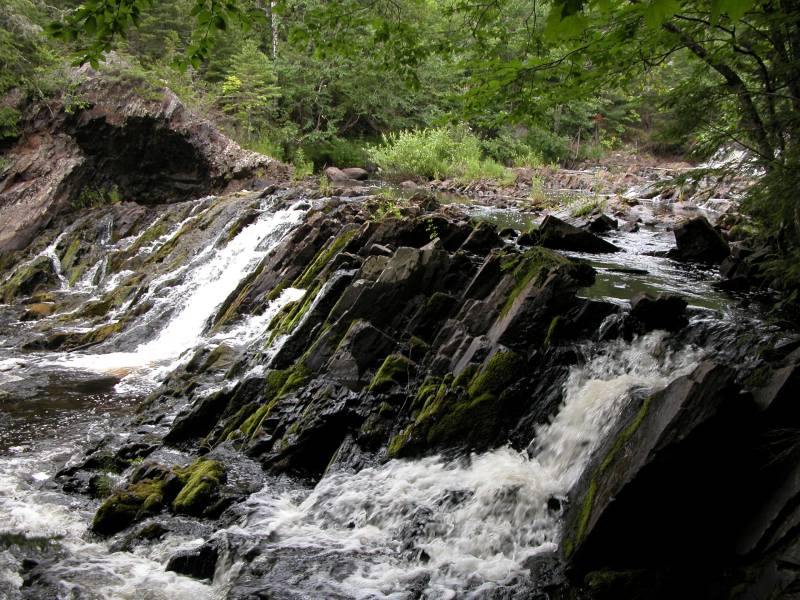
Chicagon Falls

August 2001
This waterfall is a few miles outside of Crystal Falls MI (the falls Crystal Falls was named for has been destroyed by a dam). The falls is near Bewabic State Park and you may be able to get directions from the park. I am unclear on whether or not the falls is open to the public. I visited it in 2001, and as far as I know it was okay to do so then. There seems to be some question about the path people commonly took to the falls trespassing on someone's private property. To play it safe I will not give any directions to the falls. Besides I am not sure I really remember how I got there. Here is some help from MapQuest. You can ask the locals for more information.
The falls is about 15 to 20 feet high in a very shady spot, making it a challenging one to photograph. I was not real pleased with any of the pictures. There are lots of interesting trees and rocks around the falls. You can climb out on the rocks at the base of the falls.
Coopers Falls
May 2011
Coopers Falls is a decent sized drop on the Black River in the town of Coopers Falls. Unfortunately the land all around the falls is private, so you cannot get close to it on foot. The only view available is from the side of Route 6, aka Coopers Falls Road, as it winds its way through town. You can see the falls from the road if you are driving east. There is no room to pull over right by the falls, but there is some space a bit farther down the road. You can walk back to take a picture. Be careful. The road is steep and curved sharply.
Deadline Falls
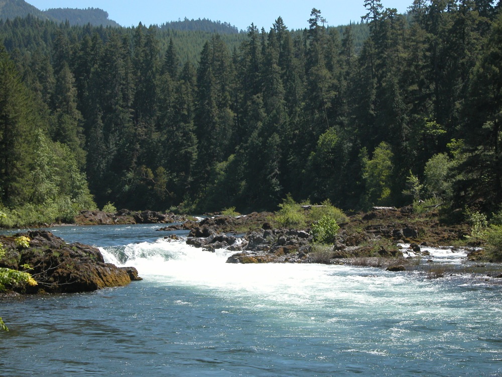
June 2008
Deadline Falls is a low wide drop on the North Umpqua River. The falls is only 12' high, but it is 75' wide. It is the largest of several drops on the river. The falls is easy to visit, being alongside Route 138. Route 138 leads on to many much more impressive falls, such as Watson Falls. Salmon can often be seen jumping Deadline Falls.
Eric's Falls
May 2006
Eric's Falls is located on the West Branch of the Huron River east of Skanee. This, like Big Eric's Falls further downstream, is named for Eric Erickson. This is a small falls, with a drop of at most 5 feet. The falls is easy to reach, if a bit out of the way. Take Black Creek Road south from Skanee Road for about 3 miles. Take a left. The road should immediately cross a bridge. The falls is just below the bridge. There is a larger falls downstream (West Branch Falls) but it is on private property. Big Falls is also nearby.
Explorers Falls
September 2009
Explorers Falls is a small waterfall on the Little Carp River downstream of Trappers Falls. It is so small that I am not even sure that this is a picture of Explorers Falls. This is a picture of a rapids between Trappers Falls and Traders Falls in roughly the vicinity of where Explorers Falls is supposed to be, but the real Explorers Falls may be another rapids. This is over 3 miles from the nearest trailhead. The hike along the Little Carp River is quite scenic, but Explorers Falls is not one of the highlights.
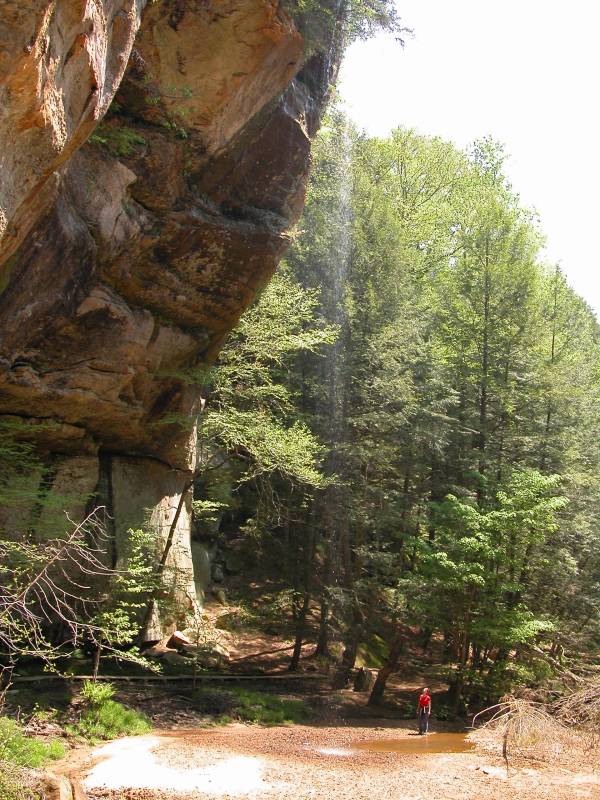
Falling Water Falls
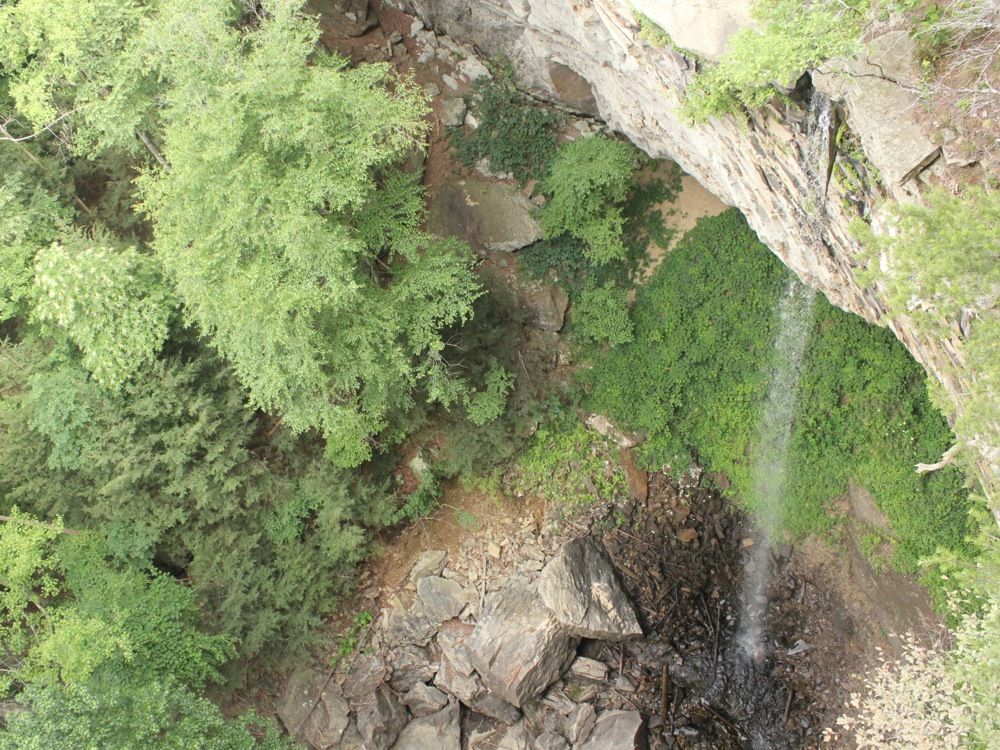
June 2014
Falling Water Falls ia a 110' plunge falls located in the Cumberland Plateau above Chattanooga Tennessee. The falls and the gorge below are part of the Falling Water Falls Natural Area. The falls can be accessed most easily from above, but it hard to get a good view of the falls. There are no barriers here, and the drop is severe. There is a small parking area off of Forest Park Drive on the top of the escarpment. A short hike leads to the falls.
It is possible to access the falls from below, but it requires a bushwack up the creek, and there is no official parking.
Furnace Falls
May 2011
Furnace Falls is a small but scenic drop on the Irondale River. The falls is only a meter or two high, and is better described as a rapids. There is a roadside park next to the falls, making it very easy to visit.
The falls is located next to Route 503. There is also a town named Furnace Falls, about a kilometer to the south. The town is not on Route 503, so if you drive through town you will not see the falls.
The falls faces west and is especially pretty near sunset.
Gile Falls
July 2004
This small waterfall southwest of Hurley Wisconsin in the town of Gile is on the West Branch of the Montreal River. There are two main drops here with a sharp curve between them. The total drop is listed at 15 feet.
Gile Falls is off of 77 west of Hurley. To reach the falls park at the fire station off of 77. In the southeast corner of the parking lot there is a hiking/cross country ski trail. Follow this trail and it will take you to a bridge just above the falls. This trail skirts one of the impressive man made hills here. The hills were created during the mining era.
Some directions tell you to take Kokogan Street to Gile Falls Street. However there are signs posted here saying the trails are closed and large piles of deadwood block the trails.
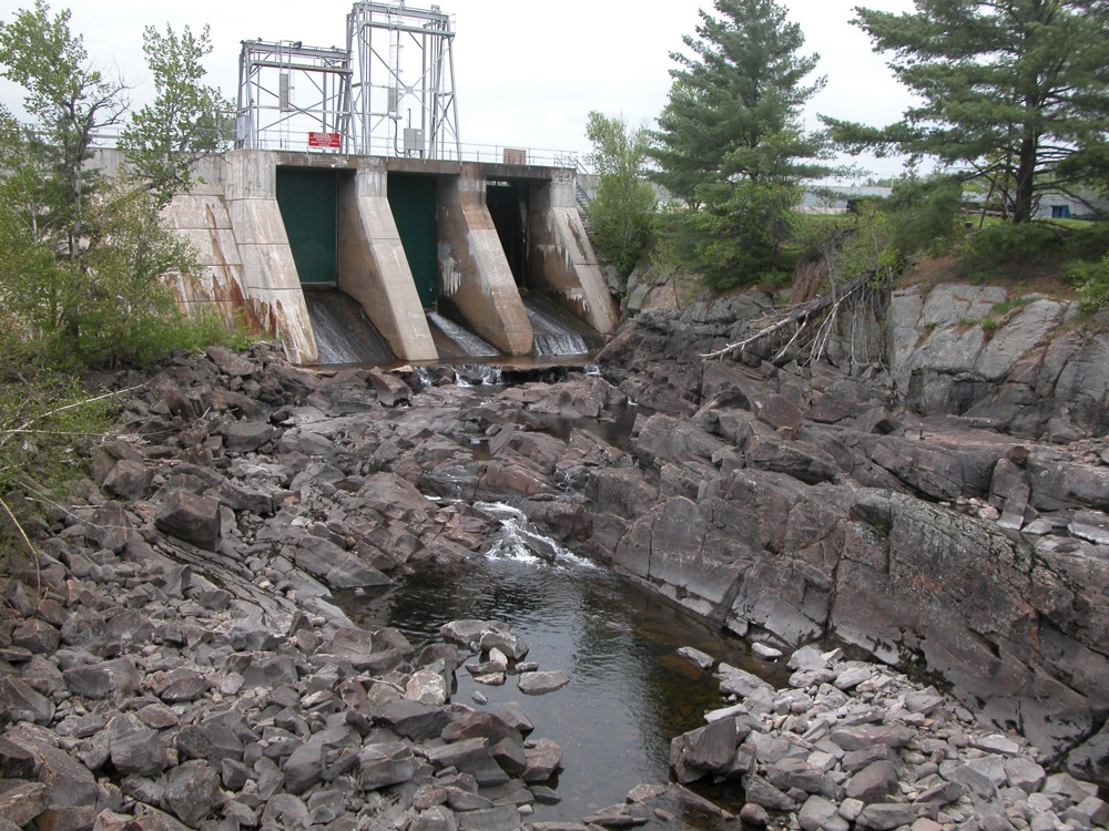
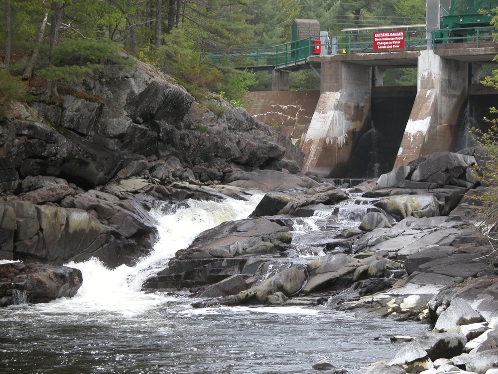
Great Falls
November 2006
The Great Falls on the Caney Fork has been severely altered by the Great Falls Dam. The Caney Fork River is one of the major tributaries of the Cumberland River, and carries a lot of water. It is unclear what the falls looked like before the dam was built. The rocky and mostly dry river bed is several hundred feet wide. There are a couple of spots where the little water that still flows drops about 20 feet. I do not know if larger drops existed behind the dam. Originally this was probably a large and fierce cascade.
There is an overlook and trails that will take you down to the river bed. From the looks of it, the river still runs high once in awhile, so keep an ear out for sirens.
The construction of the Great Falls Dam resulted in the accidental creation of Twin Falls, which can easily be seen from Great Falls. You can walk down the river bed towards the falls, but the outflow from the power house will prevent you from reaching the falls.
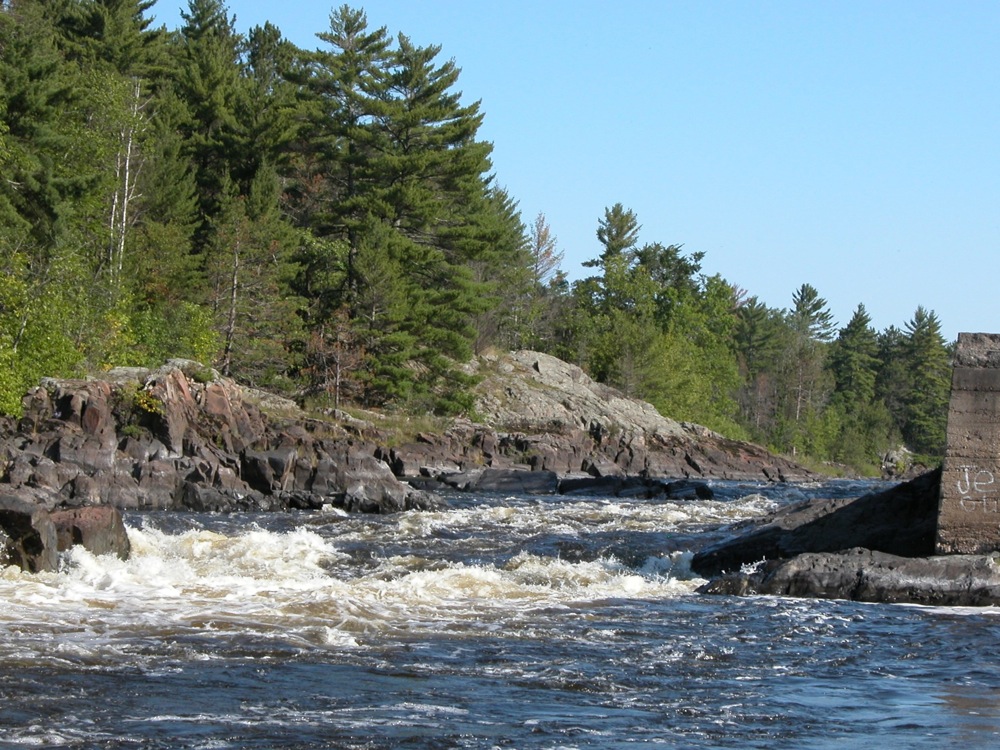
Like many large historical falls, Great Falls shows up on maps.
Greenstone Falls
September 2009
Greenstone Falls is a small scenic falls on the Little Carp River. The falls is about 20' wide, and less than 10' high. This is the most easily reached of the "backcountry" falls in Porcupine Mountains State Park, being about 1/2 mile from the trailhead. The trailhead to the falls is at the end of Little Carp River road. If you continue on the trail for another 2+ miles you will reach the much larger Trappers Falls.
Hidden Falls
June 2005
This small waterfall is located in St. Paul. It is located in Hidden Falls Regional Park, which is right across the river from Minnehaha Park and Minnehaha Falls. This is a small falls and does not have a lot of water. It had been raining heavily the day before the photo was taken.
From Minnehaha Falls, cross the river on 46th Street/Ford Parkway and take the first right. This twisty road is Mississippi River Blvd. The entrance to the park is on the right just after one of the turns. The sign is not real easy to see when coming from the north. Once in the park, park at the first parking lot, and walk to the right (north) to find the falls.
There is a long trail that follows the shores of the Mississippi River that cuts through the park. They are also picnic areas and restrooms.
Indian Falls
Main Falls, September 2006
Small Falls
Indian Falls is in Indian Falls New York. There are many towns with 'falls' in there name, and you know that at one time there must have been a waterfall there. In many cases dams have replaced the falls, but Indian Falls still has its waterfall. The waterfall is on private property and there is no good place to get a view of it from the road. There is a bar and grill next to the falls from which you could get a decent view of the falls. Unfortunately I was there at 10 in the morning and the bar was not yet open.
The falls is on Tonawanda Creek and appears to be about 20 feet high, and 50 feet wide. Indian Falls is on the Onodaga Escarpment, which is responsible for a number of falls in Western New York, including Akron Falls. Upstream about 1/2 mile of Indian Falls you can find Little Falls. Just follow Little Falls road and look for a parking area on the left side of the road. This is a cascade with a gradual drop of 5 to 10 feet. The land around this falls appears to be public and there are some trails along the river bank that lead to the falls.
There is a 6 foot high Indian Falls in nearby Lockport New York.
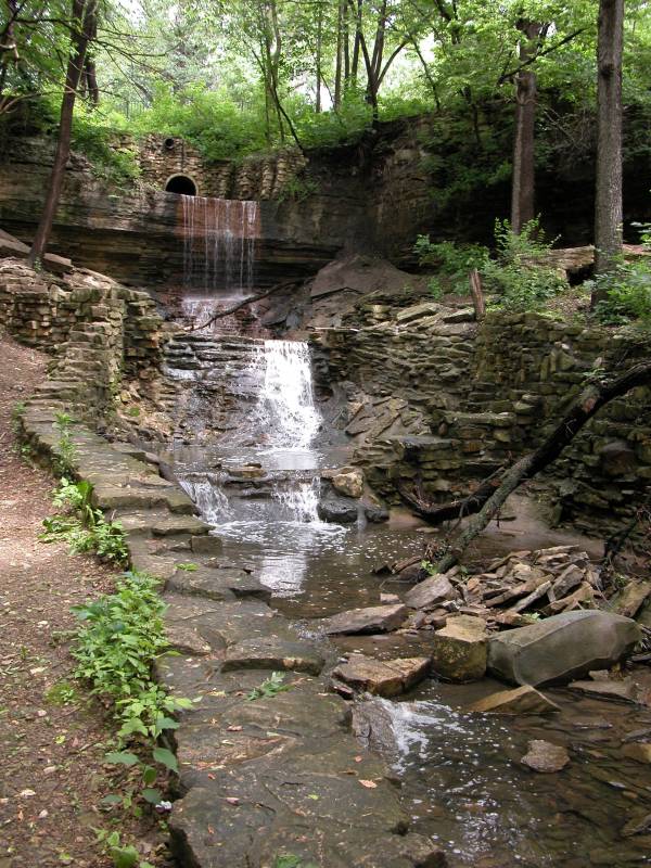
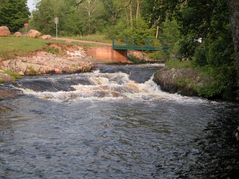
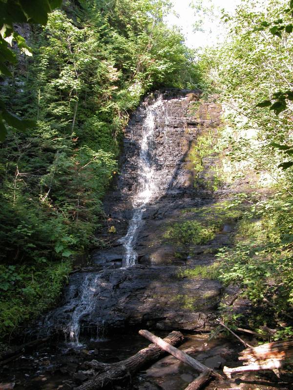
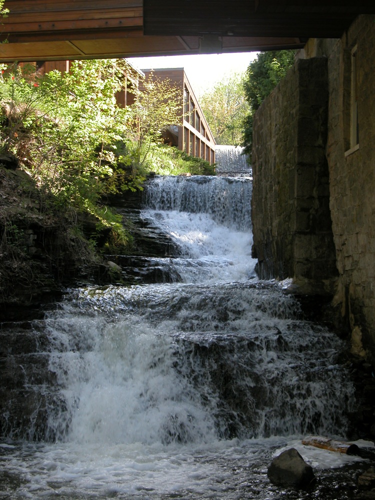
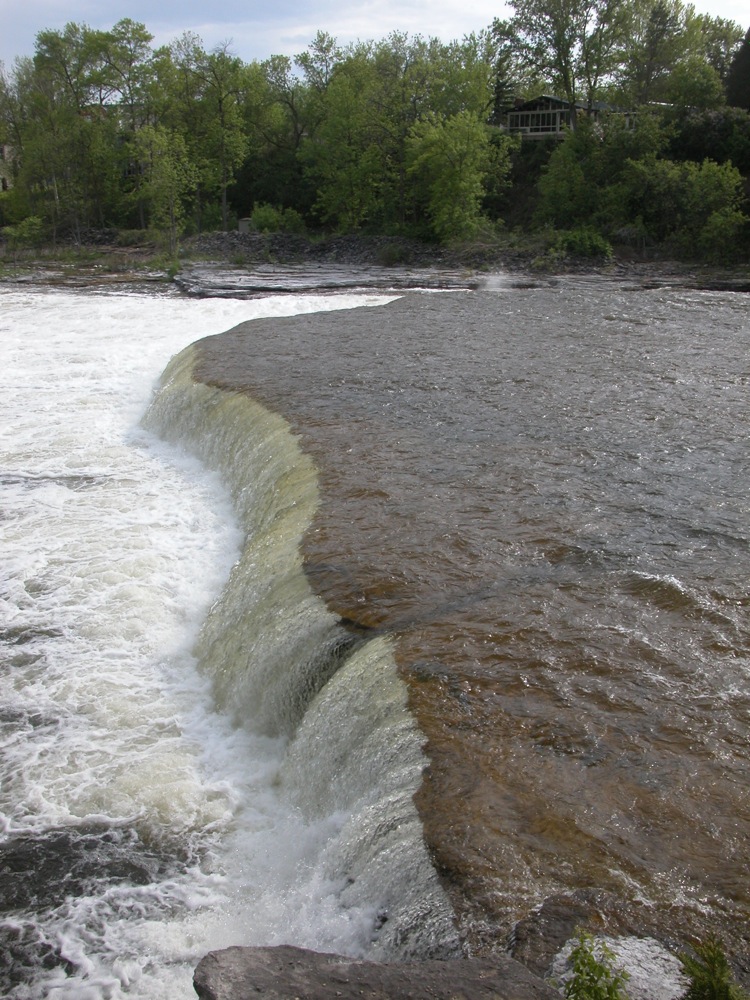
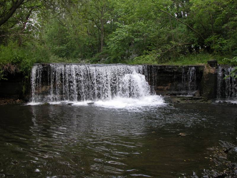
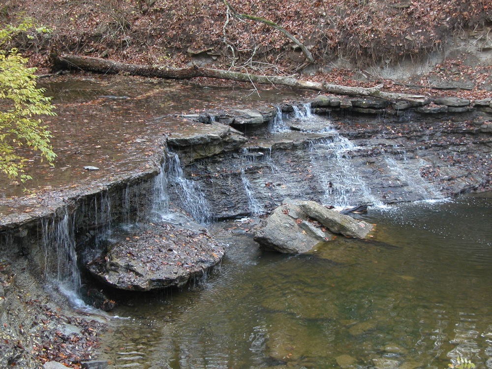
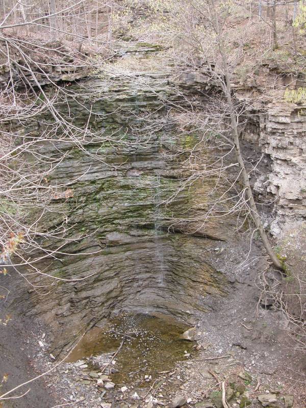
Java Village Falls
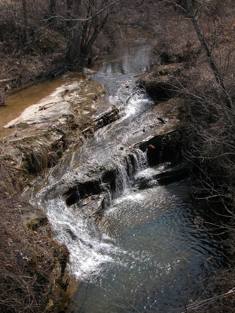
May 2010
Java Village Falls is an 8' drop plus some small cascades, located in Java Village New York, alongside Route 78. The falls is just above the bridge. You can walk up the creek. I do not know if there are any other drops worth seeing.
This falls is listed as Angel Falls in the USGS data.
Jones Gap Falls
May 2002
This small 50' waterfall is in Jones Gap State Park in South Carolina. Jones Gap State Park is 25 miles northwest of Greenville off US 276 and 11 miles northwest of Marietta. The Falls is roughly 2(?) miles from the Jones Gap Trail trailhead. The falls themselves are not particuarly impressive, but the general area is quite lovely. The trail follows the Middle Saluda River closely. There are lots of cascades and small falls along the river.
Misty Cavern Falls is another small waterfall in the area. From Jones Gap State Park, you can hike to Ceasar Head State Park (the two are adjacent). The impressive Raven Cliff Falls are at Ceasar head. Unfortunately I did not know this when I was down there. The 100 foot Falls Creek Falls are also quite close by.
Jumbo Falls
June 2015
Jumbo Falls is small, remote and wild waterfall. It is a 20' wide, 6' high drop on the Jumbo River west of Marquette. The falls is located off of MI-28, about 16 miles east of Bruce Crossing, and about 22 miles west of the US-41 junction. Turn south on Golden Glow Road. This is a dirt road. Follow this for 1.6 miles and take the first left. Follow this road. There will be a fork after .3 miles. Keep to the left, and follow the road until about 1 mile until it ends. The falls are a short distance from the parking area. You will be able to hear them.
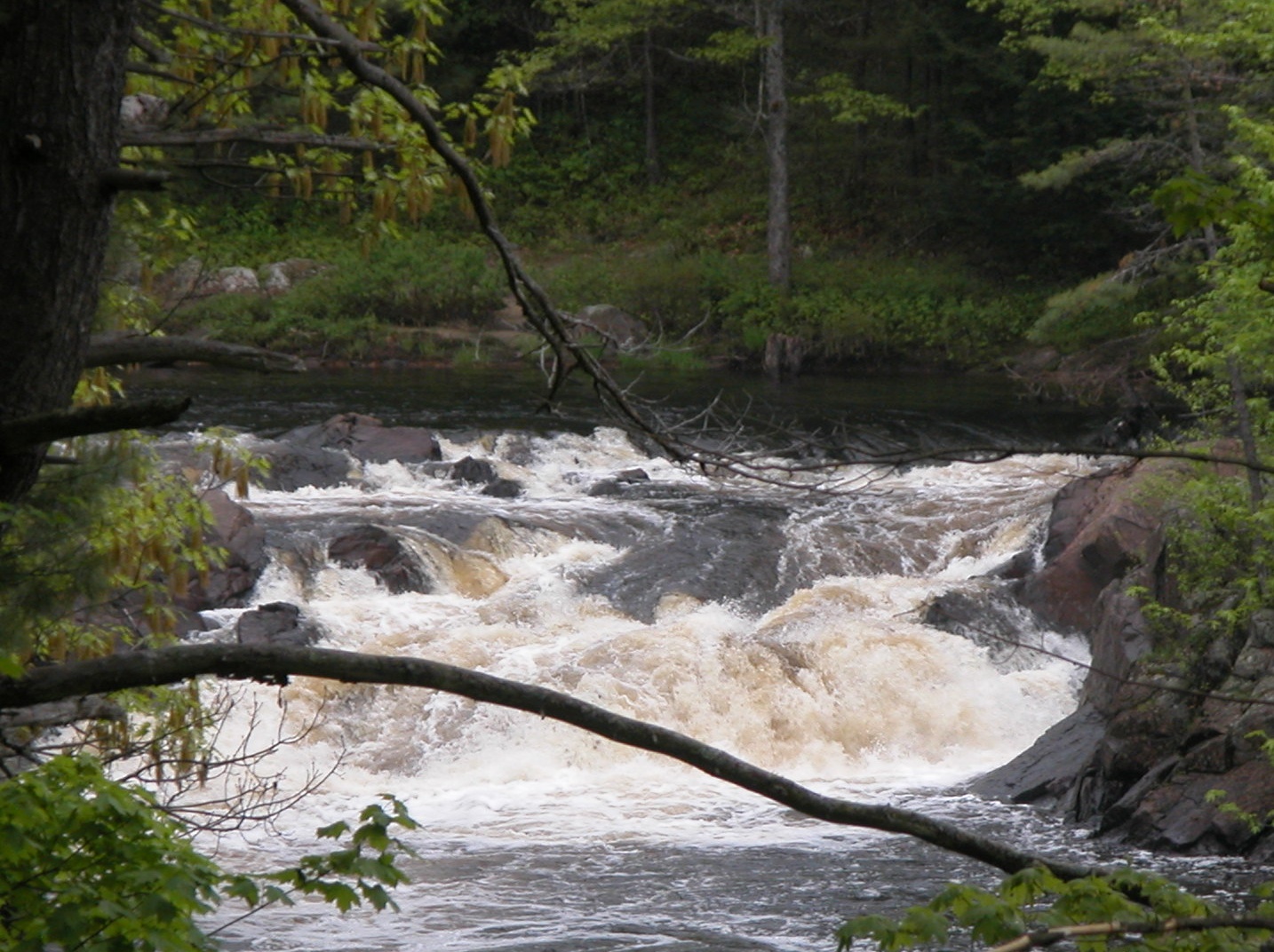
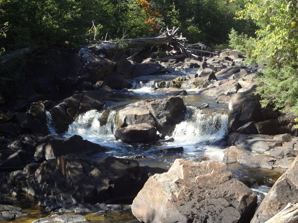
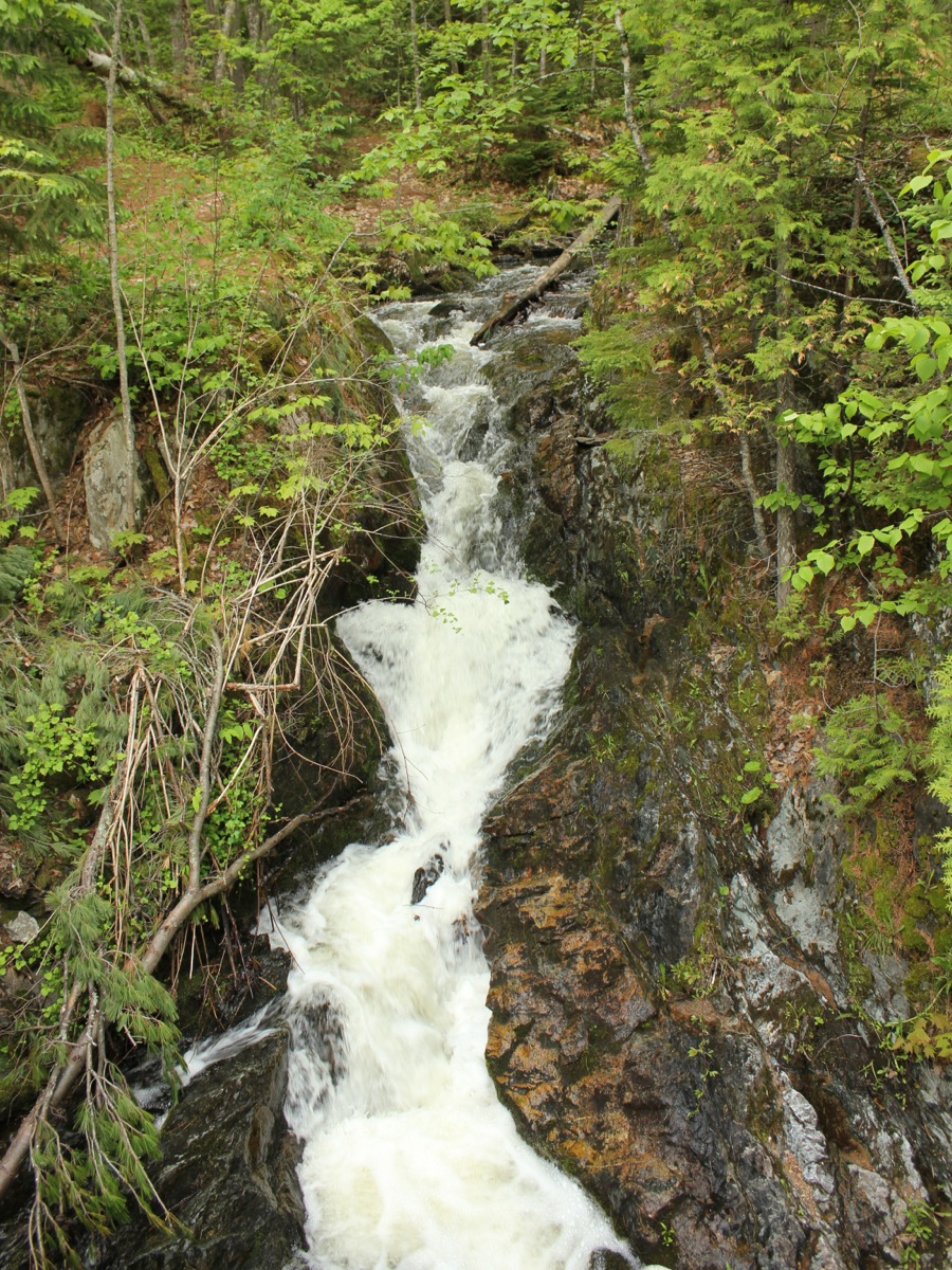
Kakabika Falls
June 2015
Kakbika Falls is a series of falls on the Cisco Branch of the Ontonagon River. This is a complicated waterfall. The river does an S curve with a number of cascades and drops. No drop is particularly high, and there is no vantage point from which you can see all the falls.
I visited this falls on a bright sunny day, which made photography difficult. The picture shows the final drop which is a long narrow chute.
Kakabika Falls is located off of US 2 about halfway between Watersmeet and Marenisco. Turn north on to Road 527 and head .5 miles to the bridge. There is a parking area just south of the bridge. Park here and hike downstream to see the falls. There is a trail.
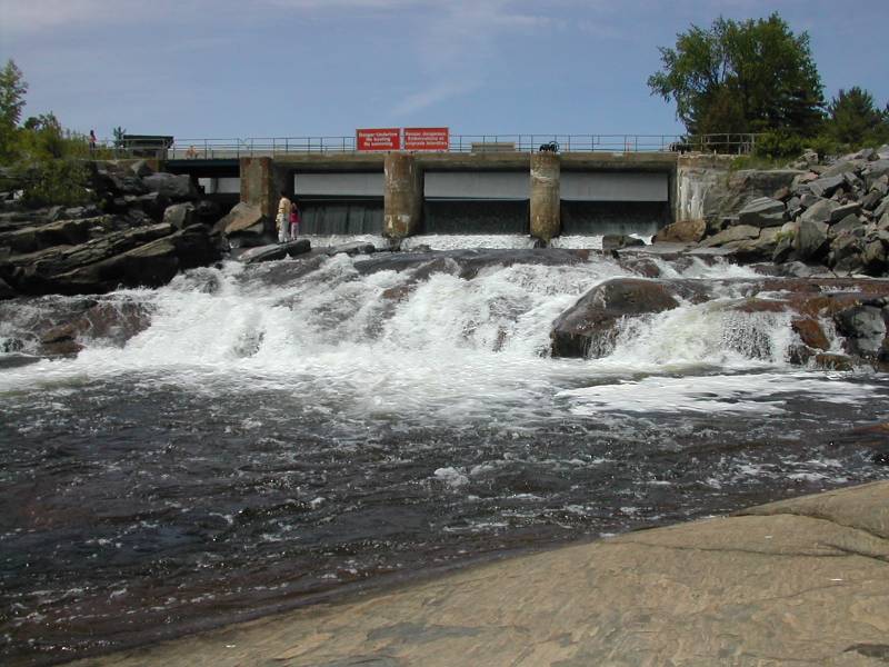
Kennebec Falls

July 2004
Kennebec Falls is a small waterfall right along Hwy 17 in Ontario, roughly halfway between Blind River and Massey. If you are heading towards Chutes Provincial Park or Manitoulin Island from the west you will drive right past this waterfall. It is visible from the bridge. There is a small "parkette" here, although it was closed due to bridge repairs. The waterfall is only a few feet high, but it is 100 or more feet wide. There is a micro hydro-electric plant here run by the Serpent River First Nation.
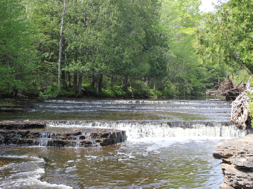
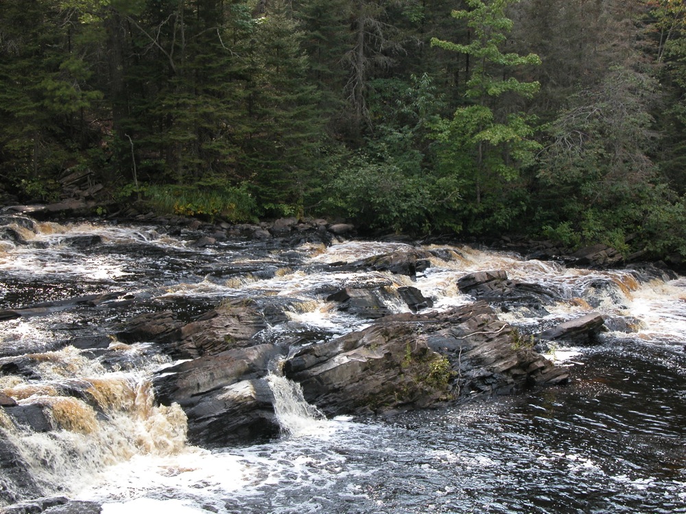
Keshena Falls
October 2006
Keshena Falls is a low wide waterfall on the Wolf River. The Wolf River originates in northern Wisconsin and its waters eventually reach Lake Winnebago and then Lake Michigan's Green Bay by means of the Fox River. The upper stretches run through a rough rocky land and there are many rapids and small falls. Big Smokey Falls, which is few miles upstream of Keshena Falls, is the biggest drop on the river. At Keshena Falls the river gradually drops 10-20 feet. The river is very wide here, and the falls consist of three or more large segments. There is no spot where you can see all of the falls. In addition to the falls there are the remains of an old bridge an hydroelectric plant here. The falls are on the Menominee Reservation and are culturally significant.
They were repairing the bridge the day I visited. I do not know if better views can be found on the other side of the river (it is very easy to get to the other side by means of Route 47 but I did not know it). Keshena Falls shows up on my road atlas. To reach it head north from Shawano on Route 47/53. Stay on Route 53 when it branches off from 47, about 10 miles north of Shawano. Keshena Falls road will be on the left a 1/4 mile past the junction.
Kimball Falls
July 2004
Kimball Falls is in Kimball Wisconsin. While driving west along US 2 from Saxon Falls to Peterson Falls you will see a small sign on the south side of the road for Kimball Falls. Kimball Falls is a small rapids in a small park. It is less than a mile from US 2 and easy to get there, so visiting it will not take much time, and it would be a nice area to stop for a lunch break. The sign for Peterson Falls is the same style as the sign for Kimball Falls, but Peterson Falls is far more impressive.
Kokiwanee Falls
March 2005

October 2004
This 20'? waterfall is on the lands of the former Camp Kokiwanee Girl Scout Camp. The land was recently purchased by ACRES and is now open to the public as the Kokiwanee Nature Preserve. The falls is just outside of Lagro Indiana. From US 24 take Hwy 524 south into Lagro. Follow it across the Wabash. Take a right onto Hanging Rock Rd. Follow this until you reach Country Road 300 E. Follow this for a short distance. The park is on the right. A short distance from the parking area a sign directs you along a long, rambling and not always well defined trail that eventually leads to the falls. It is about a 30 minute walk. You can also follow the main trail, an old road, and after about 30 minutes a sign will direct you towards the waterfall. If you are feeling lazy, you can actually drive to within viewing distance of the falls. Just continue on County Road 300 E. Take a right at the stop sign, and then take the next right into the Tailwater Fishing area. There is a parking lot, and the falls will be on the right.
There are some other falls of similar size and appearance along the Wabash. I am not sure how much water any of these falls ever has.
Little Rapids

May 2010
Little Rapids is a small waterfall located in the town of Little Rapids, a few kilometers north of Thessalon. The Little Thessalon river tumbles over a series of small drops, with a total drop of about 4m. There are two distinct sections to the falls, one just below the dam, and the other a short distance downstream by an old hydroelectric plant. There are rough trails between the two along the river banks.
The falls is easy to find. From Thessalon head north on Hwy 129. When 129 takes a big turn to the right, turn left on to Little Rapids Road. You will see the dam on your left in a half kilometer. Before the dam there is a dirt road on the left leading down to the Ken McColman Fish Hatchery. There is a sign. You can park here and see the lower part of the falls, and then walk upstream to the dam. You can also park by the dam and work you way downstream.
Little Illinois River Falls
June 2008
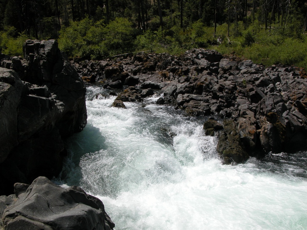
Little Illinois River Falls is located in south western Oregon on the Illinois River, in Siskiyou National Forest, just north of Cave Junction, along US-199. This is a very minor waterfall, especially compared to all the many spectacular waterfalls Oregon has to offer. The river is funnelled through a narrow rocky channel, but only drops about 10 feet. It is a scenic site, but not spectacular, and even within Siskiyou there are far more impressive falls. But it is a waterfall, is listed on maps, and is close to a major road.
The waterfall is easy to find. From US-199, head west on Eight Dollar Rd, also known as National Forest Development Road 4201. Follow this road for about 2 miles. The road is paved for all but the last 1/2 mile. A signed parking area for the falls is on the left. From the parking area a trail leads down to the river and to the falls. The trail is not long, but the elevation drop is at least 150 feet.
Little Falls
Little Falls in Low Water, August 2003
Little Falls is a small stream that falls into the Kaministiquia River Gorge, a mile or so downstream of Kakabeka Falls west of Thunder Bay Ontario. It can be reached via the Mountain Portage Trail
This waterfall is probably about 40 feet high, and is probably much more impressive in the spring.
Marble Rapids
May 2011
Marble Rapids is a small road side falls located on Eels Creek. Mill Lake Road crosses Eels Creek just below the rapids, and it is easily viewed from the bridge. Mill Lake Road runs from Route 28 to Route 620.
The larger and more remote High Falls is several miles downstream. Another High Falls is just a couple of miles upstream, but it is not clear if this falls can be visited or not.
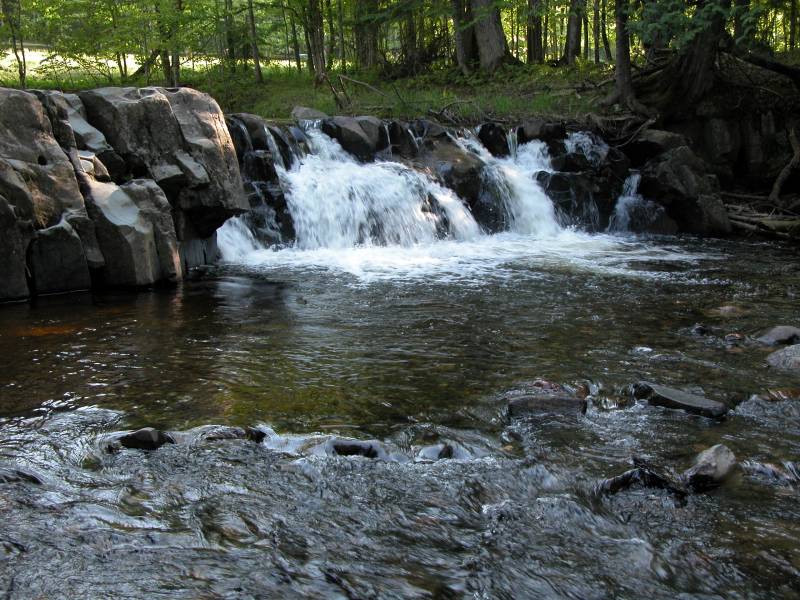
Mash Fork Falls
May 2009
Mash Fork Falls is a 7' falls in Camp Creek Resort State Park. The falls is easy to reach by car or foot. The park can be reached from exit 20 on I-77. Once in the park, turn left at the sign for Mash Fork Campground. You will soon see a gravel road on your right that leads to the falls. The larger Campbell Falls is less than a mile away.
There is some inconsistent information out there about this waterfall. The online park map shows a falls on Farley Branch, not Mash Fork Branch, and the location of that falls better matches my memory of how I got there. Unfortunately the gravel road that leads to the falls does not show up on maps, and I did not take a GPS reading. However I cannot find any information about a waterfall on Farley Branch, and lots of online photos of the falls I visited can be found and they are all labelled "Mash Fork Falls".
It had been raining a lot when I visited Camp Creek, so the falls had far more water than they typically do.
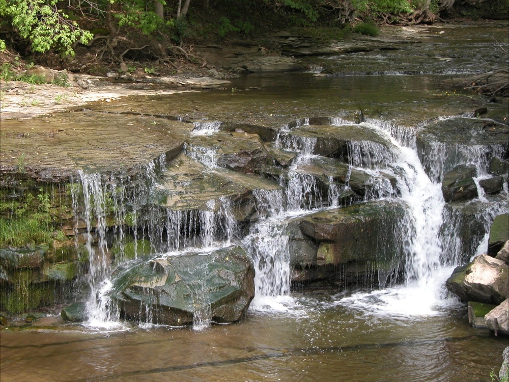
Matthiasville Falls
May 2011
Mathiasville Falls was a small falls on the south branch of the Muskoka River. It has been all but obliterated by a dam. The water is mostly diverted. When I visited during a wet spell in May, only a trickle was flowing through the falls.
The falls is located off of Route 18, about 10km east of Highway 11. Mathiasville Road will take you to the falls.
McCormick Creek Falls
October 2011
McCormick's Creek Falls is a 10' drop located in McCormick's Creek State Park. This is Indiana's oldest state park. The focal point of the park is the falls and the impressive canyon that McCormick's Creek has carved out. The canyon is a mile long, and more than 100 feet deep, which is quite significant for the otherwise relatively flat Indiana landscape. The creek drops over 150 feet on its way through the park, but the falls is the only drop of any significant height.
The falls are easily seen from an overlook that is a short walk from the parking area. A stair way will take you down into the gorge, and rough trails lead upstream to the falls. There is no bridge over the creek. In high water crossing the creek is not possible.
McGowan Falls
May 2007
McGowan Falls is the smallest of the many falls in Ontario's Grey County. There is a dam on top of the falls, and the height of the falls is at most 10 feet. This is definitely not worth a long drive, but its worth a quick stop on your way to visit the many waterfalls in the Owen Sound area. The falls is located in a park just east of the Hwy 4/Hwy 6 junction. Inglis Falls is about 40km to the north. Eugenia Falls is about 30km to the east.
Mex-i-min-eFalls
June 2015
Also known as Burnt Dam Falls, this a low falls on the Middle Branch of the Ontonagon River. The river drops at most 10' in two distinct steps.
The waterfall is located in a small national forest. There are only half dozen sites, but given how out of the way it is you probably have a good chance of finding a spot to camp if you are so inclined.
To reach the falls, head east 7 miles on old US Highway 2 from Watersmeet. The first 6 miles are paved. Take a left on to Forest Road 4500. There are no signs for the campground or the falls here. Follow this just over a mile to the campground.
Michipicoten Harbor Falls
September 2004
This small 10' waterfall is a few miles west of Silver Falls along Michipicoten Harbor road. It is visible from the road but the view is obscured. You have to get out of your car and walk a short distance to get a close up view. I do not know what the official name fo this waterfall is, or how regular it is. The picture shown here was taken on a very rainy day in September. This falls is right near the border of Michipicoten First Nation lands. Dore River Falls is also on Michipicoten land. It can be visited by canoe or kayak. I have no idea if it is accessible by land. Rumor has it that is is slated for hydroelectric development.
Mills Falls
May 2011
Mill Falls is a tumbling cascade located in Ancaster behind the Old Mill Restaurant. The falls is located on Ancaster Creek, upstream of Sherman Falls. The falls drops 10m in a series of drops. There is a dam at the top of the falls.
There are not a lot of vantage points from which to see Mill Falls. The restaurant is built over part of the falls. There is a viewing platform by the dam at the top of the falls. The lower part of the falls is more interesting, but views are limited.
Mississagi Falls
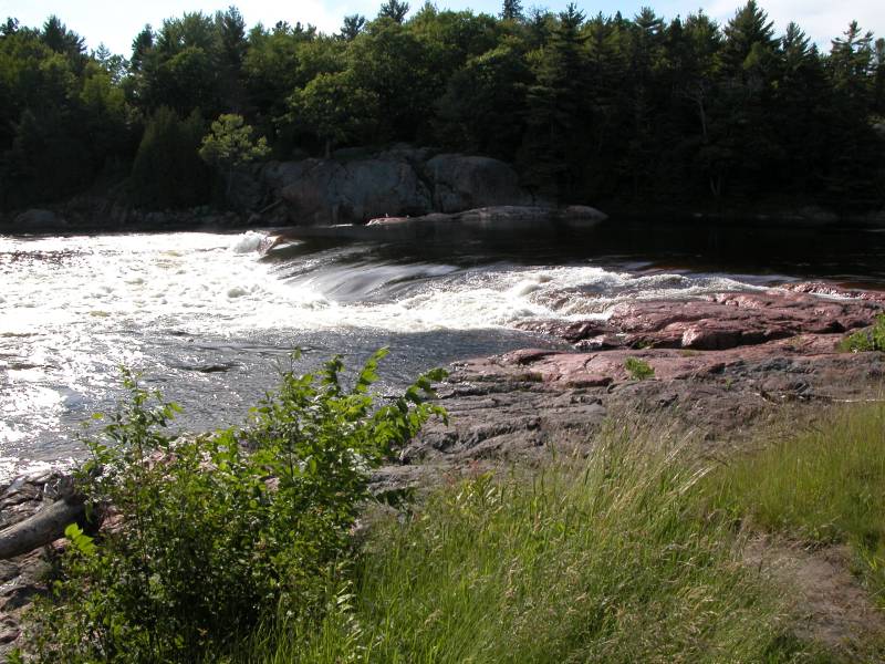
July 2004
This waterfall shows up in MapQuest and is mentioned on canoe routes. The waterfall is about 5 feet high, but it is over 100 feet wide and a lot of water goes through this fall. It is visible from Hwy 17 just west of Blind River, Ontario. There is a short two track off of Hwy 17 that leads to the falls. Be careful because the two track is located right along a curve on Hwy 17. The Mississagi's much more impressive plunge is at Aubrey Falls far to the north.
Moneypenny Falls

May 2015
Moneypenny Falls is two tiered 30' falls near Tunkhannock Pennsylvania. The waterfall is on private property. It can be seen from the road, but the views are obscured by trees. To reach the falls from Tunkhannock, head south on Highway 29. Take a left on to State Route 2007. Follow this for 4 miles, and take a left on to Thurston Hollow Road. Follow this for a half mile to a wide turn. There is a large parking area on the left side of the road, and plenty of evidence of trails leading to the falls. There are also a lot of "No Trespassing" signs.
Maybe it is because I used to watch "Gilligan's Island" as a child, but I find it very amusing that Money Penny Falls is located on Thurston Hollow Road.
At the intersection of 2007 and Thurston Howell road there is an odd collection of old fire engines and other things on the road side.
Nama Falls
September 2011
Nama Creek Falls is a small, and very remote falls near Manitouwadge Ontario. The creek tumbles down a series of steps, none of which is more than a meter or so high.
Reaching this waterfall is not easy, and the pay off to effort ratio is extremely low. From Manitouwadge, drive west on Caramat Industrial Road for 14km. This is a wide, but bumpy gravel road. Take a left and head south at the fork. This road quickly turns into a one lane forest road. A regular car may not be up to this road. After 8 km you will reach a wash out, and the "roads" become two tracks and trails. Just beyond the washout, take a right and follow the trails, keeping to the right when possible. The trail eventually turns into a hiking trail, that follows a ridgeline through the forest before descending steeply down to the falls. The final leg of the trail is overgrown and not well defined. None of the trails are signed or maintained.
The much larger Four Bay Falls is nearby, but it is also harder to reach.
Nonesuch Falls
September 2009
Nonesuch Falls is a small waterfall on the Little Iron River, located in the abandoned town of Nonesuch within the boundaries of Porcupine Mountains State Park. The falls is at most 10 feet high, and the river does not carry a lot of water in the summer. One interesting thing about the falls is that the bedrock is tilted at roughly a 45 degree angle, creating interesting obstacles for the river. Far more interesting than the falls is the remains of the old late 1800's mining town of Nonesuch. The crumbling ruins of a few old buildings can be found near the river and many subtler bits of evidence also remain.
Nonesuch is located off of South Boundary Road near the eastern edge of the park. From the parking area it is about a mile hike along an old road to the town ruins and falls. The falls are a few hundred feet upstream of the old town.
Ocqueoc Falls
May 2005
Ocqueoc Falls is the only "major" waterfall in Michigan's lower peninsula. In rockier, hillier parts of the world this would be a nameless rapids of no note but here in the farmlands and forests of Michigan it merits its own little park. The falls is at most 5 feet high. There is a small gorge below the falls, with rocky walls about 20 feet high. The Ocqueoc Falls State Forest Campground is just across the road, and the Bicentennial Pathway passes by the falls.
The falls is about 10 miles northwest of Onaway, the nearest city. From Onaway head east on MI-68. MI-68 takes a left turn after about 8 miles. According to some maps, this northbound stretch of MI-68 is part of Millersburg Road. After 2 miles, MI-68 veers off to the right, but continue straight. Take a right onto Ocqueoc Falls road. According to my road atlas, Rainy River falls is about 6 miles to the east, but it is on private property. I imagine it is similar in size and appearance to Ocqueoc Falls.
Ogemaw Falls

May 2006
Ogemaw Falls is a 12 foot drop on Ogemaw Creek in Baraga County Michigan. It is located off of Baraga Plains Road, which intersects with US-41 just a mile or so north of Canyon Falls. Head west for about 1.5 miles. The road will turn to the left, and there will be a large pond to the left. This is where the road crosses Ogemaw Creek. The falls are a few hundred yards to the left. The road crosses above the falls, so you cannot see them from the road. You have to climb down into the gorge to get a view. This is not difficult, but there is no real trail. This is a small waterfall. Many much more impressive waterfalls can be found in Baraga County.
Overlooked Falls

September 2009
Overlooked Falls is a small falls on the Little Carp River. The scenic falls consists of two drops, each about 5' in height. This is the most easily accessed of the falls on the Little Carp River, big or small. It is only a few hundred feet from the parking area. The trailhead to the falls is at the end of Little Carp River road. This is also the trailhead to Greenstone Falls, which is about 1/2 mile away. The trail also leads to the much larger Trappers Falls, which is three miles away.
Papermill Falls
September 2006
Papermill Falls is located in western New York, about 3 miles south of Avon. This waterfall is only about ten feet high and is very easy to visit. From Avon head south on Route 39 (locally known as Avon Road). Take a left (east) onto Papermill Road. The road crosses the creek just above the falls. There is a small county park on the left side of the road before the bridge. No hiking is necessary. In addition to the falls there is a very pretty old stone bridge just upstream of the current bridge.
Papermill Falls is located roughly halfway between the falls in Rochester and the falls in Letchworth.
Pemene Falls
September 2009
Pemene Falls is a rapids on the Menominee River on the Michigan/Wisconsin border. The river drops about a total of 10' over a stretch of 100'. There are the remains of an old dam near the final drop of the falls. The surrounding rock and forest is quite scenic.
The falls is very easy to visit. There is a signed parking area for it off of State Road, a mile north of Michigan road G 18. State Road is gravel, as is the parking area, but easily managed by an ordinary car. A rough trail leads from the parking area over the rocks down to the falls.
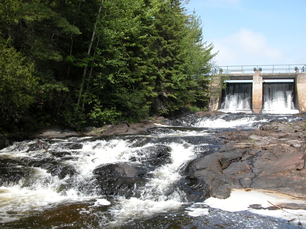
Pine River Falls

May 2017
Pine Rive Falls is a series of three drops just below the dam on the Pine River. The area is fairly easy to visit, but I was a bit surprised and disappointed by the lack of any well defined trails to the falls themselves. Perhaps this is because the falls are often dry, or perhaps I just did not try hard enough. The ticks kind of deterred me from trying too hard.
The falls can be accessed from the Pine River Flowage. There is a small picnic area by the dam. You can camp here as well. The falls can be easily heard, but not seen from the picnic area. From Florence, head south on County Road N. Take a right on to County Road D, and then a left on Pine River road. The road ends at the dam.
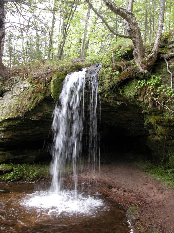
Potato Patch Falls

May 2005
Potato Patch Falls can be found right next to the Potato Patch backcountry campground in Pictured Rocks National Lake Shore in Michigan 8 miles north east of Munising Falls. I do not think the name is official. I am just following the lead of this person. The falls has several parts. The plunge is 20+ feet high. Above this there is a cascade that drops several feet. Below the plunge there is a long slide that is at least 30 feet high. You could probably get to the base of the falls, but due to the number of trees you probably would not be able to see the whole falls. The falls is just a short distance from the Lake Shore Trail head at Miners beach. You just have to hike up the hill to see the falls. The lake shore trail passes right over the top of the falls.
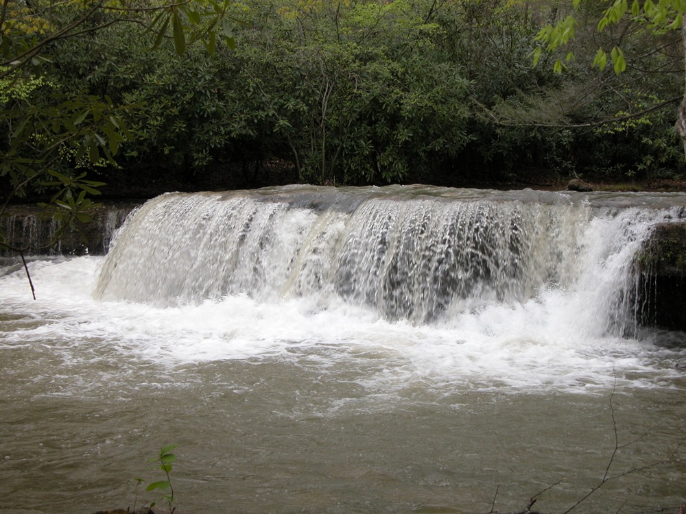
Quarry Falls
June 2014
Quarry Falls is a roadside falls along Highway 64 on the Cullasaja River. Quarry Falls is a slide with a height of around 15' high. It is located between the much larger and more impressive Dry Falls and Cullasaja Falls. The spot is a popular swimming hole. Based on the falls nicknames, such as "Sliding Rock" and "Bust-Your-Butt-Falls" it is also used a natural waterslide.
Just south of the falls there is a large pull off on the east side of the road where you can park. Be careful crossing the road, because of the curves.
Ranney Falls
May 2011
Ranney Falls is located on the Trent River in Ferris Provincial Park. The falls is only 2 meters high, but it is nearly 100m wide. The Trent River races over this falls. Often streams are a bit sluggish just above a waterfall, but not so in this cae.
There are not a lot of opportunities to explore the falls. A trail follows the rim of the gorge. There are stairs leading down to a vantage point near the lip of the falls. There does not appear to be any other way into the gorge, and it does not look like it would be safe anyway. Downstream of the falls is the Ranney Gorge. A pedestrian suspension bridge spans the gorge. You can get a nice, but distant view of the falls from the bridge. The bridge is fun all by itself. It is 10m above the water, and sways when people cross it or the wind blows.
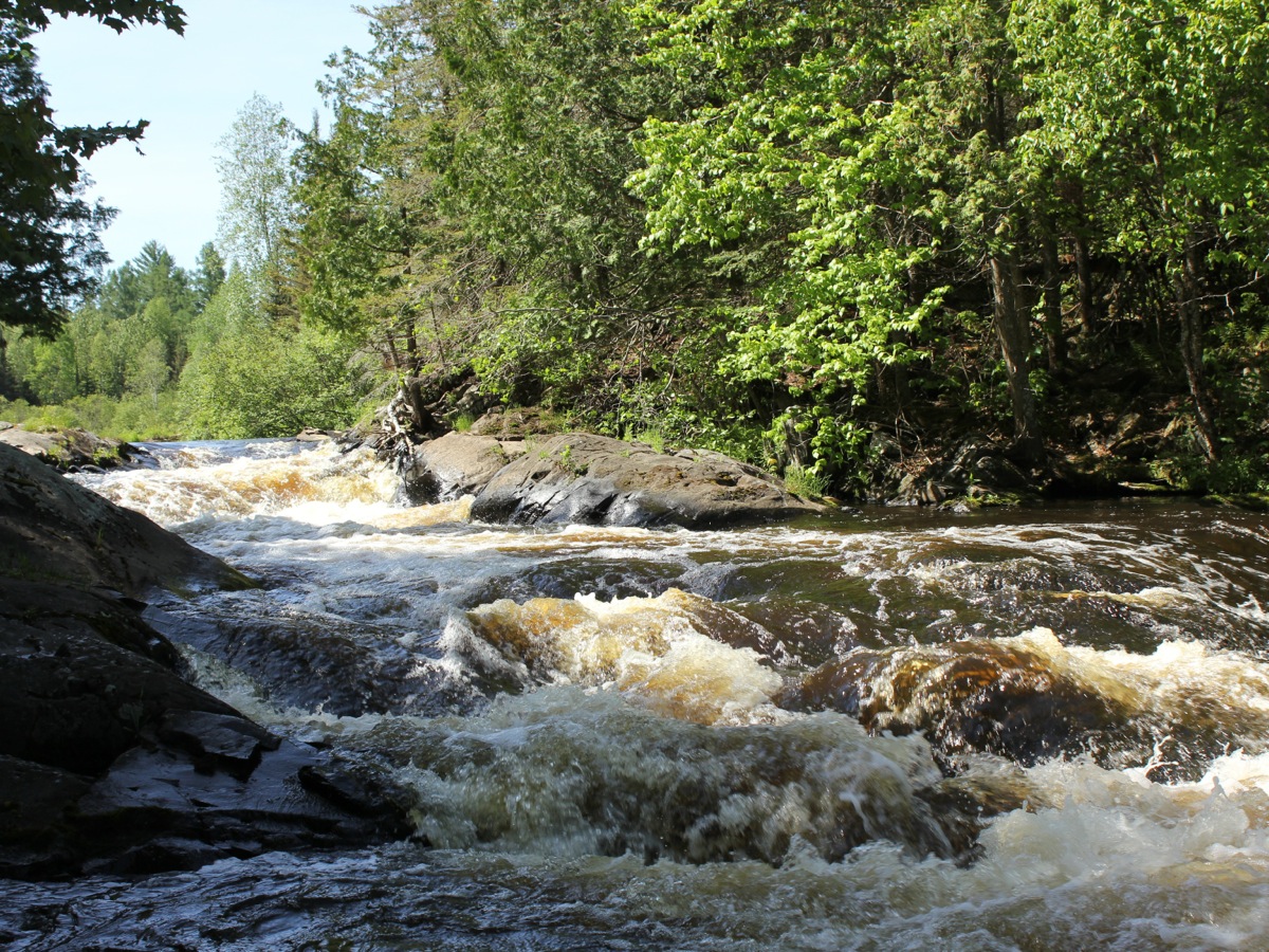
Rapid River Falls
May 2012
Rapid River Falls is a series of small step falls on the Rapid River. The largest drop is perhaps two feet high. In typical water levels kids can safely wade across the river above and below the falls.
The falls are located along US 41, about 22 miles north of Escanaba. The falls is located in a small park, appropriately named 'Rapid River Falls Park'. The park is located on the west side of US 41. There is a sign for the park.
Reany Creek Falls
June 2015
Reany Creek Falls is a series of drops on Reany Creek shortly before it enters the Dead River. This is a road side falls, clearly visible from the Forestville Road. The creek drops 15 feet or so. The most significant drop is best seen from the bridge. Another drop is below the bridge, and more smaller drops are upstream.
The falls are located just before the end of Forestville Road and the trailhead to the Dead River Falls. Forestville Road can be reach from Wright Street, .6 miles north of US 41.
River Falls
June 2005
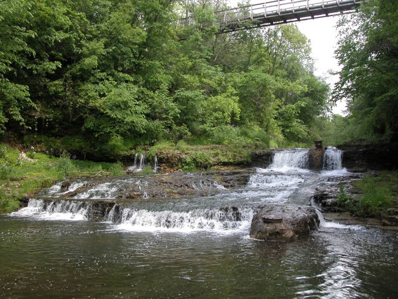
River Falls is another town in Wisconsin with "falls" in the name. The town is located at the junction of the Kinnickinnic River and the South Fork of the Kinnickinnic River. Waterfalls were located just above the junction of both rivers. Both falls were put to work by settlers. Junction Falls Dam still remains on the main fork of the river, but the dams and mills on the smaller South Fork fell into disrepair and were washed away in floods.
At least two small unnamed waterfalls each around five feet high are on the South Fork. One is easily accessible from Glen Park. There is a pedestrian suspension bridge leading into the park over the falls that gives you a nice view of the gorge. The second fall is upstream, just behind the Boy Scout Lodge at the end of Vine Street.
If you are just looking for waterfalls, make sure you have time to check out Willow Falls, Vermillion Falls, and Minnehaha Falls before spending a lot of time here. Each of those falls is far more impressive and the first two are both within 20 miles, and the last within 50 miles.
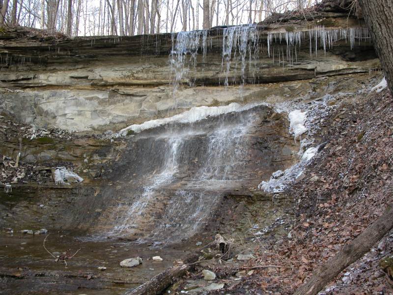
Rock Rest Falls
March 2006
Rock Rest Falls is located in Jennings County Indiana near Vernon. This small, seasonal, roadside falls is about 10 feet high. Below the falls is a small rocky ampitheatre and gorge. The waterfall is located along side Rock Rest Road between US-50 and State Road 7. Rock Rest Road is known as County Road 75 where it meets US-50 and Country Road 25 where it meets State Road 7. The falls is on the west side of the road and is only 30 feet from the road. There is an area alongside the road where you can park. The land the falls is on is part of the Calli Nature Preserve.
Scott Falls
May 2004
Scott Falls is a small roadside waterfall. It is 10 miles west of Munising on M-28. The falls is a single 10 foot drop. There is a small park by the falls. Even on a rainy day in the spring the falls does not have a lot of water.
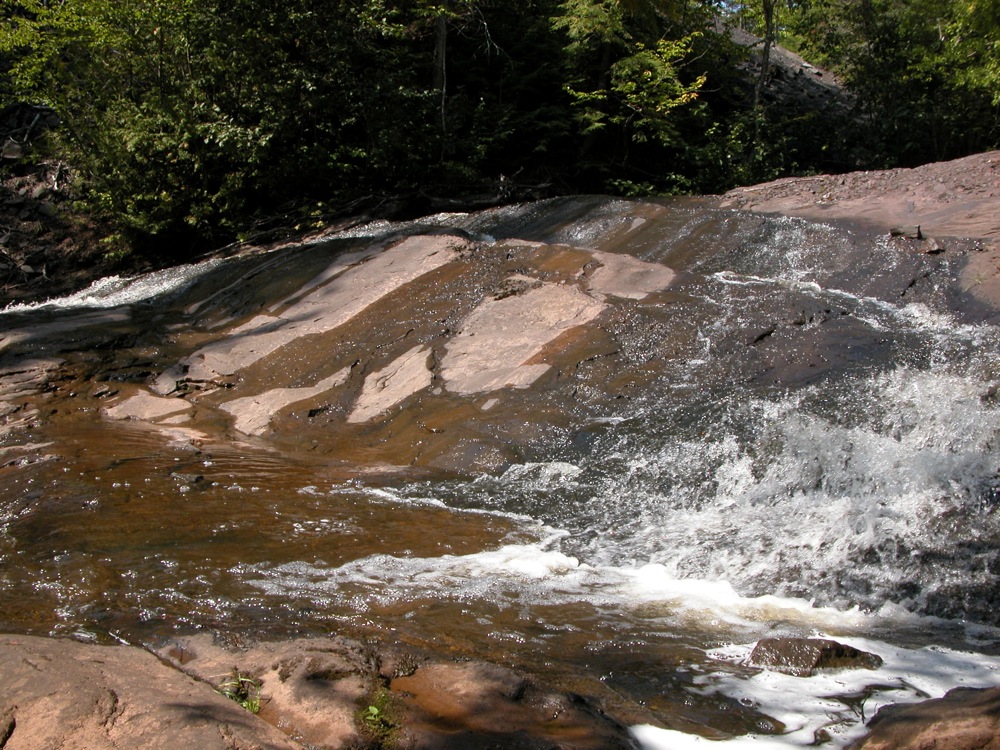
Scott Creek Falls
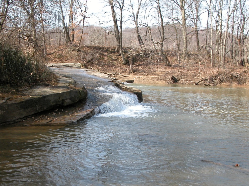
March 2010
Scott Creek Falls is located along Route 93 a few hundred feet from where the creek empties into the Hocking River. The creek only drops about 5 feet, but in terms of volume it is the largest waterfall in the area. Unfortunately due to the angle of the sandstone ledge the creek falls off you really cannot see much from the roadside. Pictured is the north east corner of the falls. The falls continues around the corner, and appears to be higher in the middle. You could get a great view from the farmland across the creek, but that is private property. You could also get a nice view from the water itself.
There is a small pullout alongside the west side of Route 93 opposite of Scott Creeks Rd. If you wanted to try to view it from the water, there is a river side park 1/2 mile upstream of the confluence of Scott Creek and the Hocking River from which you could launch a kayak.
Sharon Woods Falls
November 2010
Sharon Woods is a 730 acre park north of Cincinatti. One of the highlights of the park is Sharon Gorge. Sharon Creek has carved a gorge 90 feet deep in places on its way down Mill Creek. Along the way are a number of rapids, and two small waterfalls. The upper falls is about 8 feet high, and the lower one about 5 feet high. Depending on water levels both falls can be up to 20 feet wide. Both falls can be seen from the gorge trail. For better views of the upper falls you have to get down into the gorge.
These falls are best seen just after a rain. The creek is often dry, or nearly so. There is a dam at the head of the gorge that controls the levels on Lake Sharon. There are also two small dams downstream of the gorge which have created two small artificial falls.
Sharon Woods is located off of US 42, a mile south of the interchange with I-275.
Silver River Falls
August 2001
This small waterfall is located on the Silver River in the Keewenaw along M-26 about 4.5 miles east of Eagle River and 4 miles west of Copper Harbor. This Silver River is different and smaller than the Silver River in Baraga County. The falls consists of a number of small drops just downstream of the M-26 bridge over the river. Each drop is a slide a few feet high. The river has a small watershed and rarely has a lot of water. There is a small picnic area on the north side of M-26.
Smalley Falls
July 2004
Smalley Falls is in Wisconsin near Pembine. It is a minature version of Long Slide Falls which is 1/2 mile downstream. There is small parking area and a trail that leads to the falls. The falls drops around 10 feet or so over a stretch of around 100 feet. You can hike from here to Long Slide Falls. Like Long Slide Falls, there are no fences or railings here.
Speckled Trout Creek Falls

September 2005
This is a small waterfall on Speckled Trout Creek, just south of Lake Superior Provincial Park. It might actually be in the park, but I am pretty sure that it is not. The waterfall is a narrow chute about 10 feet high and 30 feet long and only a couple of feet wide. The creek has carved out some interesting potholes and there is a nice big pool at the bottom.
There is no official trail to this waterfall. You can walk down the creek to reach it. There is a two track on the north side of the creek, but it was gated and marked as private property. I learned about this falls from fishing sites. Fish from the lake cannot get past the waterfall.
Swayze Falls
April 2006
Swayze Falls is located in Ontario's Short Hills Provincial Park. Swayze Falls is a 50' high seasonal wet weather waterfall. Unless it has been raining recently, you are likely to find just a trickle as seen in the photo, or even an entirely dry falls. The falls used to flow more regularly, but deforestation has affected the stream flow.
The Short Hills are the work of an ancient river which broke up the escarpment creating a series of hills. The park protects 735 hectares of this unique environment. A series of hiking, biking and horse trails wind through the park. Swayze Falls is located in the southwest corner near the Roland Road access point. A second smaller waterfall can be found in the park on Terrace Creek.
Tibbets Falls
September 2009
Tibbets Falls is low, wide and noisy falls on the Sturgeon River. The river tumbles over a series of small steps, dropping about a total of 10 feet, followed by a long stretch of white water. The river is around 80 feet wide at this point.
To reach the falls head north on Plains Road from Route 28. After about three miles you will cross the Sturgeon River. The road will turn to the left. The road to Tibbets Falls will be the first road on thee left. There is a sign. The "road is a simple two track that may not be passable in wet weather. The two track is not wide enough for two vehicles, so be prepared to back up if you run into someone else. I chose to walk the trail. When you reach the first fork in the road, take a left. The road ends at a small turn around. The total distance to the turn around is about 3/4 mile. It is a short walk from here down into the gorge to see the falls.
The North Country Trail passes by Tibbets Falls. If you continue hiking west you will eventually reach O Kun de Kun Falls.
Tioga Creek Falls


June 2015
Tioga Creek falls ia a series of small drops along Tioga Creek accessible from a highway rest area. The falls are located on US 41 a few miles west of Nestoria. Tioga Creek Roadside park is on the south side of the road. The lower cascade is visible from the parking area. A marked trail follows the creek upstream for a few hundred feet to the small upper drop.
There is a much larger falls on Tioga Creek several miles downstream. The falls is on the property of a rentable backwoods cabin.
Trethewey Falls
May 2011
Tretheway Falls is a small falls on the south branch of the Muskoka River with a large dam built on top of it. This is not a particularly interesting or scenic falls, but it is on the maps. The falls is easy to reach. Just head east on Route 118 from Highway 11 for 3km and turn north onto Tretheway Falls Road.
Tobacco Falls
September 2009
Tobacco Falls is a series of small drops on the Tobacco River shortly before it empties into Lake Superior. The drops are each only a foot or two high. The falls are along Lac la Belle Road about one mile north of Gay Michigan. The falls are visible from the road. There is a roadside park along the shore where the Tobacco River meets Lake Superior. From here you can walk under the bridge to get a better view of the falls. Based on the looks of the satellite imagery, there is some more white water a bit further upstream. I do not know if that rapids is accessible by the public.
Traders Falls
September 2009
Traders Falls is a small remote falls on the Little Carp River in the Porcupine Mountains. The falls is less than 5 feet high, and 2 miles from a road. Given the size of the falls it is surprising it has a name at all. It is possible this is the farthest point one could easily canoe up the river from the lake. If it was not for the sign, I would not have known this was Traders Falls.
Trap Falls
August 2001
Trap Falls is in the interior of Michigan's Porcupine Mountains State Park. This small waterfall is remote. As you see, no roads show up in this map from MapQuest. It is a hike of more than two miles to reach this waterfall. If you are looking for a nice hike, this can be quite rewarding, but if you just want to see a waterfall, your time is better spent elsewhere.
The waterfall is only about 10 feet high. There is a long stretch of rapids above and below the falls. The falls is in a deeply forested area and is usually in shadows. The shortest way to the falls is take the Government Peak Trail from M-107. I do not recall there being much of a parking area here. It is just over 2 miles on this trail to the falls. You can also take the Union Spring Trail. It is about 4 miles to the falls on this trail. From the Lake of the Clouds overlook it is nearly a 6 1/2 mile hike to the falls. All the distances are one way. Trap Falls is one of the sights on the 15 mile Escarpment Trail/Government Trail loop.
Twelve Foot Falls
July 2004
Twelve Foot Falls is in Wisconsin's Marinette County, 12 miles southwest of Pembine on the Pike River. As the name suggests, this waterfall is about 12 feet high. It is a slide, like many of the waterfalls in the area. Further downstream you can find Eight Foot Falls. The waterfalls are in a county park with a $2 day use fee. Camping is also available. There are many nice vantage points from which to view the falls and trails lead to the top of the falls.
Signs will lead you to this waterfall from US 141 or US 8. From US 8 head south on Lily Lake Road and follow the signs. On this route it is about 4 miles to the falls. From US 141 head west on Beecher Lake Road and follow the signs. On this route it is about 9 miles to the falls, only three of which are paved. Here is some help from MapQuest.
Eighteen Foot Falls is a short drive away.
Upson Falls
July 2004
Upson Falls is in Upson Wisconsin. It is in a small town park off of Park Rd. If you are heading south on 122, take a right when you reach Upson and you will be on Park Rd. There are signs on 77 telling you how to reach Upson Falls.
This is a small waterfall consisting of a couple of drops, the largest of which is around 6 feet high. The waterfall is on the Potato River (or Creek at this point). As the Potato River flows north it gets more impressive. The large Potato Falls are roughly 20 miles away. Foster Falls is about 6 miles downstream.
Whispering Falls
May 2005
Whispering Falls is in Ohio's Hocking Hills. It can be found along the gorge trail from Old Man's Cave to Cedar Falls. The falls is roughly in the middle of the 2 mile trail. The small stream free falls around 100 feet into the Queer Creek gorge. This falls was still running in May, which means it outlives many of the other minor falls in the area, but I doubt it often makes it to June. There are at least two other seasonal falls to be found in the Queer Creek gorge.
White's Falls
May 2007
White's Falls is a small waterfall in Ontario near the shores of Lake Huron, in Muskoka District. This is a small waterfall, and it has a dam on top of it. The falls is about 10 feet high, and 40 feet wide. There are a large number of waterfalls like this in this part of Ontario, dam included. White's Falls is located east of Hwy 400 on White's Falls Road. There is a small roadside park by the falls. The falls is on the stream that flows from Six Mile Lake to Gloucester Pool. This is another common feature of area waterfalls. They are often on the inlet or outlet of a lake. If you continue east, you will reach Big Chute. The falls here has been dammed dry, but the Big Chute Marine Railway is a fascinating engineering marvel.
Willamette Falls
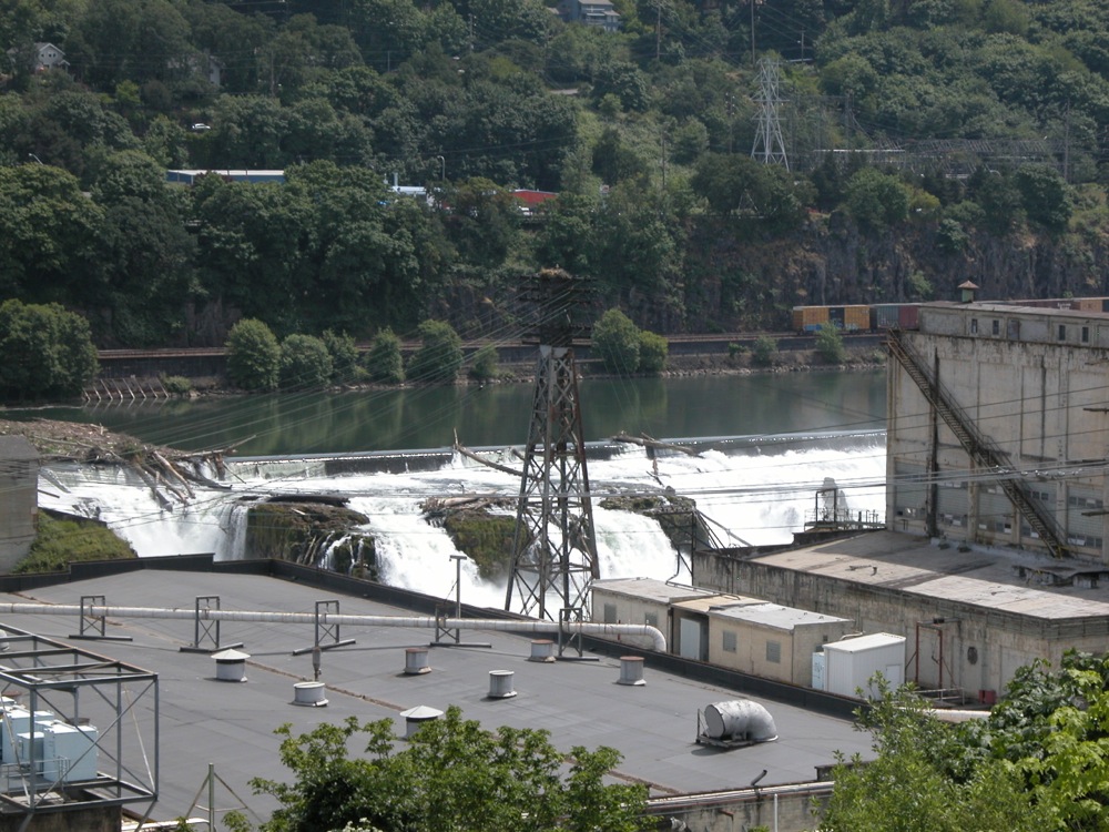
May 2008
Willamette Falls is by no means a minor waterfall when judged by size. The Willamette is a large river, with over 30000 cubic feet per second of water at its mouth. The falls, located 26 miles upstream of the mouth is 40 feet high and over a 1000 feet wide. Unfortunately visiting the falls is not easy. The falls is partially dammed, and industry lines the river below the falls. There are no unobstructed views available on land. The photo above is the best I could manage. Views from the water would be better, but kayaking or canoeing the Willamette is not a trivial matter either.
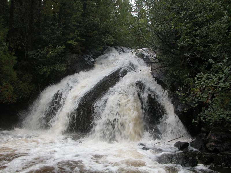
Yondota Falls

May 2015

May 2015
Yondota Falls is a 10+ foot drop on the Presque Isle River. Upstream and downstream of the drop are a series of rapids, making for a long noisy stretch of river. This is not a big falls in terms of height, but the river carries a lot of water, especially in the spring and early summer.
This is a wild waterfall, and fairly remote. From US 2, head north on Forest Road 523 for 3 miles. This starts out as a paved road, but becomes a dir road after a mile. Once you cross the bridge over the Presque Isle River, there is a parking area on the west side of the road. The trail starts here, and follows the river a quarter mile to the falls.
The Presque Isle River eventually makes its way to Porcupine Mountains State Park and Lake Superior, where it tumbles over Manabezho Falls, Manido Falls and Nawadaha Falls.
This page has been accessed
324613 times.
Last Modified:
Sunday, 02-Jul-2017 23:49:41 MDT.