


Eugenia Falls is in the town of Eugenia, in Ontario's Grey County, on Grey County Road 13, just north of Hwy 4. It is a short distance from Flesherton. It is about 50 kilometres south east of Owen Sound, and 100 km north west of the Toronto Area. This is another of the many waterfalls of the Niagara Escarpment, and is one of the more impressive.
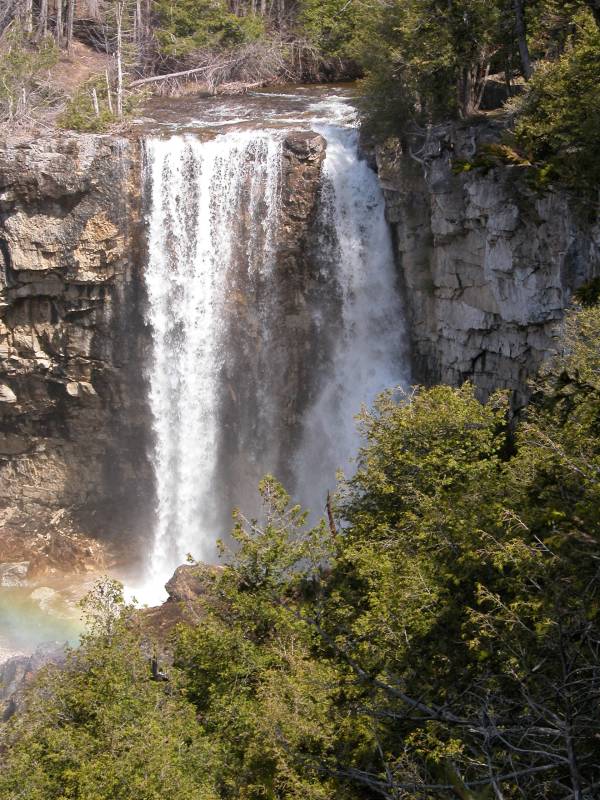
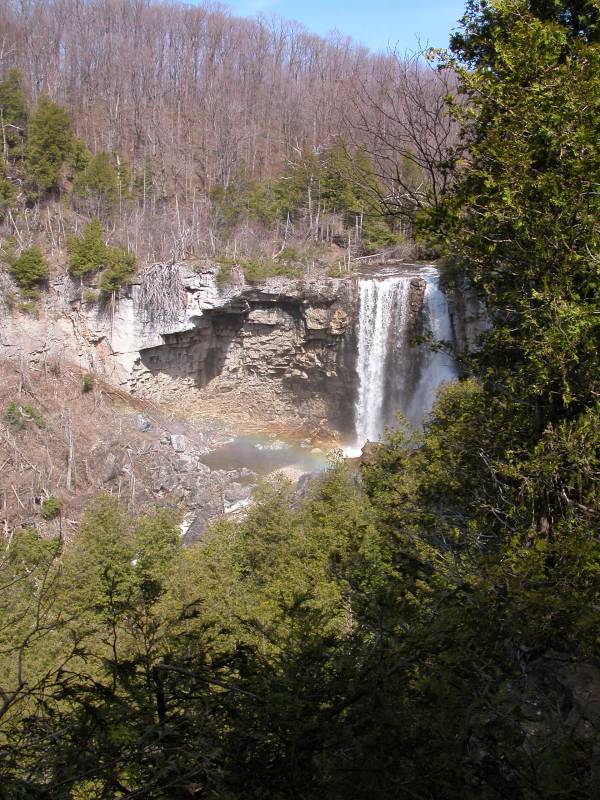
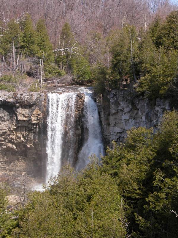
It is a short walk from the parking area to an overlook right on top of the falls. If you follow the trails downstream a hundred feet or so there is a very nice view of the whole falls.
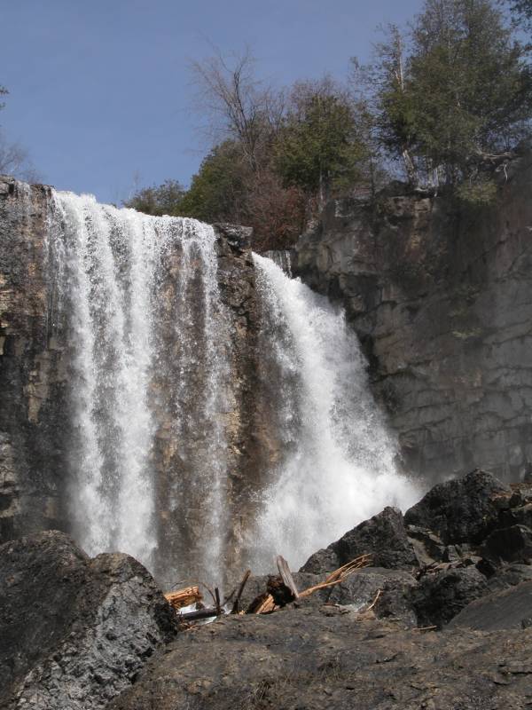
Getting into the gorge is not easy, and probably not recommended, but it is possible. You really should not even think about trying to get into the gorge unless you are willing to climb over a lot of slippery rocks and fallen trees and risk all sorts of injuries just for the sake of getting a picture. The trail continues along the edge of the gorge, which is very sheer and nearly 100 feet high at this point. The wall along the edge of the gorge ends, but the trail continues. There are trees on both sides of the trail, but you do not want to trip here. Farther down there are ways to scramble down into the gorge, but they are not obvious, and require some climbing effort.
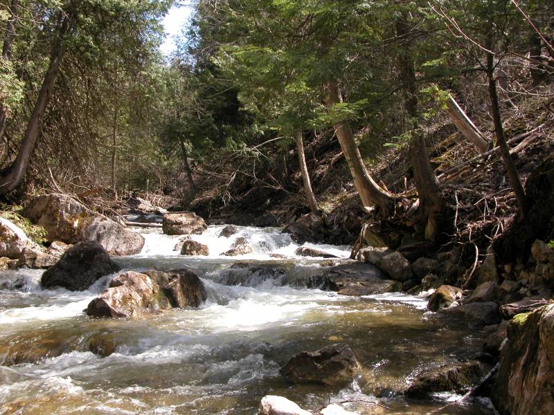
If you head away from the gorge, you will find a large well groomed trail. This trail leads out of the World War I monument near the parking area, and it may be part of the Bruce Trail. If you follow this trail downstream for 20 minutes, you will eventually reach the level of the river. The trail does not lead exactly to the river, but it gets you close enough. From here on, there is no official trail. I did see one red blaze, but that was it. You can slowly work your way up along the river banks. There are a lot of mossy rocks and piled up deadfall left behind by high waters, but if you perservere and do not slip and crack your head open on the rocks, you will see lovely stretches of white water, a 30+ foot, hard to photograph lower falls of the cascade variety, and finally a wonderful view near the base of the falls.
It is much easier to hike along the base of the escarpment wall. There is much less deadfall, and other than the threat of being killed by falling rocks, it is relatively easy going. You can also see where people climb into and out of the gorge.
This waterfall gets very thin in the summer. By late May it usually has already lost a lot of its power, as the pictures below show. On the plus side, the landscape is a lot greener.
[Niagara Escarpment] Nearby Falls
Hoggs Falls is around the corner and down the road. Inglis Falls, Jones Falls, Indian Falls, Keefer Falls and Walters Falls are in the nearby Owen Sound area.
Other Websites
The falls are in the Eugenia Falls Conservation Area. For some reason, the picture on that website is reversed. That must be a picture of the falls admiring itself in the mirror. A nice description of nearby waterfalls can be found in Waterfalls of Grey County.
Photo Gallery
 |
 |
 |
 |
 Down in the Gorge |
 The Hard to see Lower Falls |
 May 2007 |
 May 2007 |
This page has been accessed
130311 times.
Last Modified:
Saturday, 19-Sep-2009 16:03:27 MDT.