


Saxon Falls is located on the Montreal River just a few miles upstream of Superior Falls, about 10 miles west of Ironwood. The Montreal River forms part of the border between Michigan and Wisconsin so the falls is technically in both states.
Like Superior Falls there is a dam and power plant here and the water is diverted. The best way to visit the falls is to drive to the dam. From here there is a trail that leads to the falls. Most of the trail is a boardwalk built on top of the diversion pipes. It crosses the river to the Michigan side. Once across the river signs will direct you to the top of the falls, or the bottom of the falls. I suggest you follow the trail to the top of the falls. This heads into the trees and leads to a nice view above the upper drop. You can continue through the woods on a well beaten path to an overlook above the bottom of the falls, and to the same spot that the trail to the bottom of the falls leads.
The trail to the bottom of the falls continues on the diversion pipes and ends at one of the power dam buildings. From here you have to climb down a vertical steel ladder, which is not trivial, and is the main reason I suggest using the upper falls trail instead. You can then work your way up to the overlook, or climb another ladder, and descend the stairs down into the gorge. I personally did not try the latter option, so I do not know if it is worth it.
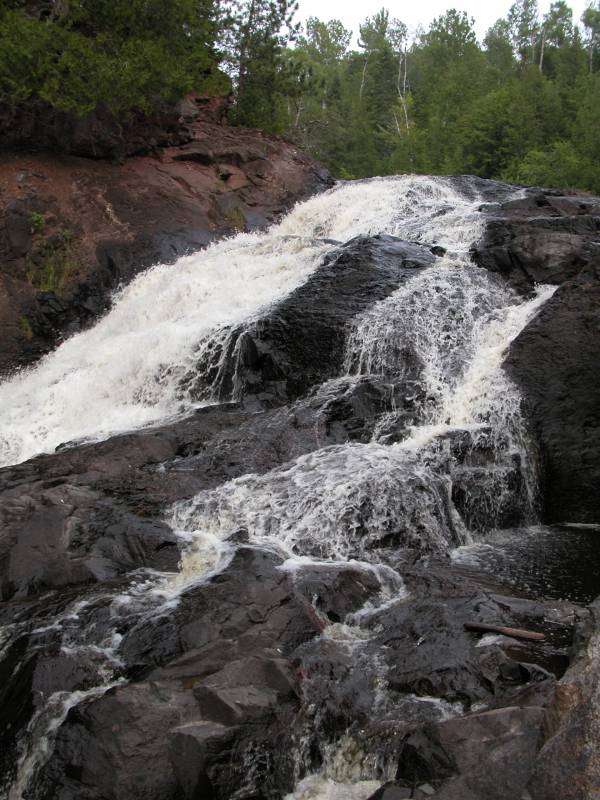
In high water the lower part of the falls has three segments. If you are into white water rafting, this is supposed to indicate that the gorge is runnable, but only for those who really know what they are doing.
To reach the falls from US 2, turn north on 122. Take a right onto County Rd B. When the road takes a 90 degree right turn, turn left onto the dirt road leading to the Saxon Falls Flowage. There is a sign. If you are travelling west on US 2 you will encounter County Rd B before 122. Take a right onto County Rd B, and when the road turns 90 degrees to the left, keep going straight onto the dirt road leading to the Saxon Falls Flowage. Follow the signs to the dam.
The first time I visited the falls I stopped at the parking area downstream of the dam. There is no visitor friendly viewing area for the falls here. From the parking area there are trails that go to the right into the woods. From here you can make a difficult descent down to the falls. This is not easy, and may be impossible in higher water.
[Iron & Gogebic County] Nearby Falls
There are a lot of waterfalls in this area. Superior Falls is downstream on the Montreal River and is just a short drive away. To reach Superior Falls from Saxon Falls, return to County Rd B and take a right. When you reach 122, take another right. Interstate/Peterson Falls are farther upstream. Potato Falls is about 15 miles away. Copper Falls State Park and the Black River Scenic Byway are both within 50 miles.
Photo Gallery
 Full falls |
 |
 Lower middle segment |
 Lower leftmost segment |
 |
 Obscured side view |
 Wisconsin Side, July 2004 |
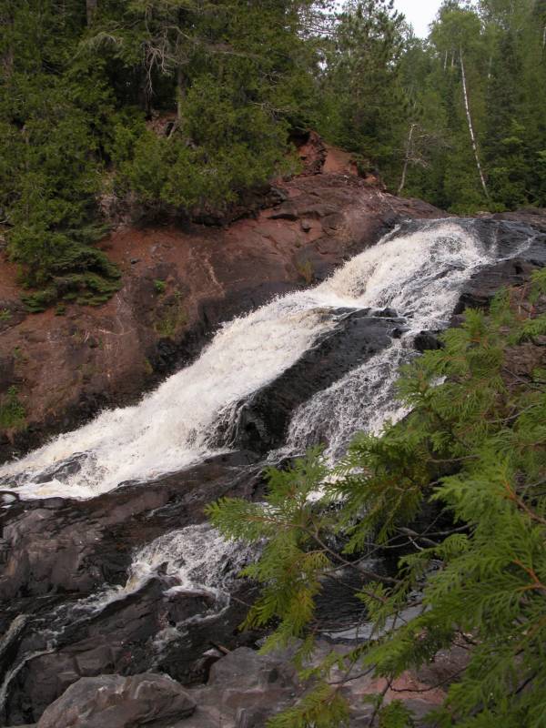 Wisconsin Side, July 2004 |
This page has been accessed
103565 times.
Last Modified:
Thursday, 31-Dec-2020 12:18:51 MST.