


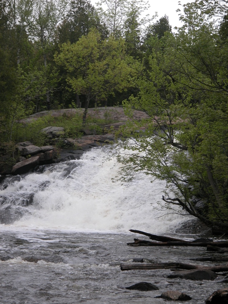
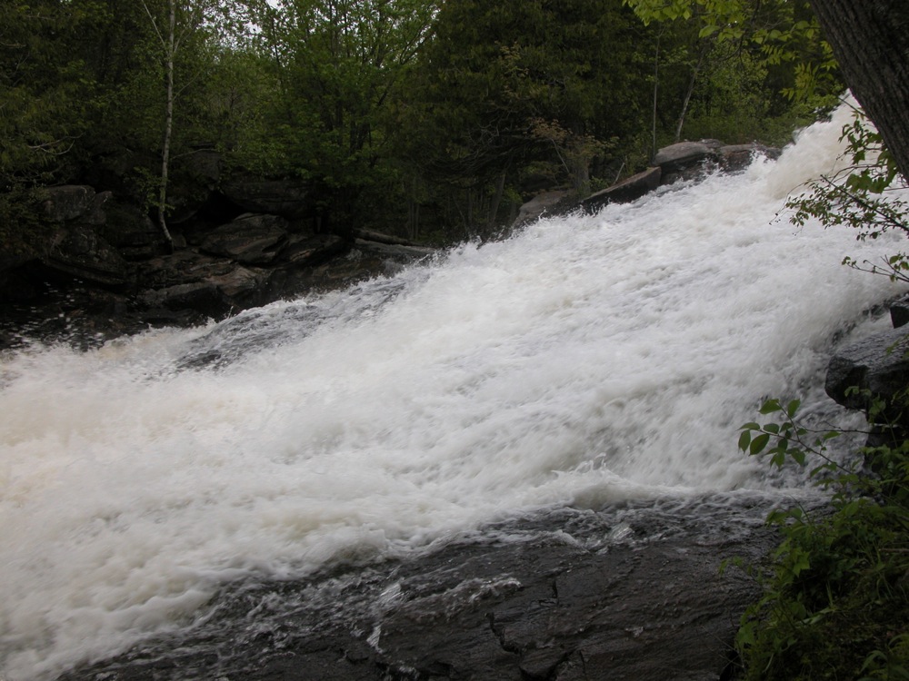
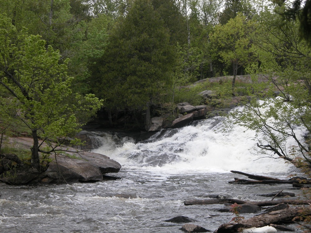
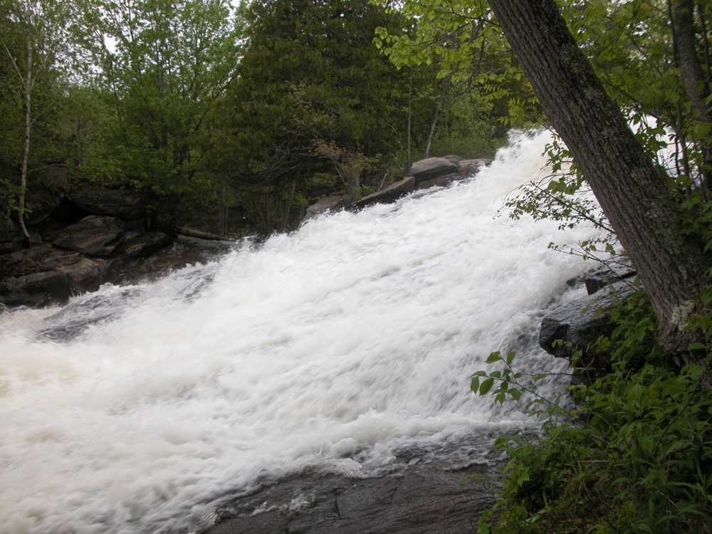
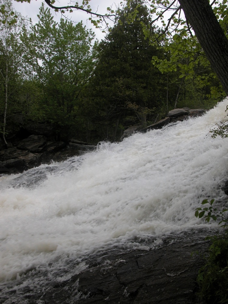
High Falls of Eels creek is a wild, sliding falls located a few kilometres east of Woodview. Eels Creek slides down and around a rocky slope. The majority of the water goes down a slide on river right, but part of the creek heads down a smaller channel on river right around a large rock outcropping that segments the falls. A submerged rock near the top of the falls creates a large water wheel, spraying water a meter or more into the air. This is one of the few falls in the area that has not had a dam built on top of it.
Reaching this waterfall is a bit of an adventure. It used to be possible to hike to the falls from the neighboring Petroglyphs Provincial Park, but this trail has been closed. Now the easiest way to access it is from where Northeys Bay Road crosses Eels Creek. There is a small parking area on the east side of the creek. From here you can launch a canoe, or start hiking.
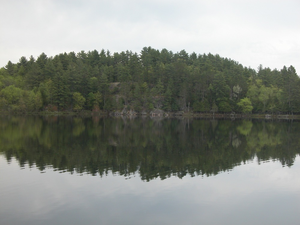
The canoe is the easier option, and gives you more opportunities to explore the falls, as you can visit both sides. Eels Creek is wide and slow between the falls and the road, with only one or two spots with a strong current.
The hike is straightforward except you have to cross a smaller creek and 100 or so meters of marshy terrain. The trail starts out clear and easy. About 1/2 km in the trail will descend down to a small creek which you will need to cross. There is no bridge, and the other side of the creek is marshy. Note, this creek is only a few meters wide, and cannot be confused with the much wider Eels Creek. I found a couple of logs to cross. Once on the other side you need to work your way west through the marshy area back to the high ground along Eels Creek. From here it is a straightforward hike on an obvious trail up to the falls.
There are other trails that follow the smaller creek upstream. These trails look much more promising, but they do not seem to lead anywhere. I made the mistake of following some of these trails, and spent a couple hours going nowhere in particular. There is at least one small falls on the little creek, but it is not really worth the effort it takes to get there.
It is hard to get a good view of the entire falls from the east side. The falls curves a bit, and trees near the base block the upper part of the falls. When the water is lower it may be possible to get a better view, or even cross the creek.
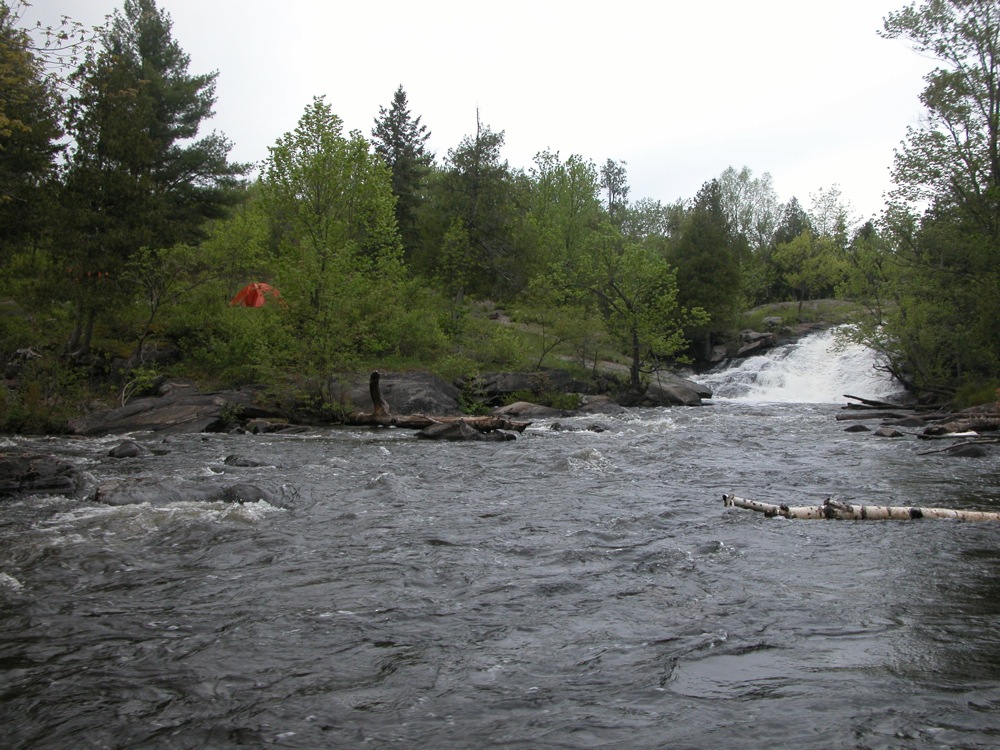
The falls is a popular camping spot for canoeists. The area was not as messy as I feared it might be, based on complaints I had read online, but it was still early in the year. I was there on Victoria Day weekend, and 5 or 6 groups were camping at the falls.
Whoever was responsible for naming waterfalls in this part of the world apparently did not have much imagination. This is one of 14 "High Falls" in Ontario between Ottawa and the Georgian Bay. There is also a "High Chute" in that area. There is even another High Falls on Eels creek, about 40km to the north.
Nearby Falls
Burleigh Falls is about 15 minutes away. Fenelon Falls is a 75 minute drive to the east, and Healey Falls is about an hour to the south.
Photo Gallery
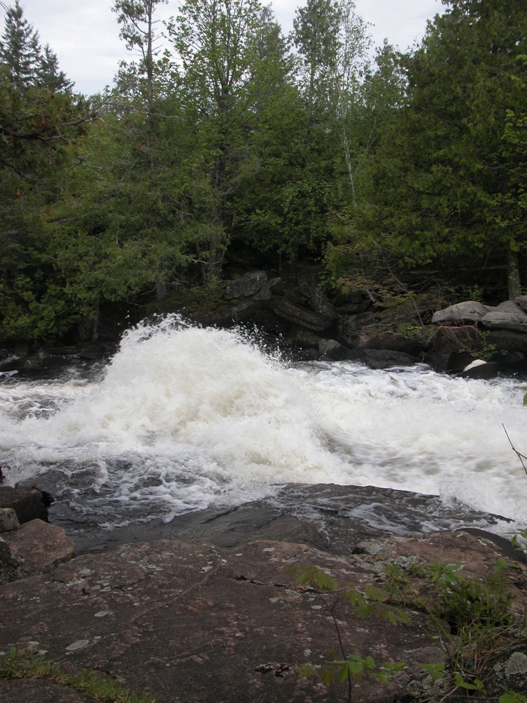 The waterwheel |
 |
 |
 The falls goes around the island The falls goes around the island |
 |
 |
 The side creek crossing |
 |
 Downstream of the falls Downstream of the falls |
 A small falls on the side creek A small falls on the side creek |
This page has been accessed
45009 times.
Last Modified:
Thursday, 06-Jul-2017 17:13:08 MDT.