

These maps were all generated with my own software and data from the ESRI Base World Map, the Census 2000 Tiger/Line Data, the National Atlas of the United States, Brainy Geography, the Geographical Names of Canada and other sources.
Maps
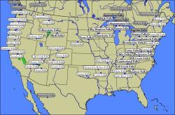 USA |
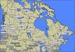 Canada |
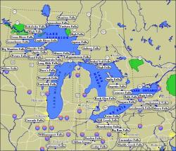 Great Lakes |
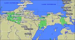
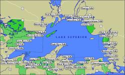 Lake Superior |
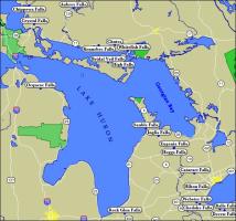 Lake Huron |
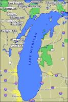 Lake Michigan |
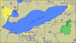 Lake Erie |
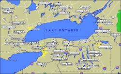 Lake Ontario |
 Michigan |
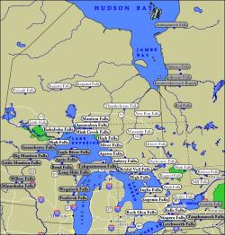 Ontario |
More Static Maps
This page has been accessed
860454 times.
Last Modified:
Thursday, 22-Jun-2017 21:05:01 MDT.