

New York is the Empire State and is one of the most heavily populated states in the country. A significant chunk of that population is located in the southeastern portion. The rest of the state, referred to as "Upstate New York", is much more lightly populated and features plenty of natural scenery. The Adirondacks contains nearly 3 million acres of wilderness.
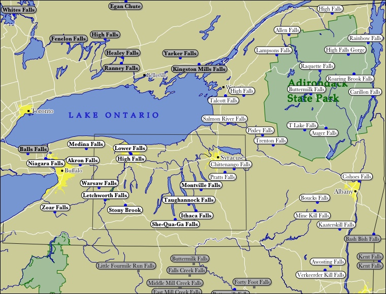
Waterfalls are plentiful in New York and come in all sorts of shapes and sizes. The map only shows a small number of the falls for which I have any information. On-line searches will turn up pictures of most of the falls on the map. Niagara Falls is on the New York/Ontario border. The Finger Lakes Region has dozens of waterfalls. The 250' Kaaterskill Falls has long been a tourist destination, and many waterfalls can be found in the mountainous northern part of New York.
There are several sites dedicated to New York Waterfalls. They include the following:
- Waterfalls of Western New York State
- Ruth's Waterfalls
- Waterfalls of New York State
- 200 Waterfalls in Central & Western New York
This page has been accessed
151962 times.
Last Modified:
Tuesday, 25-Mar-2008 16:02:03 MDT.