

The Cumberland Plateau lies west of the Appalachian Mountains and across Tennesse and Kentucky. Technicall it extends farther north, but its name changes to the Allegheny Plateau. In Tennessee many rivers and creeks have carved deep gorges, known as gulfs locally, into the plateau resulting in large number of waterfalls, including Falls Creek Falls, the highest single plunge east of the Rockies. This is also karst country, and many of the waterfalls flow into, or out of caves. Virgin Falls does both. Due to the rugged nature of the gulfs, a lot of these waterfalls are still quite wild.
Even though the Cumberland Plateau extends far to the north, only in Tennessee is it so heavily populated with waterfalls.
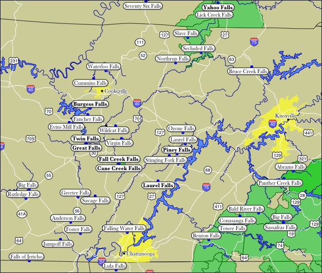
The southeastern portion of the above map is part of the Appalachian Mountains. Abrams Falls is in Smoky Mountain National Park. I am not sure of the westward extent of the Cumberland Plateau. Savage Falls is on the Cumberland Plateau, but Burgess Falls is a result of the Highland Rim, which is just west of the Cumberland Plateau. For a comprehensive list of waterfalls in this area, including pictures and locations, see the excellent Tennessee Landforms website.
This page has been accessed
131514 times.
Last Modified:
Tuesday, 25-Mar-2008 16:01:15 MDT.