

This is a list of minor waterfalls that I have visited. These falls do not get a page of their own because they are either relatively small, isolated, difficult to get to, and/or not overly photogenic. There is no exact science to this. Some of these falls are nice secluded hang outs for the locals, and I am sure that each of these waterfalls is someone's favorite waterfall in all the world, but you have to be more than a little obsessive to go seeking them all out. Another reason for listing many of these falls is that they show up as names in web searches or on maps with little or no additional information. Hopefully this page will let you make a more informed decision about trying to visit these waterfalls.
| [A-B] | [C-G] | [H-L] | [M-O] | [P-S] | [T-Z] |
42.63128N 77.3613W
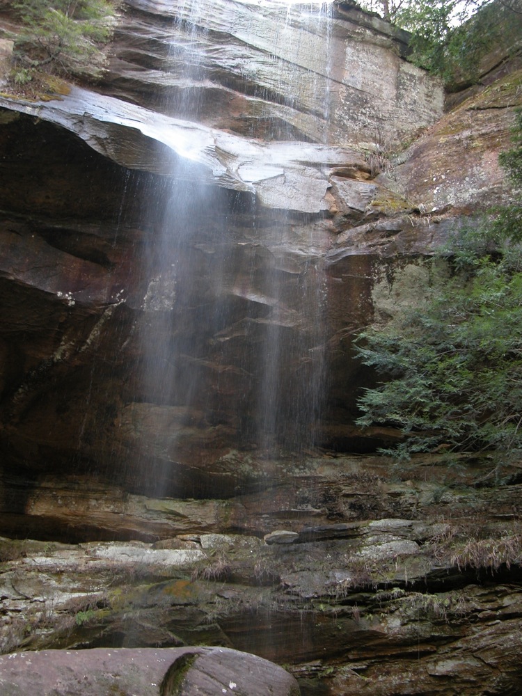
 Angel Falls
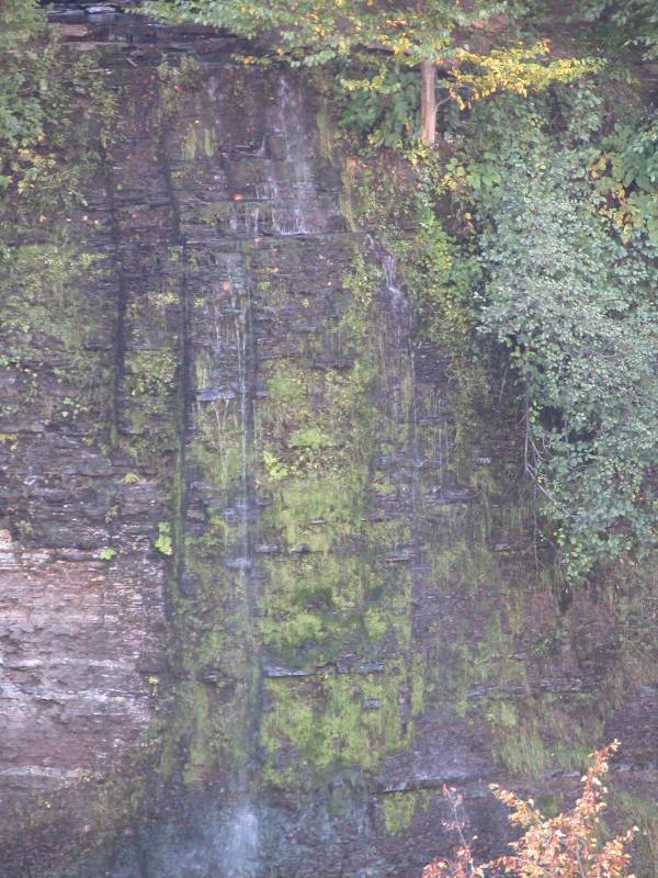
Angel Falls, zoomed in, September 2006

The view from across the gorge.
Angel Falls is a 120' foot waterfall located near Naples New York in the High Tor Wildlife Management Area. It falls into Conklin Gully. A 120' foot waterfall sounds pretty exciting, but height is not everything. The waterfall can only be easily seen from across the gorge, from several hundred feet away, and even after a good rain the night before, there was not much water going over the cliff. The falls also faces north, which makes for some difficult lighting on a sunny day.
To see the falls, start at the parking area for Conklin Gully. There is unmarked, steep trail that climbs up the side of the gorge. This is on the left hand side of the gorge, facing upstream. The trail is steep, but you do not have to ever actually climb. Eventually the trail levels out and you can see across the gorge and have a look at Angel Falls, assuming any water is flowing. To reach the base of the falls you would have to climb up Conklin Gully past the big falls. In the winter people climb the frozen falls. They reach the base by rappelling down the cliff.
There are at least two other Angel Falls in New York. The USGS lists the falls in Java Village as Angel Falls. There is also an Angel Falls downstream of Carpenter Falls on Bear Swamp Creek near Skaneatles Lake. A picture of this pretty falls can be found here.
42.39222N --79.26889W
Arkwright Falls
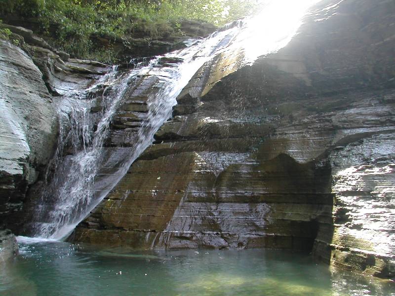
The Main Waterfall, 15', August 2002

A Fall on the left (north) fork
Arwright Falls is near the town of Arkwright, New York. There are several falls in this gorge, the main one being about 15 feet tall. Unfortunately the area is closed to the public. The land is privately owned, and the owners got tired of people trashing the area.
45.0124N 79.61395W
Bala Falls
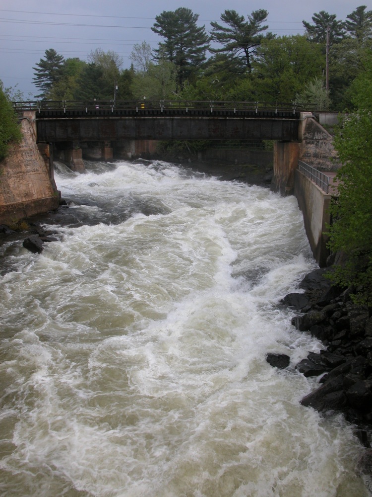
May 2011
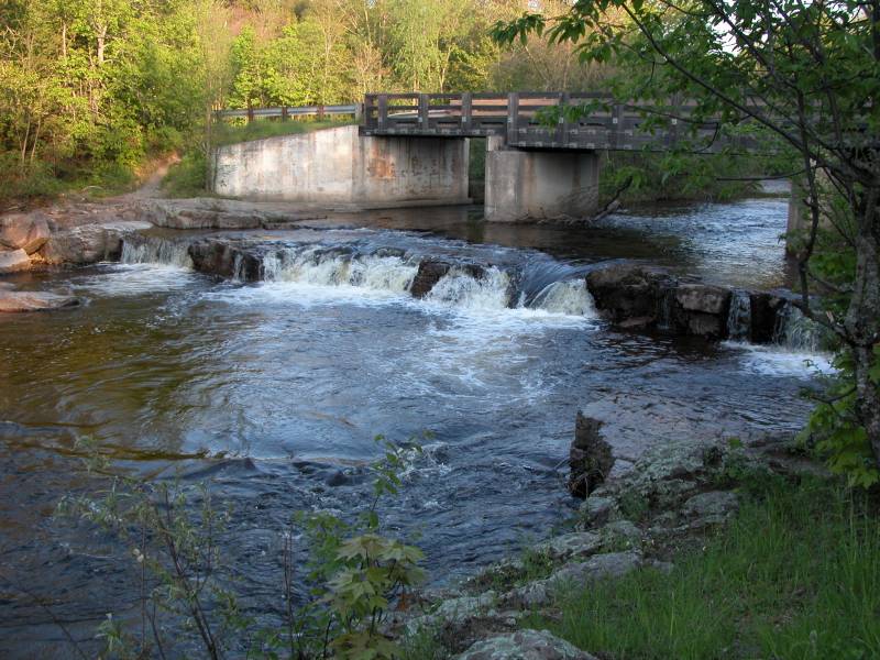
Bala Falls is a long low falls on the outlet of Lake Muskoka. There is a dam at the crest of the falls, concrete embankments line part of the falls, and multiple bridges cross it, so this is by no means a wild waterfall. It is easy to visit however, and quite fierce when the water levels are up.
The falls is located in the town of Bala, and Route 169 spans the falls. There is a large parking area on the south side of the falls and multiple vantage points from which to view them.
There are plans to develop the falls further for power generation.
46.39556N 83.29194W
Bells Falls
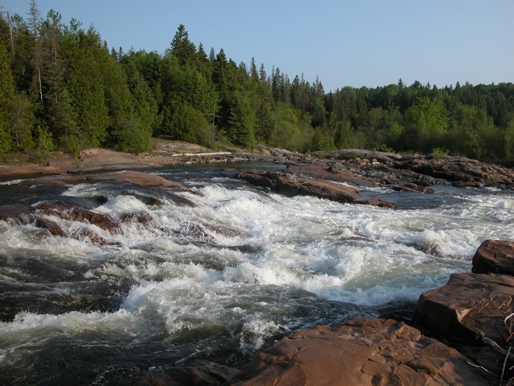
May 2010
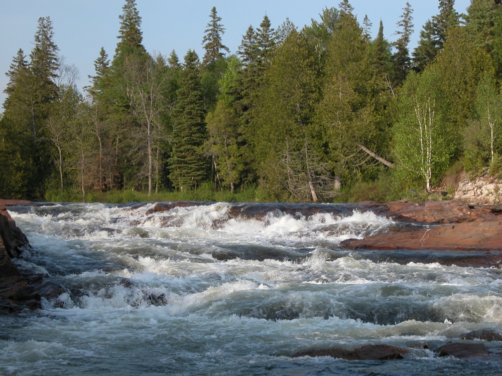
Bells Falls is a long, low and wide rapids on the Little White River. The falls width can vary depending on water levels, but it is around 30m wide. The river drops about 5m over a 50m stretch. You can easily walk around the bare bedrock alongside the falls.
This is an easy waterfall to visit. It is located in Bellingham, which is located about 10km from Hwy 17. From Hwy 17 head north on Route 546 from Iron Bridge. Turn left on to Route 544. Follow this to Bellingham. The road crosses the Little White River above the falls. Just past the bridge there is a short dirt road on the left. Park at the end of this road, and walk down to the falls.
This is not the sort of waterfall you are likely to go out of your way to see. Both this falls, and Little Rapids can be visited while on your way to the very impressive Aubrey Falls.
46.8655167N 88.08375W
Big Eric's Falls
May 2006
Big Eric's Falls is located on the Huron River east of Skanee. The falls consists of a series of drops, each of which are only a few feet high, but around 100 feet wide. It is named for Big Eric Erickson, a logger from the 20's. In addition to the falls, he also has a road, a bridge and a campground named for him (although sometimes the name is spelled 'Erick', so maybe they were named for his father?). Big Eric's Bridge Campground is right next to the falls. The falls are just below the bridge.
To reach the falls head east on Skanee Road until it ends. This is also the end of the pavement. Head right on Erick road for a mile until you reach the bridge. Beyond the bridge are rough, unpaved road, and some wild waterfalls such as Forty Foot Falls. Big Falls, a much larger drop on the Huron River, is several miles upstream.
46.7116667N 87.703889W
Big Pup Falls
June 2015
Big Pup Falls is a roadside series of small drops on Big Pup Creek north of Marquette. No individual drop is more than 5 feet, but it is a very pretty little waterfall. A rough trail starts at the road and follows the creek downstream.
The falls is located off of county road 510, just downstream of the bridge that crosses Big Pup Creek. There is room to park on the east side of the road. To reach the falls from US 41 you could head north on country road 502. After .6 miles turn right onto 510, and follow it for 17.5 miles. A longer, but less wild route, is to head north from Marquette on Big Bay Road. After 25 miles turn left on to road 510. After 2.5 miles you will reach the intersection with AAA road and 510. Turn left here, to stay on 510. From here on the roads are no longer paved. Follow this for 7 miles to reach the falls.
Yellow Dog Falls, which is also off of 510, is just a few miles to the north.
39.45311N 82.56046W
Big Spring Hollow Falls
March 2010
At over 100', Big Spring Hollow Falls is one of the highest, if not the highest waterfall in the Hocking Hills area. If it had more water, this would be a very impressive waterfall, but when I saw it it was a wispy curtain of spray. It is at least 10' wide, which makes it all the wispier.
Reaching this waterfall takes a bit of work. The trailhead for the falls is located off of Big Pine Road east of route 374. There is the parking lot for the climbing and rappelling area of Hocking Hills on the north side of the road. The trail to Big Spring Hollow Falls is on the south side of the road. Head straight towards the hills, taking the first right. The trail basically follows the base of the cliffs, with lots of up and downs. You will quickly pass a seasonal falls, which was nothing but a trickle when I was there. After about a 1/2 mile, you will reach the big falls.
There is a large rock house here, and you can easily walk behind the falls. This is not an easy waterfall to photograph, especially when the sun is behind it, which happened to be the case when I visited. More pictures can be found here.
39.47493N 82.5093W
Blackjack Falls
March 2010
Blackjack Falls is a small roadside falls in the Hocking Hills area. The falls drops just a few feet and is easily viewed from the bridge that crosses the creek just below the falls. The falls is located on Blackjack Road, about a mile northwest of where Blackjack Road meets Route 664. I believe the creek is also named Blackjack. Of the numerous minor falls in the area, this is more likely to have water than most.
This waterfall is listed in the USGS data without a waypoint.
44.29667N 90.84472W
Black River Falls
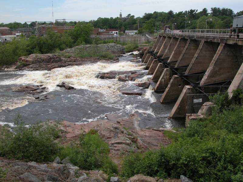
June 2005
The community of Black River Falls is in western Wisconsin just off of I-94. There are lots of cities and towns with "Falls" in their name, and you just know that there must be, or have been, a waterfall of some sort in the area, and any waterfall hunter is always tempted to go explore these places. More often than not what you will find is a dam, as is the case at Black River Falls. Here the rapids of the Black River, which is a good size river, once dropped 10-20 feet. A large dam now sits on the site, providing power to the town. When water is being released you get a sense of what the falls might have looked like.
I believe this waterfall is also known as Ni-ho-kha-wa-ne-ey-ja. This is the name that shows up at this location in the USGS data.
46.7874N 88.2394W
Black Slate Falls

May 2015
Black Slate Falls is one of the many named drops on the Slate River. There seems to be a bit of confusion about exactly which name goes with which drop, but the general agreement is that Black Slate Falls is the uppermost set of drops on the Slate River, upstream of Quartzite Falls. None of the drops are more than a few feet tall, but the river is good sized and the area is remote and scenic.
Reaching this waterfall is relatively straightforward. From Skanee Road, head south on Avron Road. This is the road just east of the bridge over the Slate River. This is a dirt road, but it is well maintained. Drive 1.3 miles, and then take a left. According to Google Maps, this is All Wood Road, but I do not recall if there are any signs. Head east for a tenth of a mile. You should reach a bridge over the Slate River. Just beyond the bridge there is parking on the left side of the road. There are trails that head upstream on both sides of the river that will take you past the many drops of Black Slate Falls. If you head downstream, you will reach Quartzite Falls.
46.818033N 89.5691W
Bonanza Falls
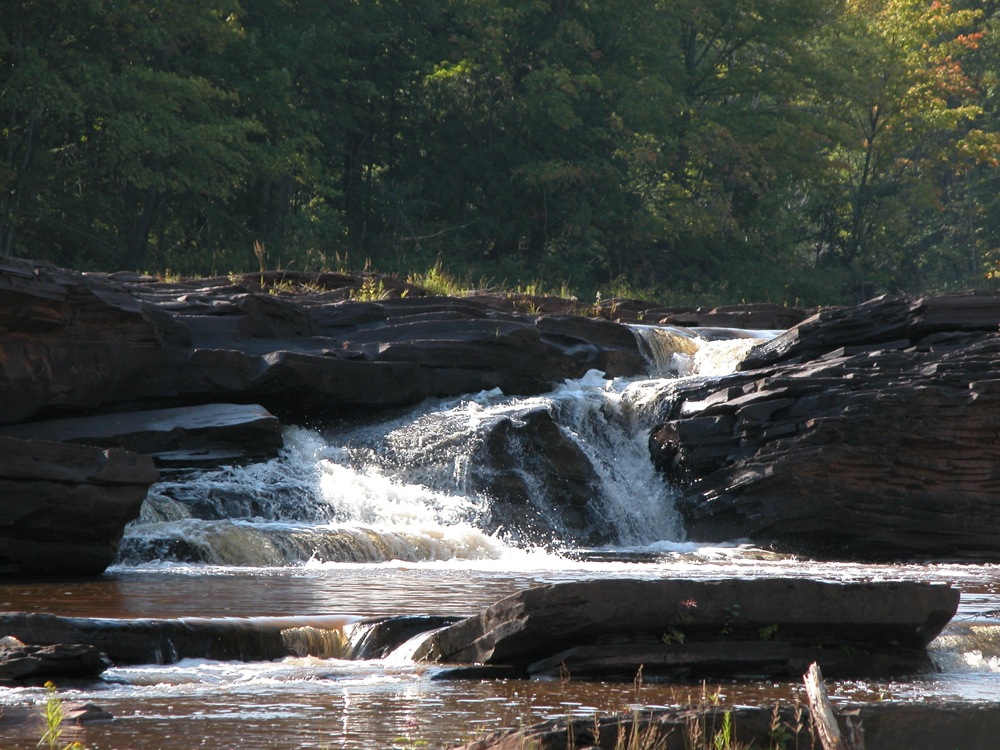
September 2009
Bonanza Falls is a wide, low falls on the Big Iron River. The falls is at most 10 feet high, but in the spring the falls is 100 feet wide. In summer it is broken up into a number of segments. The bedrock here is tilted back against the flow of the river, creating many obstacles for the water to overcome.
Bonanza Falls is located about a mile south of Silver City along Route 64. This is a sign on west side of the highway visible as you head south for Bonanza Falls. A short gravel road leads to the river. The "Bonanza" refers to the mining boom times of the 1800's.
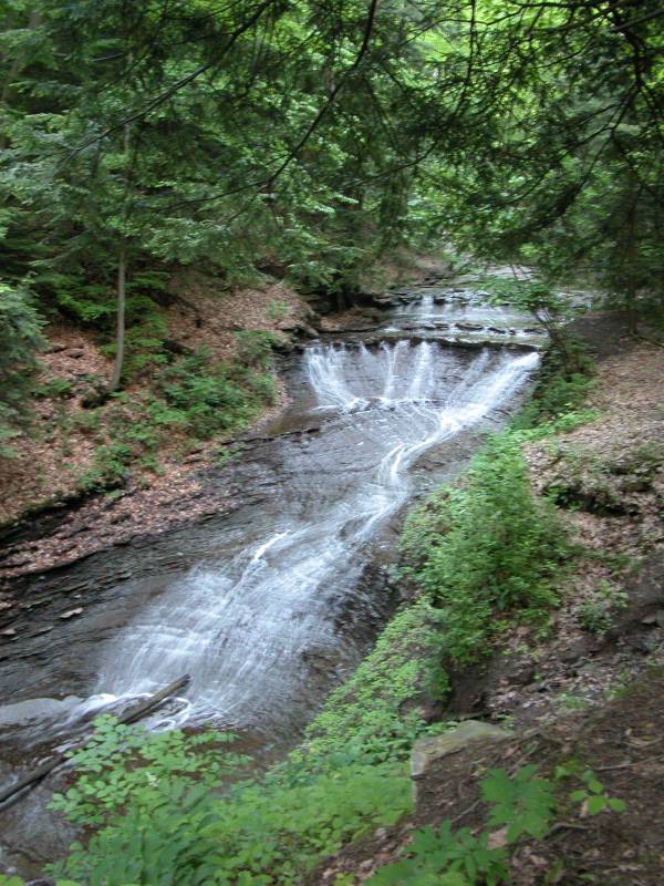
41.52444N 76.11972W
Bowman Hollow Falls

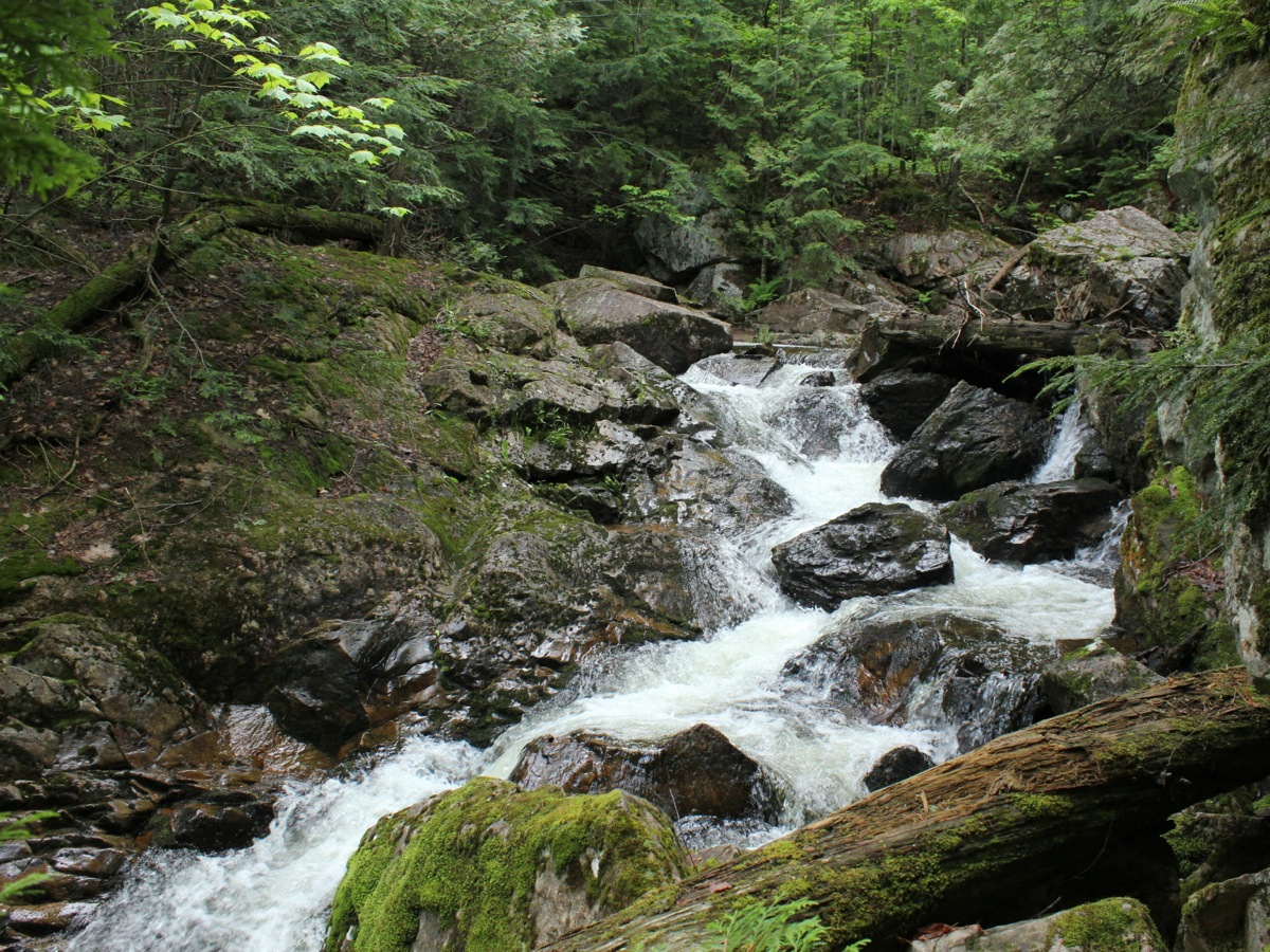
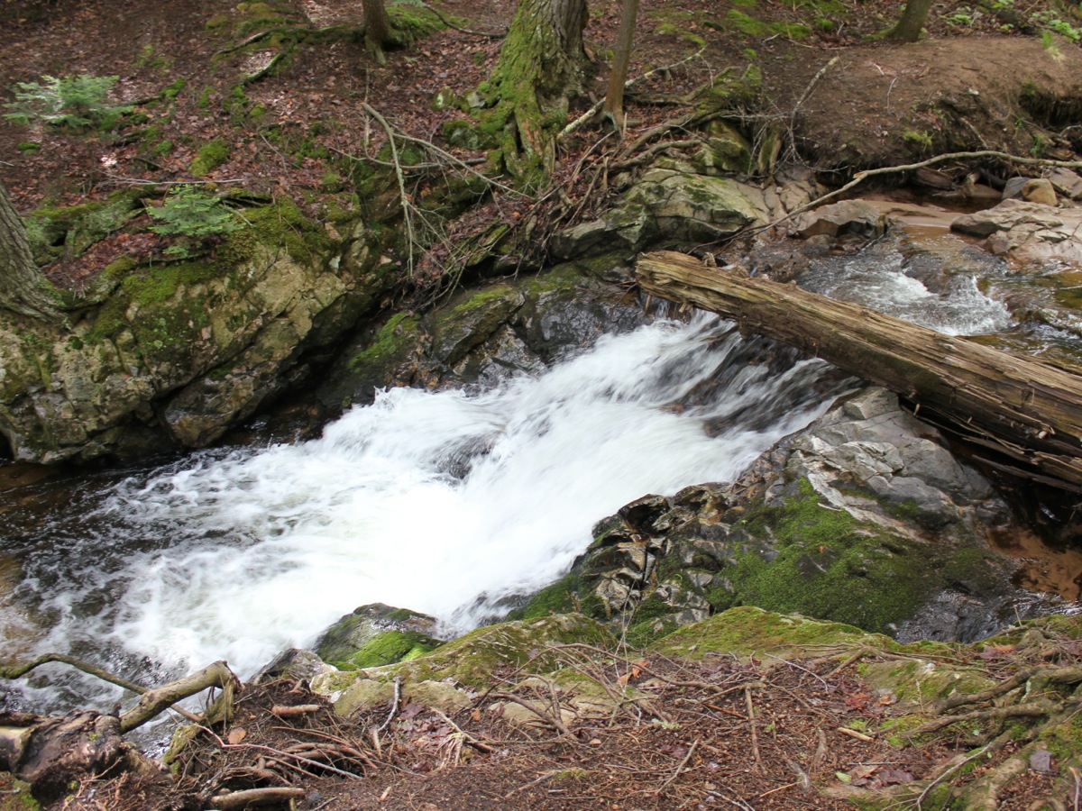
May 2015
Bowman Hollow Falls is a 20'+ falls near Forkston Pennsylvania, which is about a 15 minute drive west from Tunkhannock. You can get an obstructed view of the falls from above, but if you really want to see it, you will need to walk up the creek about a quarter mile.
To reach the falls from Tunkhannock, head west on US 6 for 6 miles. Turn on to PA 87 and continue about 8.5 miles. Take a slight left on to Main street, and follow it for 1.1 miles. Here there will be a bridge on your left that crosses the creek. If you want to see the falls from above, take the left, and cross the bridge and continue on Burgess Road. Drive for about a third of a mile. You will not be able to see the falls, but you should be able to hear them as they are only a few dozen feet from the road. There is room on the north side of the road to pull off and park, and some short trails lead to brink of the falls.
If you want to walk the creek, stay on Main Street and continue into town. I did not try this, but I am told you can access the creek from here.
41.37306N 81.54944W
Bridal Veil Falls
May 2004
This small, gently sloped 15' high waterfall is in Bedford Reservations Cleveland Metropark, in Cleveland Ohio adjacent to Cuyahoga Valley National Park. From the looks of it there is never a lot of water in this waterfall. Nonetheless it is impressive for a city park to have a waterfall. The waterfall can be accessed from the Gorge Parkway. There is a sign, trail and observation platform. The walk to the falls is short.
37.71917N 80.89222W
Brooks Falls
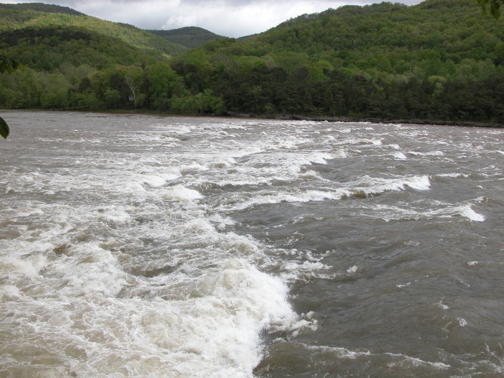
May 2009
Brooks Falls is a 4' high drop on the New River. It is notable for being over a 1000' wide, but is really not a waterfall, except in the sense of being a navigational hazard. The rapids is runnable. There is a parking area on the west side of the river from where you can view the rapids. The much more impressive Sandstone Falls is a few miles downstream. The parking area is also the trailhead for the Big Branch Trail, on which you can find the seasonal 20' Big Branch Falls.
44.556N 78.2024W
Burleigh Falls

May 2011
Burleigh Falls is a long, wide cascade between Lower Buckhorn Lake and Stoney Lake. This is a wide falls, separated by several small rocky islands. The entire falls is not visible from land. The falls is located in its namesake town aloung Route 28. The best spot to view the falls is from Old Burleigh Road, on the south side of the falls.
Burleigh Falls is part of the Trent-Severn waterway. Lock 28 circumvents the falls.
40.84N 79.499W
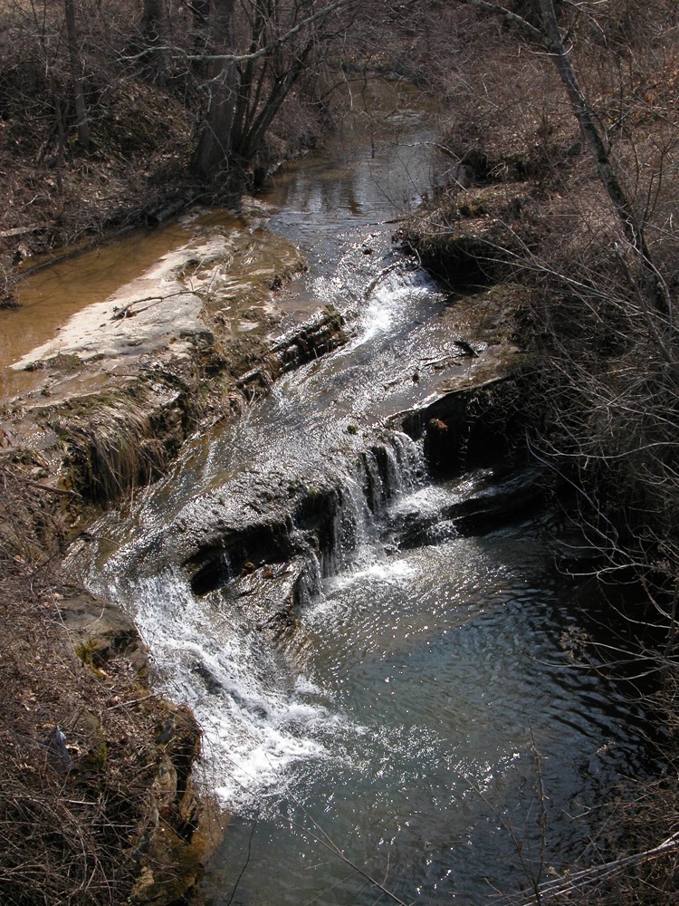
Buttermilk Falls
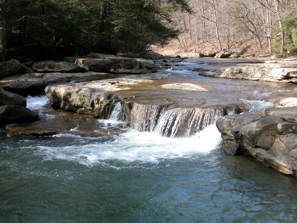
May 2009
Buttermilk Falls is a small falls with a drop of about three feet on Cowanshannock Creek. The falls can be reached by the Cowanshannock Trail. The parking for the trailhead is off of State Route 1033 north west of Kittanning. The trail is crushed gravel, and is mostly level. It is about a one mile walk to the falls. The trail also passes a very seasonal side falls.
| [A-B] | [C-G] | [H-L] | [M-O] | [P-S] | [T-Z] |
This page has been accessed
12907 times.
Last Modified:
Thursday, 03-Aug-2017 21:00:50 MDT.