

This is a list of minor waterfalls that I have visited. These falls do not get a page of their own because they are either relatively small, isolated, difficult to get to, and/or not overly photogenic. There is no exact science to this. Some of these falls are nice secluded hang outs for the locals, and I am sure that each of these waterfalls is someone's favorite waterfall in all the world, but you have to be more than a little obsessive to go seeking them all out. Another reason for listing many of these falls is that they show up as names in web searches or on maps with little or no additional information. Hopefully this page will let you make a more informed decision about trying to visit these waterfalls.
| [A-B] | [C-G] | [H-L] | [M-O] | [P-S] | [T-Z] |
46.58N 88.5889W
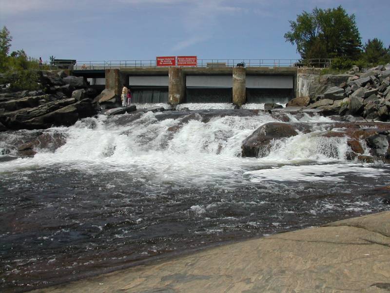
 Tibbets Falls
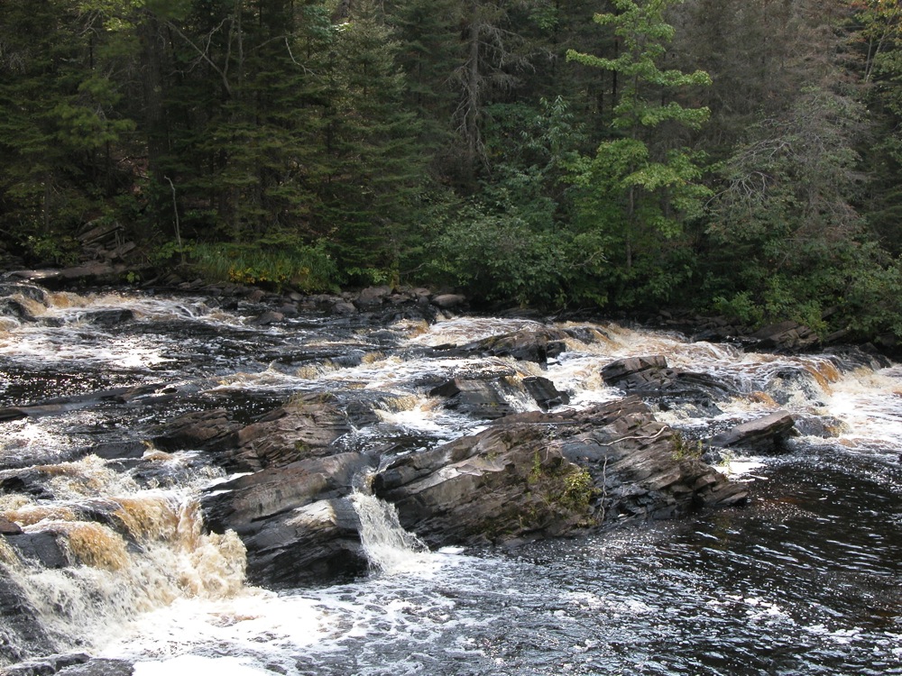
September 2009
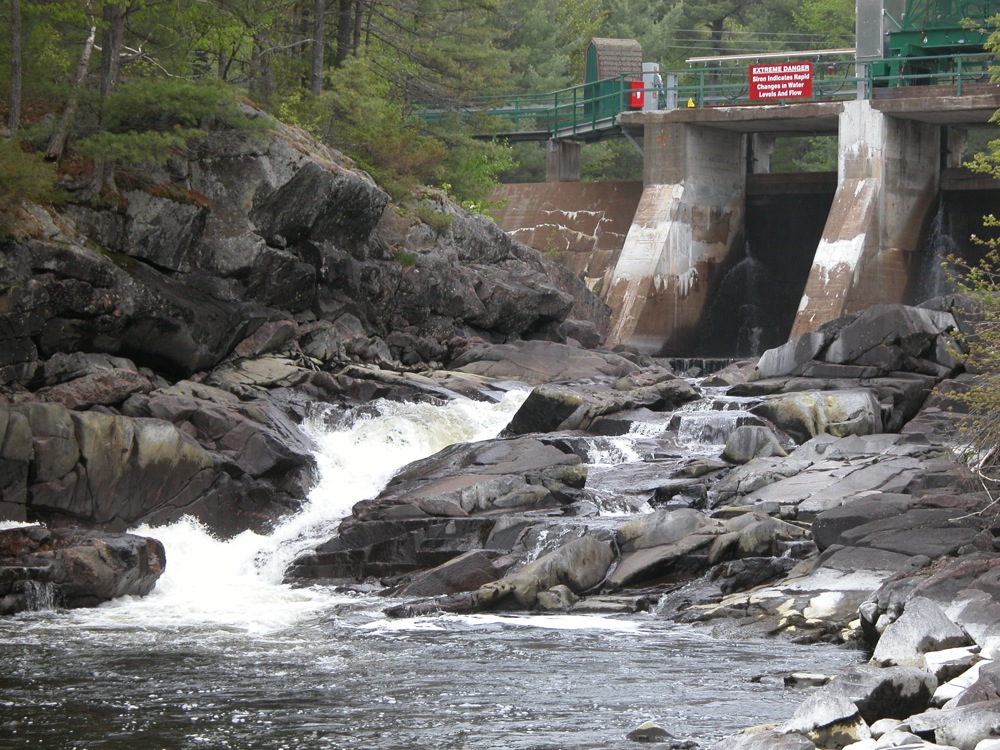
Tibbets Falls is low, wide and noisy falls on the Sturgeon River. The river tumbles over a series of small steps, dropping about a total of 10 feet, followed by a long stretch of white water. The river is around 80 feet wide at this point.
To reach the falls head north on Plains Road from Route 28. After about three miles you will cross the Sturgeon River. The road will turn to the left. The road to Tibbets Falls will be the first road on thee left. There is a sign. The "road is a simple two track that may not be passable in wet weather. The two track is not wide enough for two vehicles, so be prepared to back up if you run into someone else. I chose to walk the trail. When you reach the first fork in the road, take a left. The road ends at a small turn around. The total distance to the turn around is about 3/4 mile. It is a short walk from here down into the gorge to see the falls.
The North Country Trail passes by Tibbets Falls. If you continue hiking west you will eventually reach O Kun de Kun Falls.
46.5734N 88.3398W
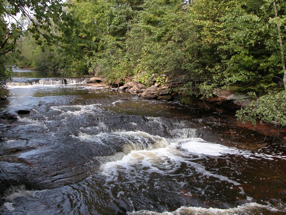
Tioga Creek Falls


June 2015
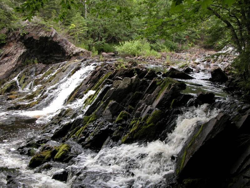
Tioga Creek falls ia a series of small drops along Tioga Creek accessible from a highway rest area. The falls are located on US 41 a few miles west of Nestoria. Tioga Creek Roadside park is on the south side of the road. The lower cascade is visible from the parking area. A marked trail follows the creek upstream for a few hundred feet to the small upper drop.
There is a much larger falls on Tioga Creek several miles downstream. The falls is on the property of a rentable backwoods cabin.
47.2313N 88.1487W
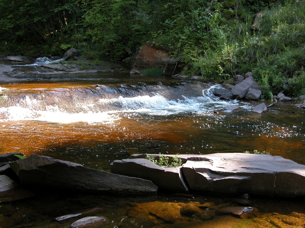
Tobacco Falls
September 2009
Tobacco Falls is a series of small drops on the Tobacco River shortly before it empties into Lake Superior. The drops are each only a foot or two high. The falls are along Lac la Belle Road about one mile north of Gay Michigan. The falls are visible from the road. There is a roadside park along the shore where the Tobacco River meets Lake Superior. From here you can walk under the bridge to get a better view of the falls. Based on the looks of the satellite imagery, there is some more white water a bit further upstream. I do not know if that rapids is accessible by the public.
46.7511N 89.8942W
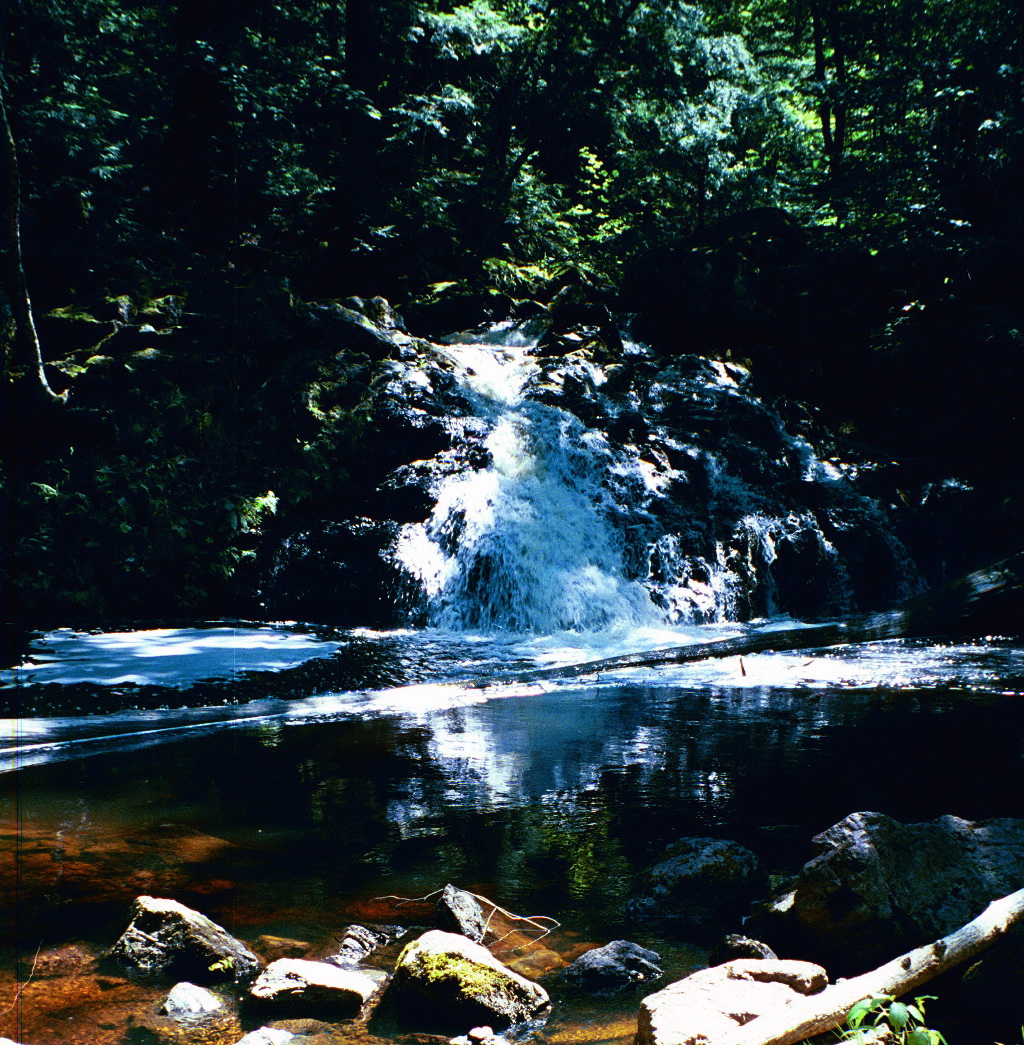
Traders Falls
September 2009
Traders Falls is a small remote falls on the Little Carp River in the Porcupine Mountains. The falls is less than 5 feet high, and 2 miles from a road. Given the size of the falls it is surprising it has a name at all. It is possible this is the farthest point one could easily canoe up the river from the lake. If it was not for the sign, I would not have known this was Traders Falls.
46.7917N 89.6906W
Trap Falls
August 2001
Trap Falls is in the interior of Michigan's Porcupine Mountains State Park. This small waterfall is remote. As you see, no roads show up in this map from MapQuest. It is a hike of more than two miles to reach this waterfall. If you are looking for a nice hike, this can be quite rewarding, but if you just want to see a waterfall, your time is better spent elsewhere.
The waterfall is only about 10 feet high. There is a long stretch of rapids above and below the falls. The falls is in a deeply forested area and is usually in shadows. The shortest way to the falls is take the Government Peak Trail from M-107. I do not recall there being much of a parking area here. It is just over 2 miles on this trail to the falls. You can also take the Union Spring Trail. It is about 4 miles to the falls on this trail. From the Lake of the Clouds overlook it is nearly a 6 1/2 mile hike to the falls. All the distances are one way. Trap Falls is one of the sights on the 15 mile Escarpment Trail/Government Trail loop.
44.983N 79.266W
Trethewey Falls
May 2011
Trethewey Falls is a small falls on the south branch of the Muskoka River with a large dam built on top of it. This is not a particularly interesting or scenic falls, but it is on the maps. The falls is easy to reach. Just head east on Route 118 from Highway 11 for 3km and turn north onto Trethewey Falls Road.
45.5808N 88.1341W
Twelve Foot Falls
July 2004
Twelve Foot Falls is in Wisconsin's Marinette County, 12 miles southwest of Pembine on the Pike River. As the name suggests, this waterfall is about 12 feet high. It is a slide, like many of the waterfalls in the area. Further downstream you can find Eight Foot Falls. The waterfalls are in a county park with a $2 day use fee. Camping is also available. There are many nice vantage points from which to view the falls and trails lead to the top of the falls.
Signs will lead you to this waterfall from US 141 or US 8. From US 8 head south on Lily Lake Road and follow the signs. On this route it is about 4 miles to the falls. From US 141 head west on Beecher Lake Road and follow the signs. On this route it is about 9 miles to the falls, only three of which are paved.
Eighteen Foot Falls is a short drive away.
46.3705N 90.4115W
Upson Falls
July 2004
Upson Falls is in Upson Wisconsin. It is in a small town park off of Park Rd. If you are heading south on 122, take a right when you reach Upson and you will be on Park Rd. There are signs on 77 telling you how to reach Upson Falls.
This is a small waterfall consisting of a couple of drops, the largest of which is around 6 feet high. The waterfall is on the Potato River (or Creek at this point). As the Potato River flows north it gets more impressive. The large Potato Falls are roughly 20 miles away. Foster Falls is about 6 miles downstream.
39.4217N 82.5392W
Whispering Falls
May 2005
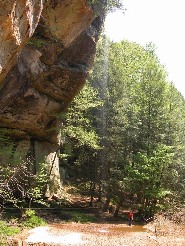
Whispering Falls is in Ohio's Hocking Hills. It can be found along the gorge trail from Old Man's Cave to Cedar Falls. The falls is roughly in the middle of the 2 mile trail. The small stream free falls around 100 feet into the Queer Creek gorge. This falls was still running in May, which means it outlives many of the other minor falls in the area, but I doubt it often makes it to June. There are at least two other seasonal falls to be found in the Queer Creek gorge.
44.880N 79.7220W
White's Falls
May 2007
White's Falls is a small waterfall in Ontario near the shores of Lake Huron, in Muskoka District. This is a small waterfall, and it has a dam on top of it. The falls is about 10 feet high, and 40 feet wide. There are a large number of waterfalls like this in this part of Ontario, dam included. White's Falls is located east of Hwy 400 on White's Falls Road. There is a small roadside park by the falls. The falls is on the stream that flows from Six Mile Lake to Gloucester Pool. This is another common feature of area waterfalls. They are often on the inlet or outlet of a lake. If you continue east, you will reach Big Chute. The falls here has been dammed dry, but the Big Chute Marine Railway is a fascinating engineering marvel.
45.3514N 122.6208W
Willamette Falls
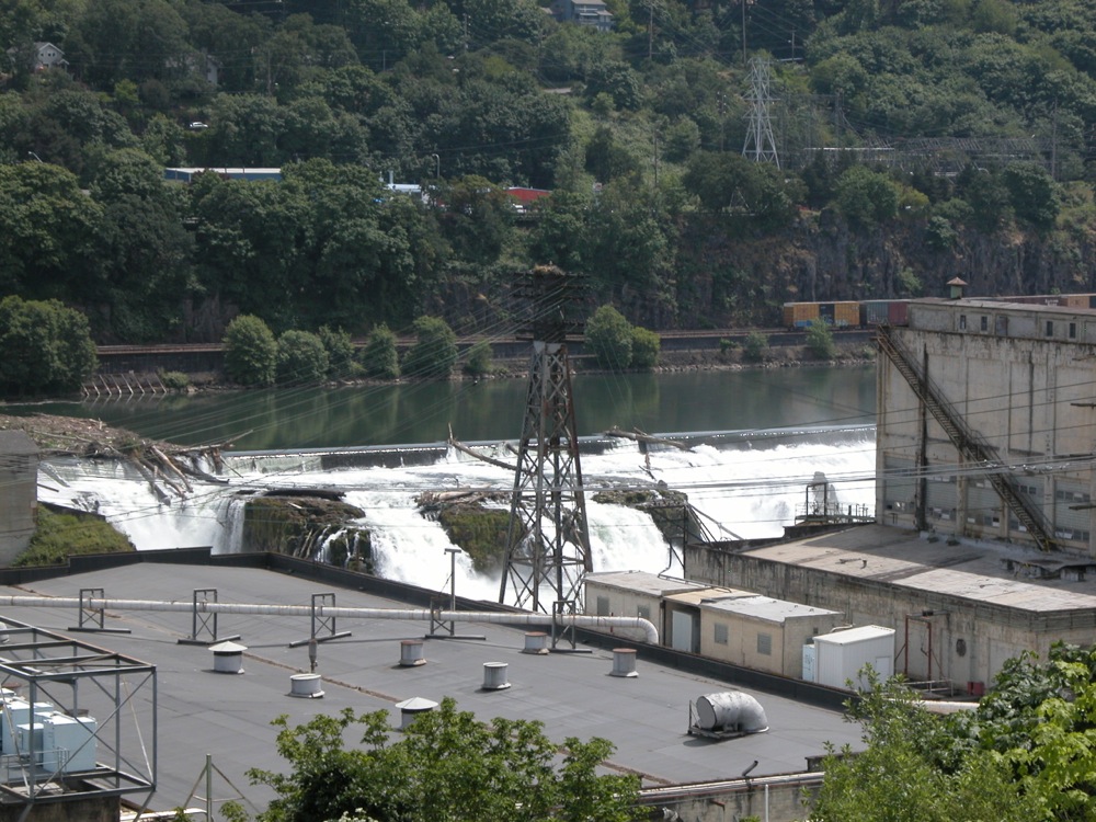
May 2008
Willamette Falls is by no means a minor waterfall when judged by size. The Willamette is a large river, with over 30000 cubic feet per second of water at its mouth. The falls, located 26 miles upstream of the mouth is 40 feet high and over a 1000 feet wide. Unfortunately visiting the falls is not easy. The falls is partially dammed, and industry lines the river below the falls. There are no unobstructed views available on land. The photo above is the best I could manage. Views from the water would be better, but kayaking or canoeing the Willamette is not a trivial matter either.
46.5657N 87.44545W
Wright Street Falls
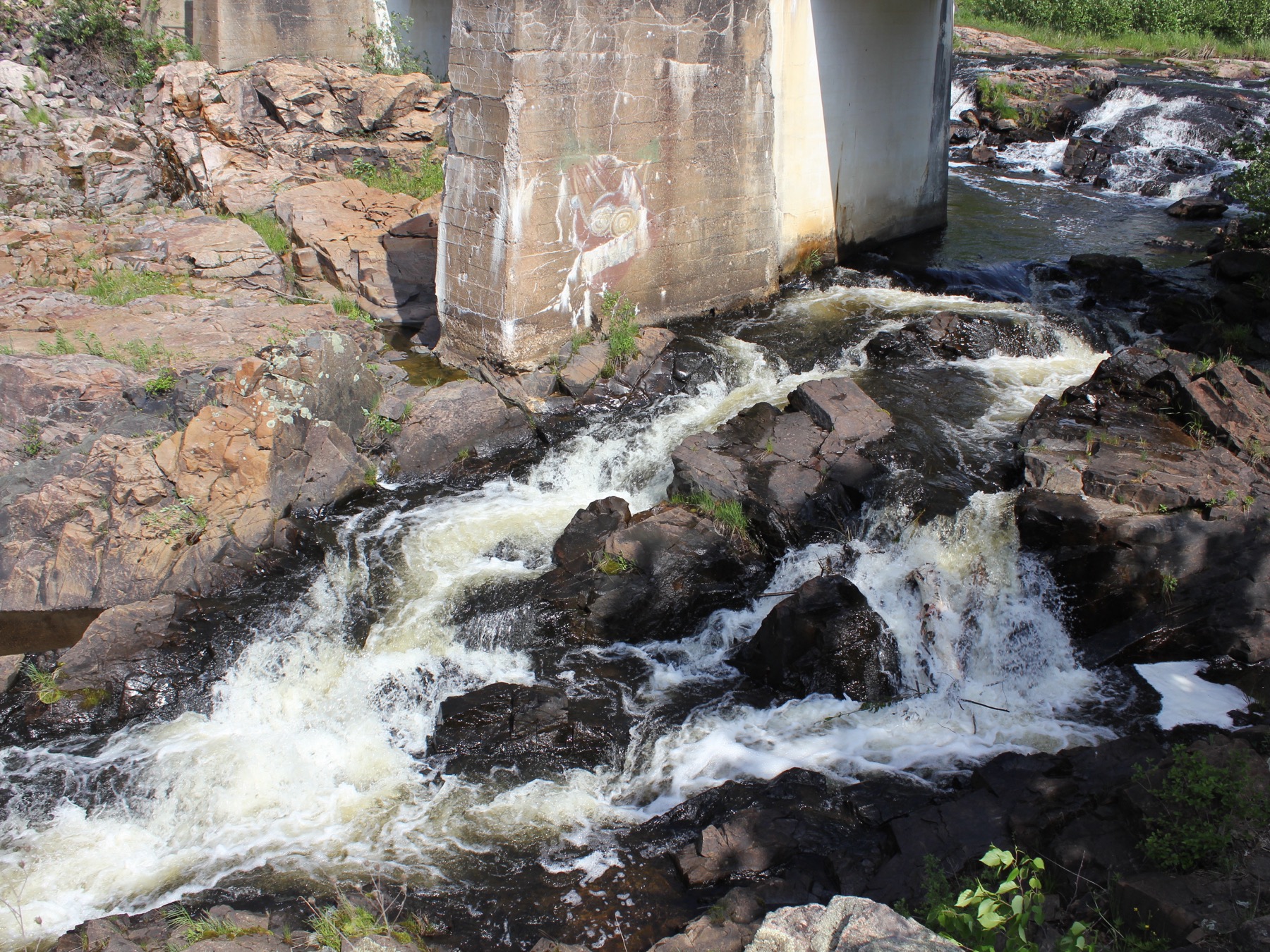
May 2012
Wright Street Falls is a small, but scenic set of drops on the Dead River. This is the second to of the many falls on the Dead River. It does not have an official name, but it is known as Wright Street Falls, because it is accessed from Wright Street. There is a small turn out on the north side of the road, about 2 miles from US 41. You can park here, then walk across the bridge to the falls.
There is a bridge above the falls which carries the pipe through which the Dead River is diverted from the Forestville Dam upstream to a generating station downstream. There is an old section of concrete pipe that you can crawl into if you like. I am not sure what its purpose was.
46.4303N 89.6844W
Yondota Falls

May 2015

May 2015
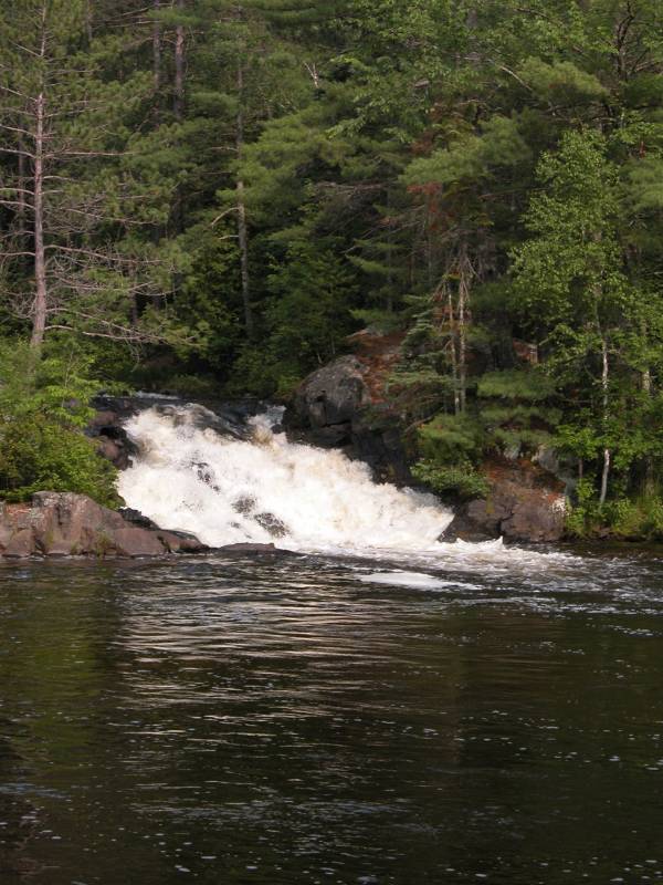
Yondota Falls is a 10+ foot drop on the Presque Isle River. Upstream and downstream of the drop are a series of rapids, making for a long noisy stretch of river. This is not a big falls in terms of height, but the river carries a lot of water, especially in the spring and early summer.
This is a wild waterfall, and fairly remote. From US 2, head north on Forest Road 523 for 3 miles. This starts out as a paved road, but becomes a dir road after a mile. Once you cross the bridge over the Presque Isle River, there is a parking area on the west side of the road. The trail starts here, and follows the river a quarter mile to the falls.
The Presque Isle River eventually makes its way to Porcupine Mountains State Park and Lake Superior, where it tumbles over Manabezho Falls, Manido Falls and Nawadaha Falls.
| [A-B] | [C-G] | [H-L] | [M-O] | [P-S] | [T-Z] |
This page has been accessed
12046 times.
Last Modified:
Tuesday, 15-Jan-2019 17:07:57 MST.