This is a list of minor waterfalls that I have visited. These falls do not get a page of their own because they are either relatively small, isolated, difficult to get to, and/or not overly photogenic. There is no exact science to this. Some of these falls are nice secluded hang outs for the locals, and I am sure that each of these waterfalls is someone's favorite waterfall in all the world, but you have to be more than a little obsessive to go seeking them all out. Another reason for listing many of these falls is that they show up as names in web searches or on maps with little or no additional information. Hopefully this page will let you make a more informed decision about trying to visit these waterfalls.
| [A-B] | [C-G] | [H-L] | [M-O] | [P-S] | [T-Z] |
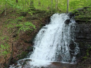
44.9062N 93.189W Hidden Falls
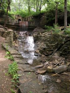
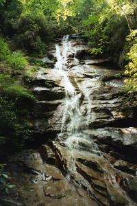
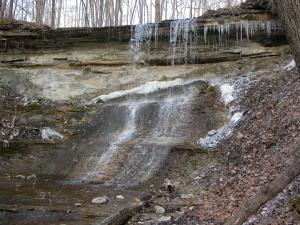
This small waterfall is located in St. Paul. It is located in Hidden Falls Regional Park, which is right across the river from Minnehaha Park and Minnehaha Falls. This is a small falls and does not have a lot of water. It had been raining heavily the day before the photo was taken.
From Minnehaha Falls, cross the river on 46th Street/Ford Parkway and take the first right. This twisty road is Mississippi River Blvd. The entrance to the park is on the right just after one of the turns. The sign is not real easy to see when coming from the north. Once in the park, park at the first parking lot, and walk to the right (north) to find the falls.
There is a long trail that follows the shores of the Mississippi River that cuts through the park. They are also picnic areas and restrooms.
43.0257N 78.3997W Indian Falls
Indian Falls is in Indian Falls New York. There are many towns with 'falls' in there name, and you know that at one time there must have been a waterfall there. In many cases dams have replaced the falls, but Indian Falls still has its waterfall. The waterfall is on private property and there is no good place to get a view of it from the road. There is a bar and grill next to the falls from which you could get a decent view of the falls. Unfortunately I was there at 10 in the morning and the bar was not yet open.
The falls is on Tonawanda Creek and appears to be about 20 feet high, and 50 feet wide. Indian Falls is on the Onodaga Escarpment, which is responsible for a number of falls in Western New York, including Akron Falls. Upstream about 1/2 mile of Indian Falls you can find Little Falls. Just follow Little Falls road and look for a parking area on the left side of the road. This is a cascade with a gradual drop of 5 to 10 feet. The land around this falls appears to be public and there are some trails along the river bank that lead to the falls.
There is a 6 foot high Indian Falls in nearby Lockport New York.
42.6720N 78.4358W Java Village Falls
35.13N 82.589W Jones Gap Falls
This small 50' waterfall is in Jones Gap State Park in South Carolina. Jones Gap State Park is 25 miles northwest of Greenville off US 276 and 11 miles northwest of Marietta. The Falls is roughly 2(?) miles from the Jones Gap Trail trailhead. The falls themselves are not particuarly impressive, but the general area is quite lovely. The trail follows the Middle Saluda River closely. There are lots of cascades and small falls along the river.
Misty Cavern Falls is another small waterfall in the area. From Jones Gap State Park, you can hike to Ceasar Head State Park (the two are adjacent). The impressive Raven Cliff Falls are at Ceasar head. Unfortunately I did not know this when I was down there. The 100 foot Falls Creek Falls are also quite close by.
46.445N 88.9134W Jumbo Falls
Jumbo Falls is small, remote and wild waterfall. It is a 20' wide, 6' high drop on the Jumbo River west of Marquette. The falls is located off of MI-28, about 16 miles east of Bruce Crossing, and about 22 miles west of the US-41 junction. Turn south on Golden Glow Road. This is a dirt road. Follow this for 1.6 miles and take the first left. Follow this road. There will be a fork after .3 miles. Keep to the left, and follow the road until about 1 mile until it ends. The falls are a short distance from the parking area. You will be able to hear them.
46.3372N 89.45195W Kakabika Falls
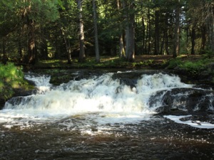
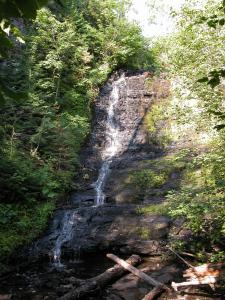
Kakbika Falls is a series of falls on the Cisco Branch of the Ontonagon River. This is a complicated waterfall. The river does an S curve with a number of cascades and drops. No drop is particularly high, and there is no vantage point from which you can see all the falls.
I visited this falls on a bright sunny day, which made photography difficult. The picture shows the final drop which is a long narrow chute.
Kakabika Falls is located off of US 2 about halfway between Watersmeet and Marenisco. Turn north on to Road 527 and head .5 miles to the bridge. There is a parking area just south of the bridge. Park here and hike downstream to see the falls. There is a trail.
46.212N 82.512W Kennebec Falls
Kennebec Falls is a small waterfall right along Hwy 17 in Ontario, roughly halfway between Blind River and Massey. If you are heading towards Chutes Provincial Park or Manitoulin Island from the west you will drive right past this waterfall. It is visible from the bridge. There is a small "parkette" here, although it was closed due to bridge repairs. The waterfall is only a few feet high, but it is 100 or more feet wide. There is a micro hydro-electric plant here run by the Serpent River First Nation.
44.8925N 88.6527W Keshena Falls
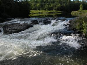
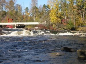
Keshena Falls is a low wide waterfall on the Wolf River. The Wolf River originates in northern Wisconsin and its waters eventually reach Lake Winnebago and then Lake Michigan's Green Bay by means of the Fox River. The upper stretches run through a rough rocky land and there are many rapids and small falls. Big Smokey Falls, which is few miles upstream of Keshena Falls, is the biggest drop on the river. At Keshena Falls the river gradually drops 10-20 feet. The river is very wide here, and the falls consist of three or more large segments. There is no spot where you can see all of the falls. In addition to the falls there are the remains of an old bridge an hydroelectric plant here. The falls are on the Menominee Reservation and are culturally significant.
They were repairing the bridge the day I visited. I do not know if better views can be found on the other side of the river (it is very easy to get to the other side by means of Route 47 but I did not know it). Keshena Falls shows up on my road atlas. To reach it head north from Shawano on Route 47/53. Stay on Route 53 when it branches off from 47, about 10 miles north of Shawano. Keshena Falls road will be on the left a 1/4 mile past the junction.
46.486N 90.264W Kimball Falls
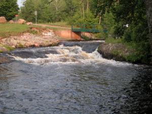
Kimball Falls is in Kimball Wisconsin. While driving west along US 2 from Saxon Falls to Peterson Falls you will see a small sign on the south side of the road for Kimball Falls. Kimball Falls is a small rapids in a small park. It is less than a mile from US 2 and easy to get there, so visiting it will not take much time, and it would be a nice area to stop for a lunch break. The sign for Peterson Falls is the same style as the sign for Kimball Falls, but Peterson Falls is far more impressive.
40.817N 85.69W Kokiwanee Falls
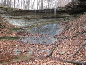
This 20'? waterfall is on the lands of the former Camp Kokiwanee Girl Scout Camp. The land was recently purchased by ACRES and is now open to the public as the Kokiwanee Nature Preserve. The falls is just outside of Lagro Indiana. From US 24 take Hwy 524 south into Lagro. Follow it across the Wabash. Take a right onto Hanging Rock Rd. Follow this until you reach Country Road 300 E. Follow this for a short distance. The park is on the right. A short distance from the parking area a sign directs you along a long, rambling and not always well defined trail that eventually leads to the falls. It is about a 30 minute walk. You can also follow the main trail, an old road, and after about 30 minutes a sign will direct you towards the waterfall. If you are feeling lazy, you can actually drive to within viewing distance of the falls. Just continue on County Road 300 E. Take a right at the stop sign, and then take the next right into the Tailwater Fishing area. There is a parking lot, and the falls will be on the right.
There are some other falls of similar size and appearance along the Wabash. I am not sure how much water any of these falls ever has.
-75.081388;41.01138 41.01138N 75.0814W Laurel Falls
Laurel Falls is a seasonal falls in the Delaware Water Gap along side Old Mine Road. There are a number of drops on Sunfish Creek. The last one is about 15' high and is visible from the road. More drops are upstream, but I did not go exploring and see them personally. I was fortunate and saw the falls on a warm sunny day after a good rain. The falls are located across from the Douglas Trailhead parking lot. A is 15 miles to the east on Old Mine Road. There are a number of other seasonal falls between the two. A couple of them were quite impressive.
42.2394N 123.679W Little Illinois River Falls
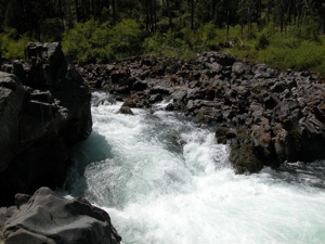
Little Illinois River Falls is located in south western Oregon on the Illinois River, in Siskiyou National Forest, just north of Cave Junction, along US-199. This is a very minor waterfall, especially compared to all the many spectacular waterfalls Oregon has to offer. The river is funnelled through a narrow rocky channel, but only drops about 10 feet. It is a scenic site, but not spectacular, and even within Siskiyou there are far more impressive falls. But it is a waterfall, is listed on maps, and is close to a major road.
The waterfall is easy to find. From US-199, head west on Eight Dollar Rd, also known as National Forest Development Road 4201. Follow this road for about 2 miles. The road is paved for all but the last 1/2 mile. A signed parking area for the falls is on the left. From the parking area a trail leads down to the river and to the falls. The trail is not long, but the elevation drop is at least 150 feet.
48.3923N 89.614W Little Falls
Little Falls is a small stream that falls into the Kaministiquia River Gorge, a mile or so downstream of Kakabeka Falls west of Thunder Bay Ontario. It can be reached via the Mountain Portage Trail
This waterfall is probably about 40 feet high, and is probably much more impressive in the spring.
46.3025N 83.5508W Little Rapids
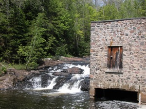
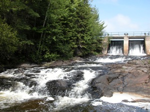
Little Rapids is a small waterfall located in the town of Little Rapids, a few kilometers north of Thessalon. The Little Thessalon river tumbles over a series of small drops, with a total drop of about 4m. There are two distinct sections to the falls, one just below the dam, and the other a short distance downstream by an old hydroelectric plant. There are rough trails between the two along the river banks.
The falls is easy to find. From Thessalon head north on Hwy 129. When 129 takes a big turn to the right, turn left on to Little Rapids Road. You will see the dam on your left in a half kilometer. Before the dam there is a dirt road on the left leading down to the Ken McColman Fish Hatchery. There is a sign. You can park here and see the lower part of the falls, and then walk upstream to the dam. You can also park by the dam and work you way downstream.
| [A-B] | [C-G] | [H-L] | [M-O] | [P-S] | [T-Z] |
This page has been accessed
10755 times.
Last Modified:
Saturday, 18-May-2019 21:33:12 MDT.


