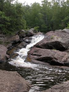
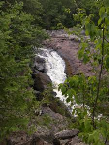
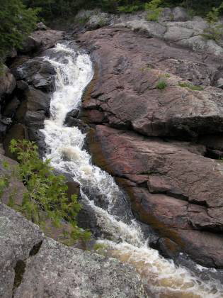
Foster Falls is located in a fairly remote location 6 miles north of Upson Wisconsin. According to one site this is the tenth highest waterfall in Wisconsin, and is 25 feet high. I do not think that is correct as the list does not include at least three Wisconsin waterfalls that are 25 feet high or higher. I also am not entirely sure that what I visited was Foster Falls. The waterfall was right where people say Foster Falls is supposed to be, but it did not seem big enough. I believe this might because I saw the falls in lower water. Apparently the Potato River splits with the eastern branch going over a steep drop and the western branch going down a more gentle cascade. I think in July the eastern branch was dry. The main drop in the western branch looked closer to 10 feet high than 25 feet high to me. This is a wild waterfall with no fences or barriers of any kind. You can clamber about on the rocks as much as you like. You can even pick up a rock or two and take it home with you.
To reach this waterfall head north on 122 from Upson, or south on 122 from Saxon. Head west on Sullivan Fire Lane. This is a dirt road, but it is well maintained. Sullivan Fire Lane is about 6 miles north of Upson and 5 miles south of Saxon. Go just about 3 miles on Sullivan. Just before the road starts to look like a two track, there is a short side road to the right which leads to a turnaround. Park here. You will be able to hear the falls, which are a short walk to the right.
You can also reach this falls from the west. The main reason to do this is to see Wren Falls on the way. From Highway 169 take Vogues Road east. The road curves around to the south and eventually back west. At about 3.6 miles take a left on the connector with Casey Sag Road. Continue west on Casey Sag, taking the left fork, until you reach the dead end at the river upstream of the falls.
[Lake Superior] [Ashland & Iron Counties] Nearby Falls
There are a lot of waterfalls in this area. Wren Falls is about 3 miles to the west. Unfortunately Sullivan Fire Lane does not cross the river, so it is a long trip to Wren Falls if you came in from 122. Potato Falls are downstream. By car they are 17 miles away. The small Upson Falls are in Upson. If you head north on 122 for 10 miles it will take you straight to Superior Falls.
Photo Gallery
 |
 |
This page has been accessed
70198 times.
Last Modified:
Wednesday, 05-Jul-2017 21:33:32 MDT.


