


Laurel Falls is located in the Laurel Snow State Natural Area outside of Dayton. The nature area features both Laurel Falls and the smaller Snow Falls, plus an old coal mine, the remains of the old Dayton Reservoir, and lots of scenery. Just outside of the nature area you can find Gooch Creek Arch.
The trail to Laurel Falls follows Richland Creek upstream, and starts out flat and level as it follows an old road left over from the coal mining days. After a mile, just before the old reservior, the trail climbs a bit and becomes much narrower. Another 1/4 mile or so takes you to a bridge over Laurel Creek. The final segment of the trail is a steep climb with several switchbacks to the base of Laurel Falls. The trail can be a little hard to follow in spots, and at one point you have to climb through a hole in the rocks.
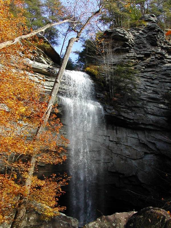
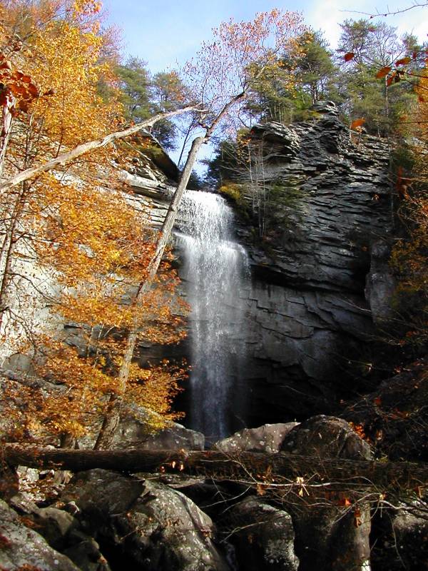
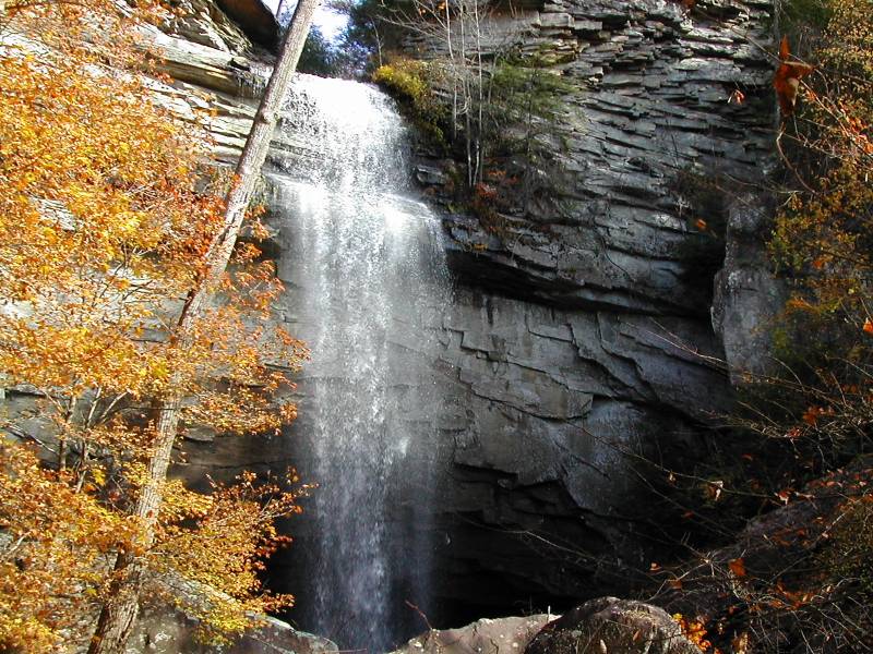
The falls is an 80 foot plunge, followed by a long series of cascades whose total drop must be a few hundred feet. The final cascade is pictured below. With some effort you could probably get a look at some of the others.
The natural area is located off of US 27 in Dayton. From US 27 head west on Walnut Grove Road. This is a paved road. Follow this for 3/4 mile and take a left onto Back Valley Road. Follow this for about .7 miles and take a right onto an unmarked dirt road (Richland Creek Road). There will be a church on the opposite side of the road. The dirt road is a mile long and ends at the trail head.
Walnut Grove Road is about 1.5 miles north of the US 27/Hwy 30 Junction, and about 14 miles south of the US 27/ Hwy 68 Junction. If you are coming from the north, Walnut Grove Road is the first light after the Hwy 68 Junction.
Snow Falls is nearby, but it is an 8 mile round trip hike, and requires crossing Richland Creek. I have seen the height of Snow Falls listed at 35' and 12'. A picture and other information can be found here.
[Cumberland Plateau] Nearby Falls
Tennessee's Cumberland plateau has a lot of waterfalls. Snow Creek Falls is a few miles away. Piney Falls and another Laurel Falls are about 25 miles to the north. Fall Creek Falls, Cane Creek Falls and the other falls of Fall Creek Falls State Park are only about 30 miles away on Hwy 30.
Other Websites
Photo Gallery
 |
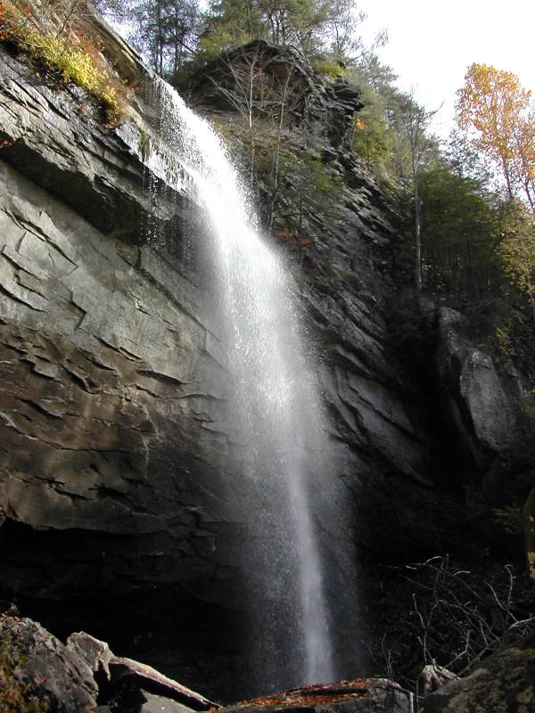 |
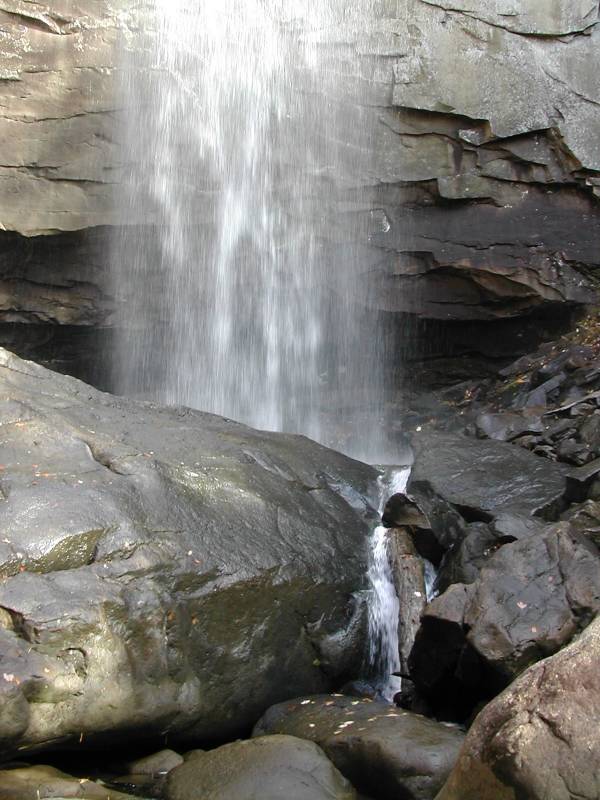 Base of Falls |
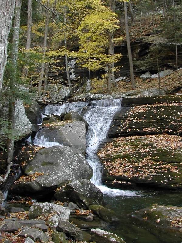 Final Cascade |
 |
|
This page has been accessed
85489 times.
Last Modified:
Tuesday, 05-Feb-2013 18:02:44 MST.