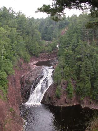
Superior Falls is located on the Montreal River just a few hundred yards from Lake Superior. The Montreal River forms part of the border between Michigan and Wisconsin so the falls is technically in both states, but it is most easily visited from the Michigan side. I do not know if it can be visited from the Wisconsin side.
This is an impressive waterfall consisting of several drops and some very dramatic gorge walls. Unfortunately there is a dam a short distance above the falls and most of the water is diverted for power generation. The power company is required to maintain at least 20 cubic feet of water per second flowing over the falls. Early spring is the best time to see the falls. I do not know how much water was flowing the day I saw the falls, but I have seen pictures with much less water.
Superior Falls is off of Hwy 122 north of US 2. The US 2 and Hwy 122 junction is in Wisconsin, but you will cross into Michigan. About 1/2 mile past the Michigan border turn left on to the gravel road that leads to the parking lot. There is a sign saying "Superior Falls". Northern States Power operates the Superior Falls Hydro plant and keep the area open to the public.
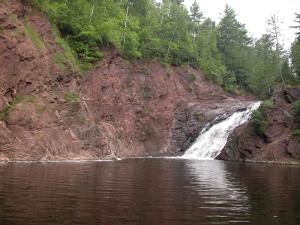
From the parking lot you can head to the left for a nice scenic view of the final drop (65 feet). You can see some of the upper falls as well from here. The fence is a bit frustating and often blocks your view, but it also will save you from a long, long fall into the gorge. The overlook is at the top of the gorge wall pictured below.
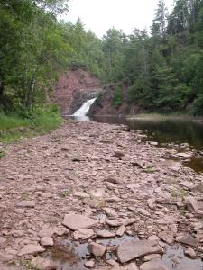
There is a wide grassy trail that leads farther upstream. From here you can find a relatively safe way down to the level of the top of the final drop. This is not a maintained trail, but it gets a lot of local traffic. From here you can get a good look at the upper drop (20 feet), a bunch of rapids above that, and the dam above that. It looks like the dam may have been built on the edge of another sizable drop.
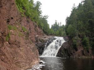
Local kids jump off the ledges here into the deep plunge pool between the two main drops. I wonder if the local moms know about this? If you look carefully at the picture below you can see one of the kids in the upper right corner.
From the parking lot there is also a paved trail that descends steeply down to the river and lake. Superior Falls is very close to the lake. You can look at the falls, and then turn around and look at the lake. Once at the bottom you can walk upstream for some closer views of the final drop. There is a well beaten path that goes behind the power house. The cliffs and rocks at the base of the falls are really spectacular. Just hope they do not open the dam while you are back there. :)
[Lake Superior] [Ashland & Iron Counties] Nearby Falls
There are a lot of waterfalls in this area. Saxon Falls is upstream on the Montreal River and is just a short drive away, but is not as visitor friendly. To reach Saxon Falls from Superior Falls, head south on 122. Take a left onto County Rd B (this is north of US 2). Head east until B takes a sharp right. There will be a gravel road to the left and a sign saying Saxon Falls flowage. Interstate/Peterson Falls are farther upstream. Potato Falls is about 15 miles away. Copper Falls State Park and the Black River Scenic Byway are both within 50 miles. This map shows the location of many nearby waterfalls.
Photo Gallery
 July 2004 |
 July 2004 |
 |
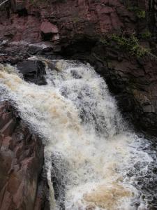 The upper drop |
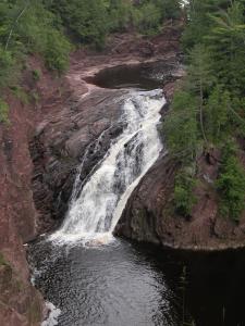 Look carefully for the jumper |
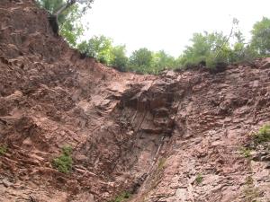 The gorge wall |
This page has been accessed
147332 times.
Last Modified:
Saturday, 03-Oct-2009 21:20:15 MDT.


