


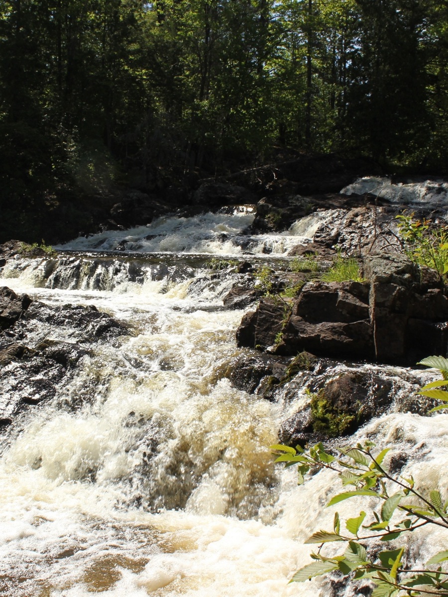
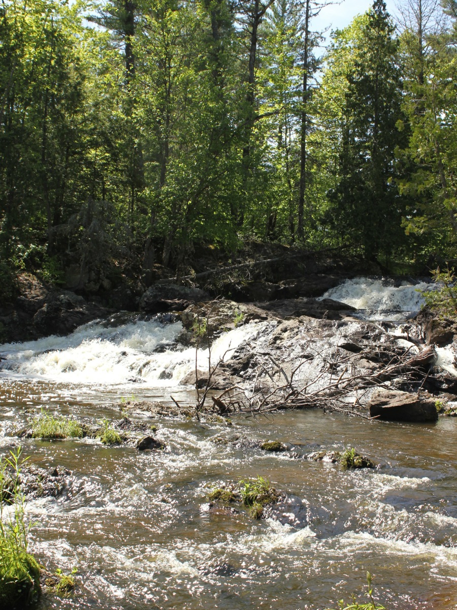
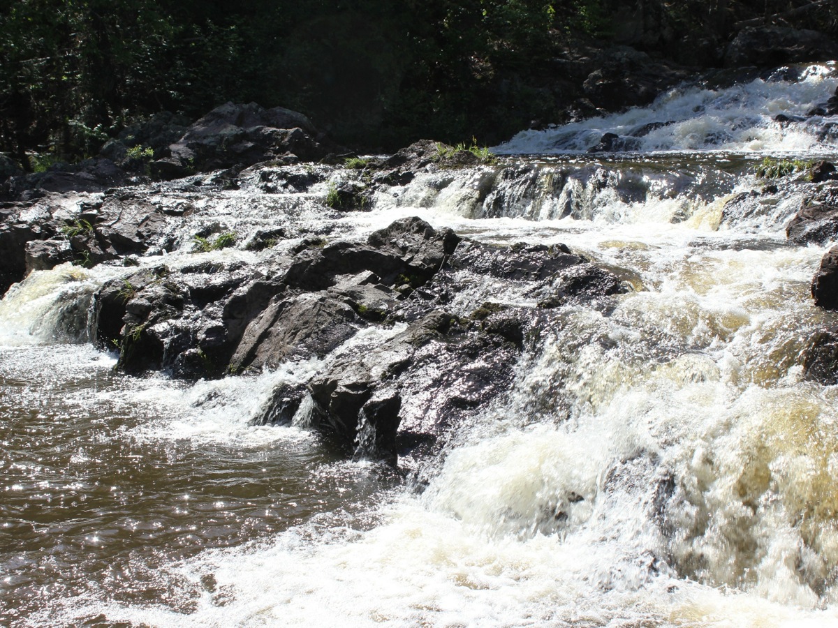
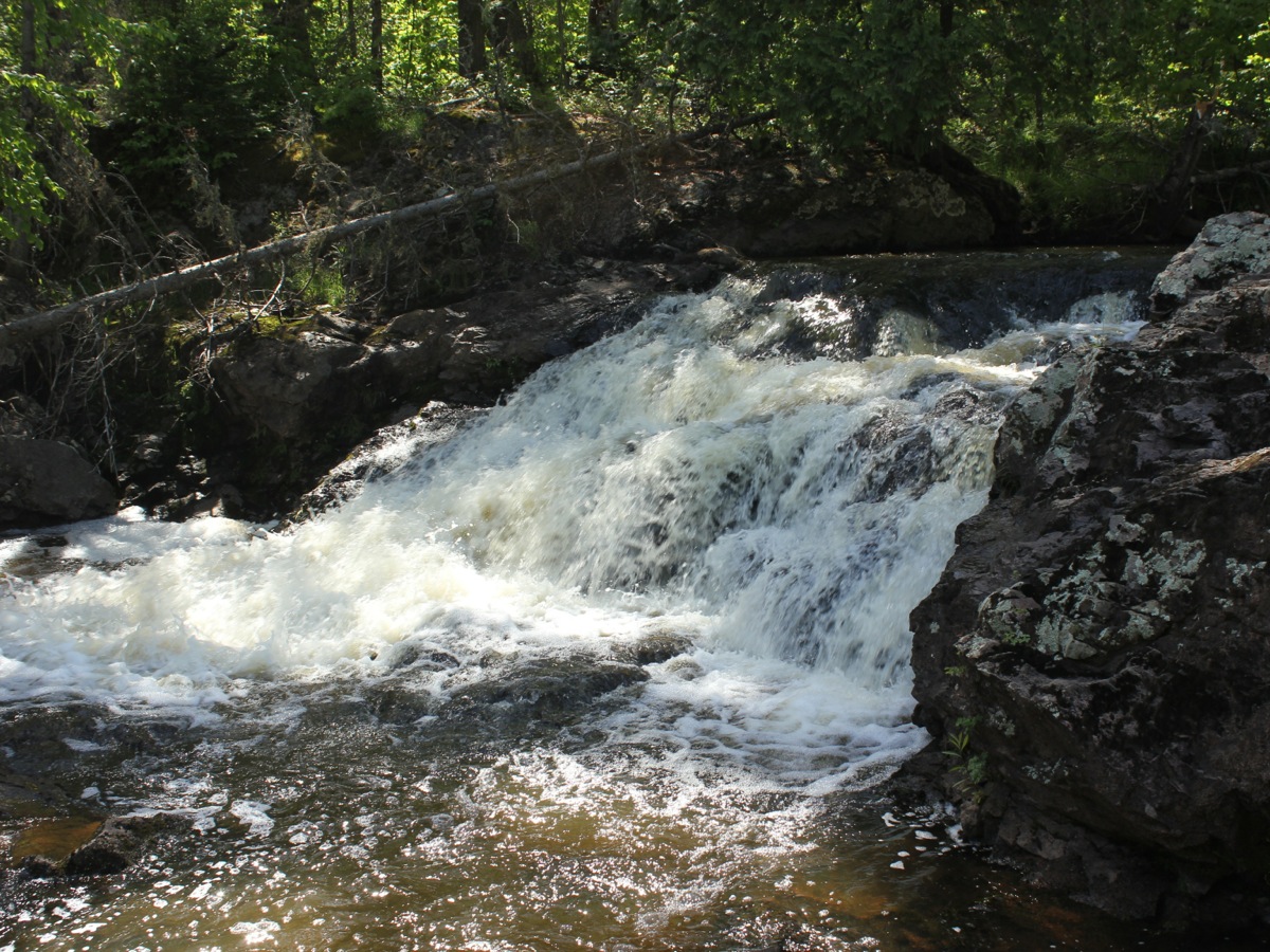
Cascade Falls is a wild waterfall located in Ottawa National Forest. Cascade Creek tumbles over a series of steps on its way down to the West Branch of Ontonagon River. The individual steps are at most 6' in height.
To reach the falls from M28 head north on Forest Road 400, which is 1.3 miles east of Bergland. Forest Road 400 is unpaved, but easily manageable by a regular car. Follow 400 for 7.3 miles. Take a right on to a side road. There is a sign. Follow this road for .3 miles to the end and park.
The trail to the fails is a mile plus. The main trail has some ups and downs. If you are looking for some more exercise, there is the more difficulat Bluff Trail that branches off from the main trail and rejoins it before the falls. The trail ends near the top of the falls. There are no established viewing areas, and you are free to clamber around the rocks to get different views of the falls. It is hard to get a look at the entire waterfall at once.
The trail ends on the north side of the creek, and the falls will be to your south west. I visited the falls on a sunny afternoon when the sun was behind the falls, that made it a challenge to photograph.
[Lake Superior] Nearby Falls
There are a number of waterfalls in this part of Michigan. The big scenic falls Agate Falls is 33 mile drive to the east, and Bond Falls is 38 miles. Manabezho Falls in the Porcupine Mountains is 45 miles to the west. The small Bonanza Falls is a 25 mile drive away.
Photo Gallery
 |
 |
 |
 |
This page has been accessed
25995 times.
Last Modified:
Wednesday, 05-Jul-2017 18:10:16 MDT.