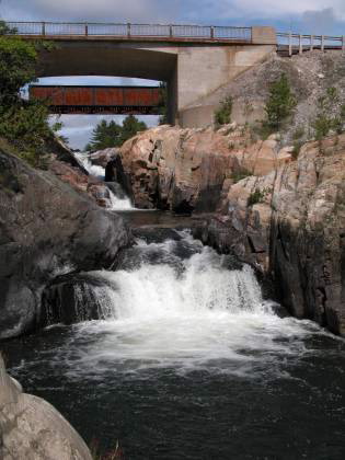
Whitefish Falls is just off of Hwy 6 north of Manitoulin Island. This is a small waterfall consisting of several drops with a total drop of about 30 feet. There used to be a powerplant of some sort here. Just the ruins remain.
There is a sign for Whitefish Falls Rd on Hwy 6. There is a small park just off of the road. From here you can walk over the rocks to the falls. It is not easy to get a good view of the falls unless you are willing to get your feet wet. There are "No Trespassing" signs on the other side of the river where the ruins are.
Note that Whitefish Falls meets Hwy 6 twice. The small park is on the north side.
Nearby Falls
If you continue south on Hwy 6 you will soon be on Manitoulin Island where you can find Bridal Veil Falls and High Falls. Chutes Provincial Park is to the northwest on the mainland.
This page has been accessed
55715 times.
Last Modified:
Thursday, 08-Oct-2009 18:09:43 MDT.


