


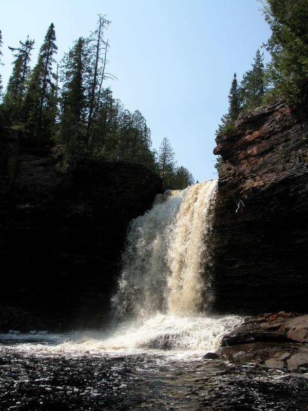
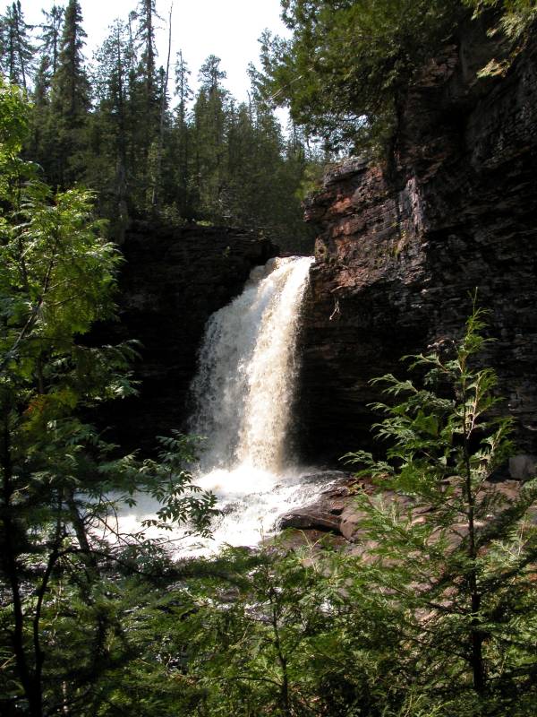
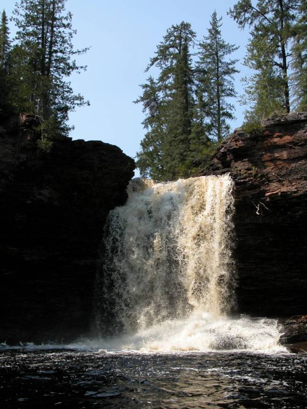
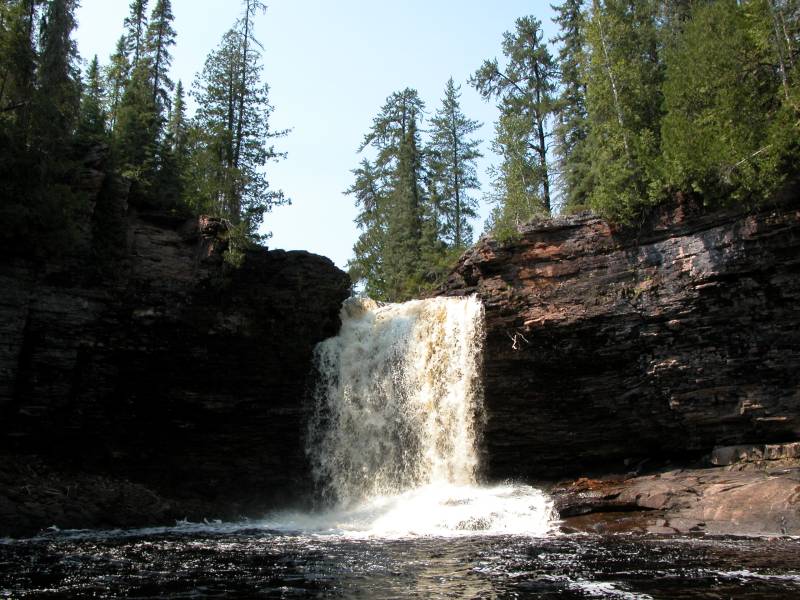
The Wolf River Falls is in a remote location outside of the small town of Dorion, along Highway 17. It is a pretty waterfall, and one of the few real plunge waterfalls in the entire Lake Superior watershed area.
There are no signs leading to this waterfall, and it does not appear to be well known even among the locals. A picture of it does show up in a Lake Superior Circle Tour guide book, but there are no directions. To get to there from 17, take Fish Hatchery Road west. This is a good dirt road, so you can take a normal car on it with little worry. Follow Fish Hatchery Road for 4 miles. There will be three right turns, but the road signs clearly indicate which road is Fish Hatchery Road.
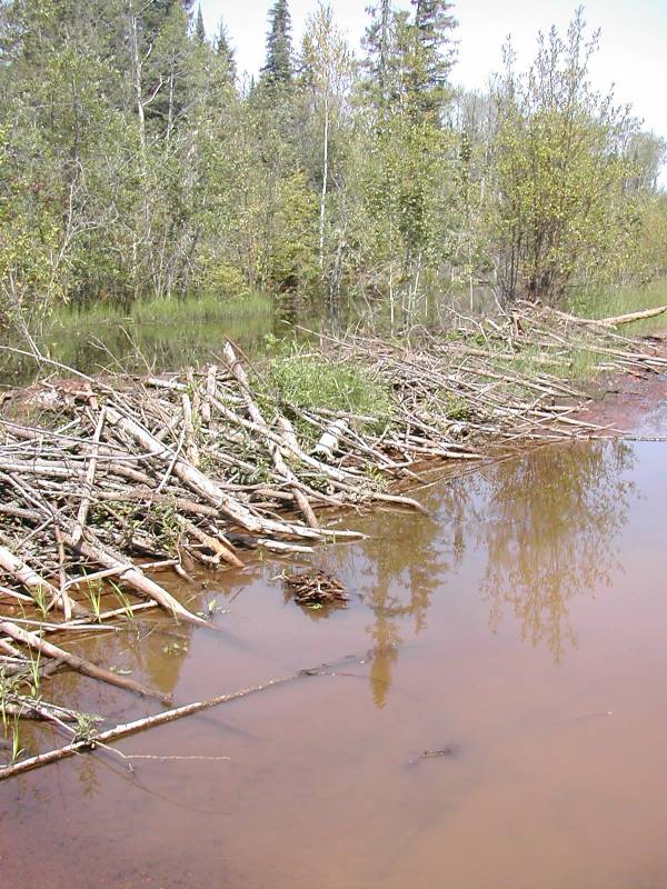
After 4 miles, take a right onto Wolf Lake Road. The road becomes a little rougher, but you will still be able to make good time. This is a logging road, but I do not know how active it is. Follow this road for 12 miles. You will pass Wolf Lake, and cross three bridges. Right after the third bridge (which crosses the Wolf River), take the "road" to the right. This is a simple two track, but it is in surprisingly good condition. Follow this for 1.4 miles (If you go down a hill and reach the Beaver Dam, you have gone too far). The "trailhead" is at a point where the road bends to the left. The road is wider at this point, and there is space to park on the right. There are no signs (we left one behind, but apparently it did not survive).
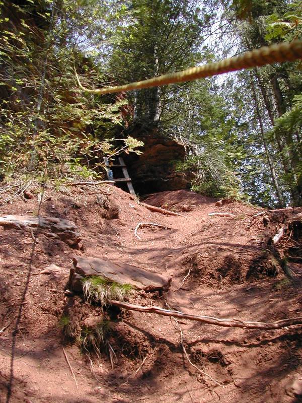
The trail is to your right, and goes down to the rim of the gorge. When you reach the rim, take a left. After at most a 1/2 mile, you will see a spot where people have descended into the gorge. It is a steep, natural stairway. This only gets you part of the way down. The trail continues to the left and right. The right will lead you to the top of the falls. The left will lead you to a simple wooden ladder and some ropes that will help you make your descent into the gorge. This is not trivial, but does not require any extraordinary skill.
Once you are at the base of the falls, you can walk right up to them, or even behind them if you are willing to get wet. You will likely have this waterfall all to yourself, so enjoy.
I have also seen this falls referred to as "Red Rock Falls". The trail head now shows up on Google Maps. It has been many a year since I visited, so maybe the signage at the falls is better than it was.
[Lake Superior] Nearby Falls
This is one of the more adventurous and remote stops on the Lake Superior WaterFall Tour. The Geographical Names of Canada lists an Upper and Lower Falls both downstream of Wolf Lake on the Wolf River. They are only about 4 miles west of Highway 11/17 and from the looks of it, Fish Hatchery Road will take you very close to these falls, but I have no idea if they are on public land or if they are worth visiting. There is also a Venice Falls, which is also located on the Wolf River where it enters Venice Lake.
Photo Gallery
 August 14, 2003 |
 August 14, 2003 |
 August 14, 2003 |
|
This page has been accessed
78257 times.
Last Modified:
Saturday, 18-May-2019 18:40:18 MDT.