


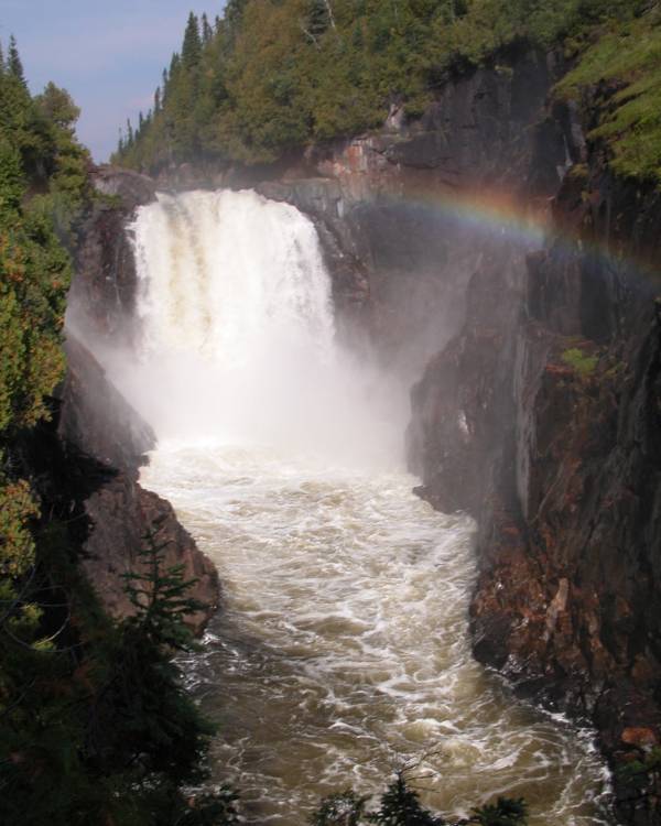
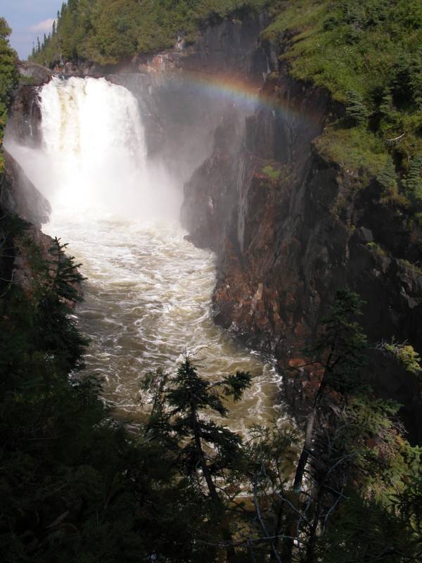
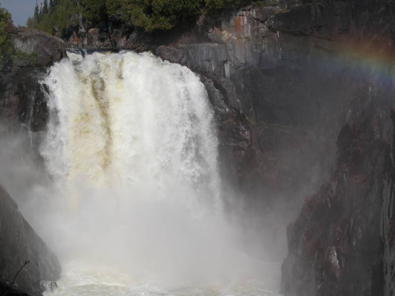
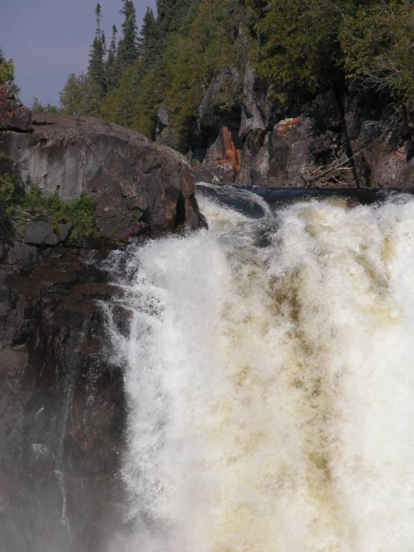
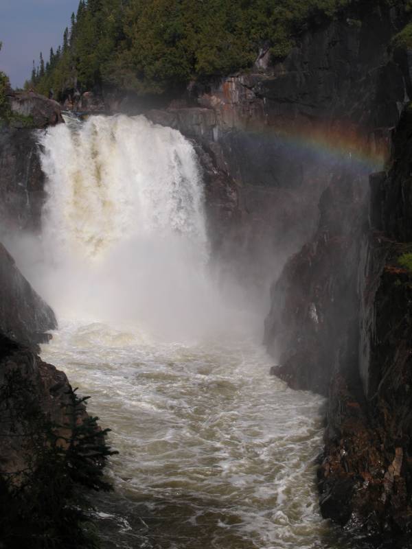
Umbata Falls is a large, isolated and very beautiful waterfall along the White River. The White River is aptly named and features a large number of rapids and small waterfalls of which Umbata Falls is by far the largest. Umbata Falls is around 100 feet high. I have seen claims that it is 100 m high, but this is just English/Metric confusion. It is still a big, impressive and wild waterfall.
Reaching this waterfall is a bit of a challenge. A common way for people to visit this falls is to canoe the White River. This is a several day affair and requires some skill. An accidental trip over Umbata Falls would surely be fatal, and there are many other dangerous rapids along the way.
You can also hike or bike to the falls. I biked (thanks to the MSU Bike Project for helping get some bikes in shape for the trip). There is an old utility road that leads to some power lines a mile below the falls. The road is gated and is closed to motor vehicles, but it is in pretty good shape. There are some steep grades and rocky sections but large stretches of the road are smooth and level. It is around 15 miles one way to the falls. I covered this distance in 3 hours. A regular biker could probably do it in 2 hours. Before reaching Umbata you will also pass Stash Rapids, Oil Can Rapids and the impressive Take-out Rapids.
The access road starts at Highway 17 about 3 miles west of Lake Rouse and 9 miles east of the bridge over the Pic River. The road is not marked at all and is very inconspicuous looking from the highway. The gate is just a short distance from the highway where the road crosses the railroad tracks, but is not visible from the highway. Here is some help from MapQuest.
I learned about the access road from the Friends of Pukaskwa. The falls is only a few kilometers outside of the boundaries of Pukaswka National Park. Pukaskwa is a nice place to stay, and has many sights of its own to see including waterfalls, although many require hikes or canoe trips of several days. The rangers there know about Umbata falls and can give you directions. It seems that few of the folks in Marathon even know about this waterfall so you might not get much help from the locals in town. They can help you find Mink Creek Falls however.
Sadly a hydroelectric plant is scheduled to be built here starting in 2005. It will be a "run of the river" operation so the falls and gorge will be left untouched, but much (all?) of the water will be diverted. The result is that Umbata Falls may end up looking like Aguasabon Falls in late summer instead of the raging torrent seen on this page. It may be that after Fall 2004 the only time to see the true beauty of this waterfall will be in the spring. You can read all about the details of the hydro project here. Ironically the project may result in easier access to the falls.
This is a wild waterfall in more ways than one. On the way in we saw two bears. One was quite large and for a short while it was not clear if he was going to let us by or not. On the way out we saw a lynx. There are also wild raspberries and blueberries beyond count. People are much scarcer. Part of the research for the proposed hydroelectric project included a survey of visitors. Less than 200 people visited the area in the summer of 2004 and only 50% of them actually visited the falls. 200 people visit Niagara every second. :)
Here are a couple of short movies of Umbata falls.
I do not know where the name Umbata comes from. The Ojibwa name for the falls is Gitchi Kaajiwaana.
[Lake Superior] Nearby Falls
The White River has a large number of rapids and smaller falls. Chigamiwinigum Falls is one of the more interesting and easier to reach. Between Umbata and Chigaminwinigum you will find Twin Rapids and Hook Falls. Along the remote coastline of Pukaskwa you will find Cascade Falls, Schist Falls and Swallow River Falls. The much easier to visit Mink Creek Falls is just off of Highway 17 11 miles west of Marathon. There are also falls on the Black River south of Highway 17.
Photo Gallery
 |
 |
 |
 |
 |
 |
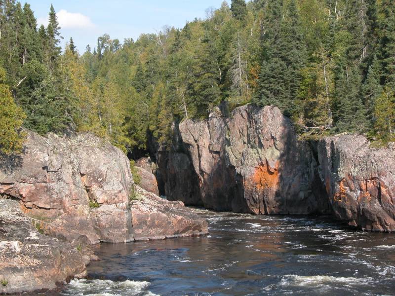 The Mouth of the Gorge |

Looking into the Gorge |
 A Bear |
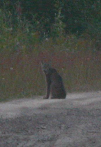 A blurry lynx |
This page has been accessed
55412 times.
Last Modified:
Friday, 02-Mar-2012 06:43:13 MST.