


Brush Creek Falls is located in the Brush Creek Nature Preserve, an 124 acre area by the confluence of Brush Creek and the Bluestone River.
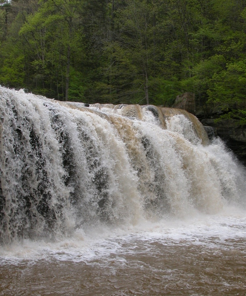
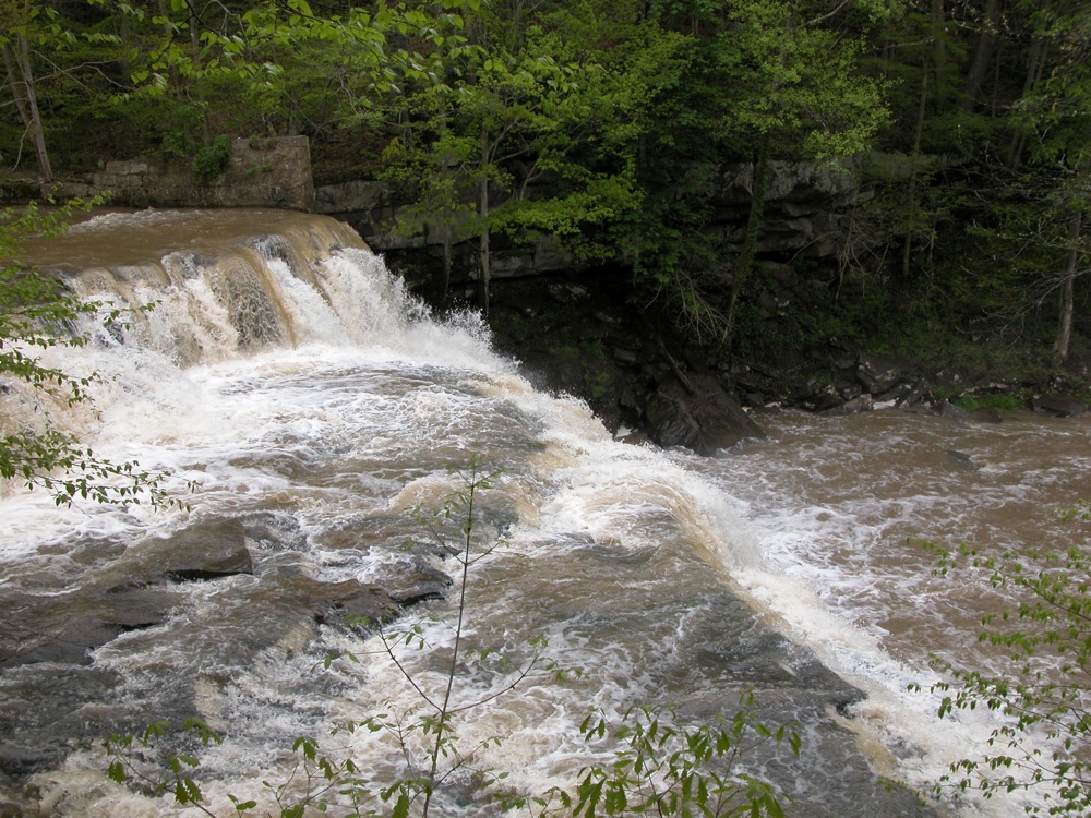
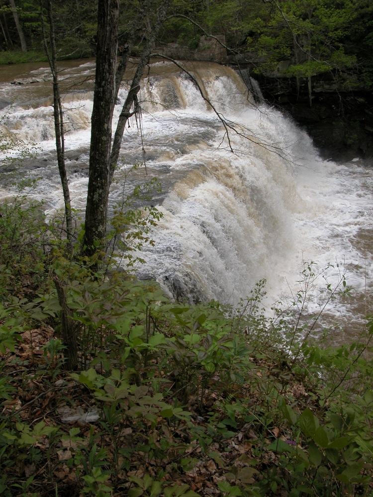
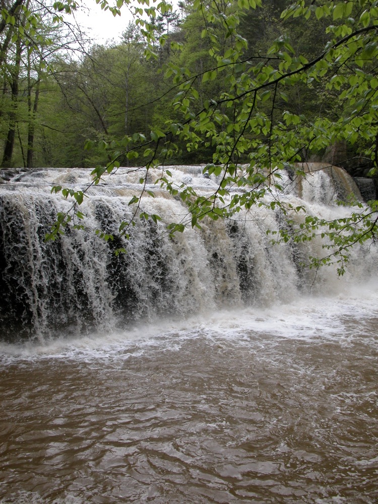
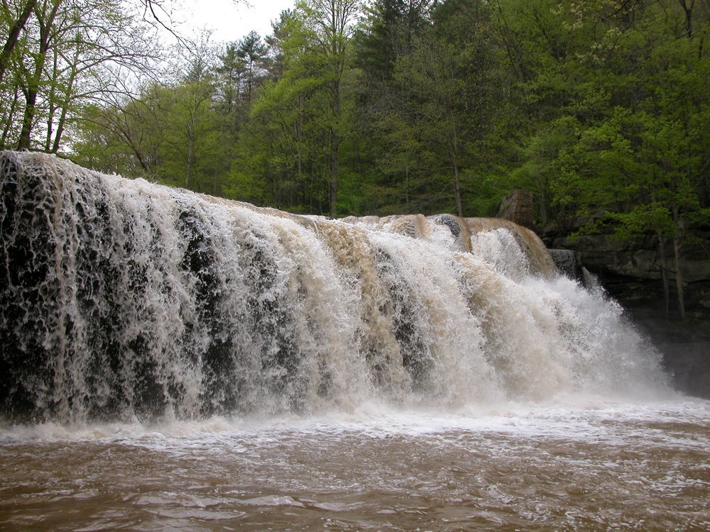
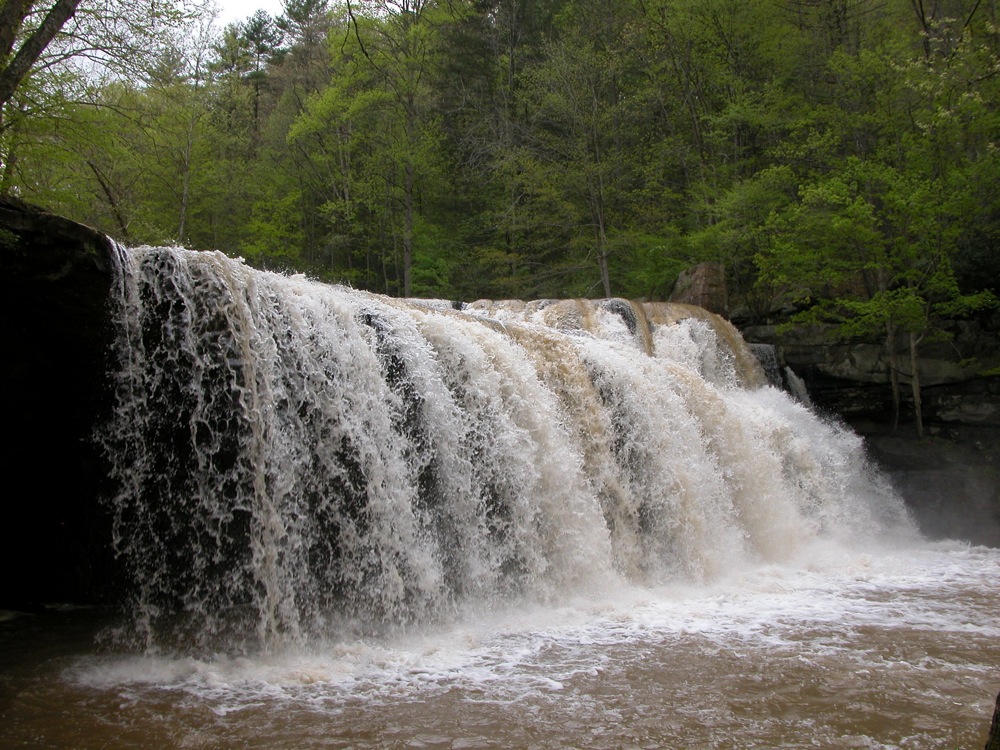
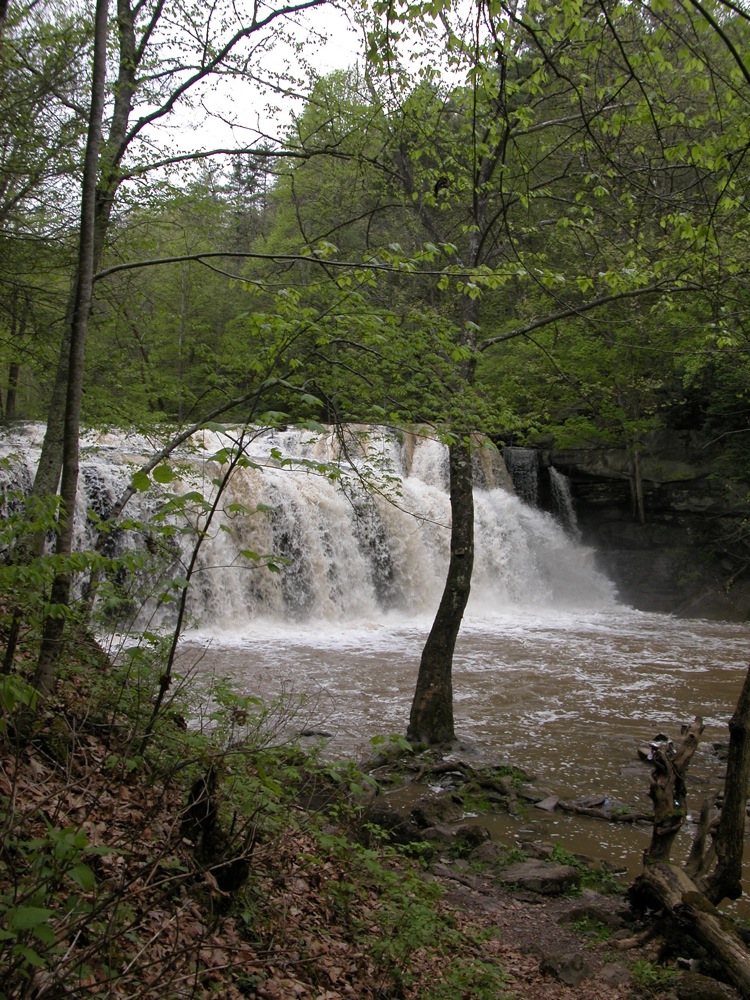
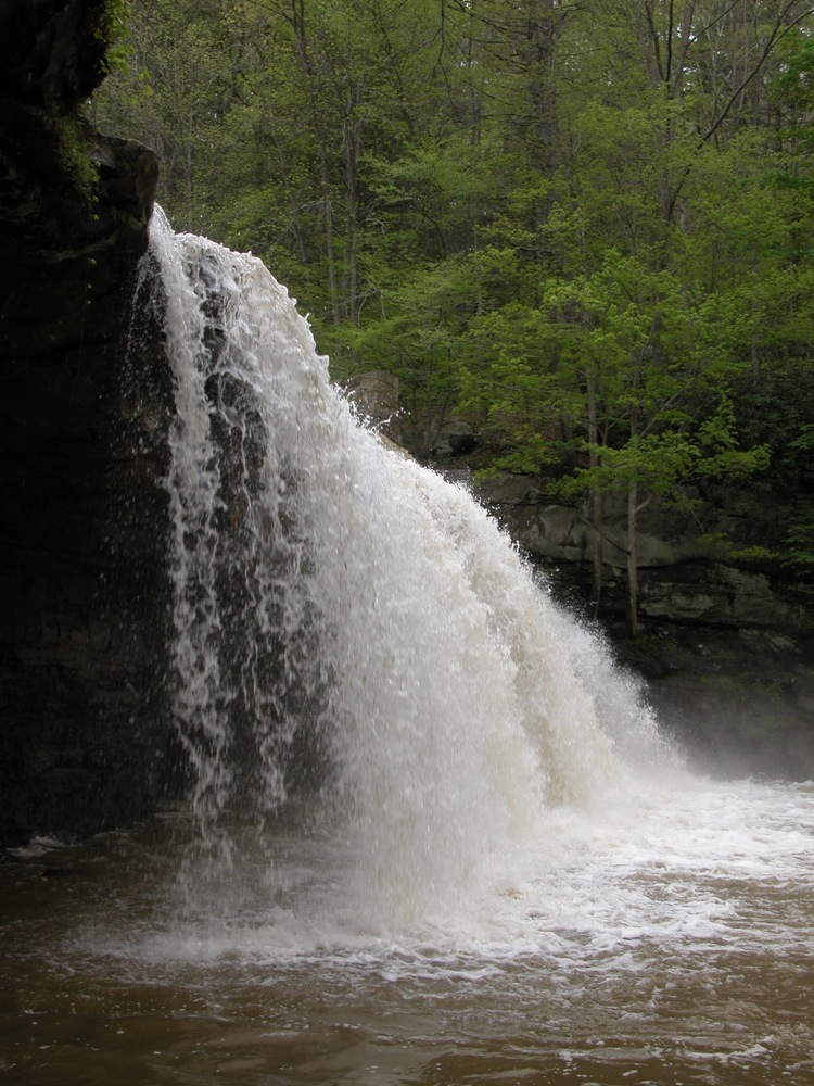
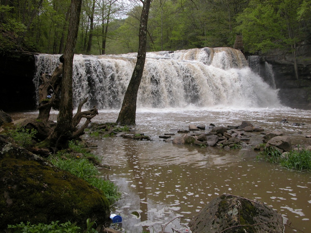
Brush Creek Falls drops 25'. The creek is 50+ wide, depending on water levels. The photos on this page show the falls after several days of rain. Typically the amount of water here will be much less. This is a very accessible falls. You can walk up to the brink of it and down to the base. In low water levels you might even be able to get behind parts of the falls.
The preserve is located along Camp Creek Speedway Road, aka Brush Creek Falls Road. There is a parking area, and a small pavilion and picnic table. An old road serves as a trail to the falls, which is about 1000' from the parking area.
The downside of the accessibility of this falls is that it is a popular party spot. There is usually a lot trash, particularly beer cans, around the falls.
The falls is close to US-77, but the highway passes high above the river valley. To reach the falls from US-77, take exit 20 onto US 19. Head south, and immediately turn east onto Pincy Flat Road (at least that is what Google Maps names it). This road crosses under US-77. Take a right onto Eads Mills Road. Take a right after about 1.5 miles, and cross under the highway again. After about a half mile, this road crosses under the highway again. Shortly after that Brush Creek Falls Road will be on the left. The parking area is a quarter mile past that.
From Route 20, which is about 3 miles east of the US-77, you can turn west on to Brush Creek Falls Road, and follow this to the falls.
Nearby Falls
There are a lot of falls in this area. If you continue on the trail a mile past Brush Creek Falls you will reach the smaller White Oak Creek Falls. Back at the US-77 exit, you can head north to reach Campbell Falls and the small Mash Fork Falls. Back along Route 20, if you head north you can find Indian Branch Falls and Pipestem Falls.
Photo Gallery
 |
 |
 |
 |
 |
 |
 |
 |
This page has been accessed
76651 times.
Last Modified:
Thursday, 06-Jul-2017 17:11:08 MDT.