


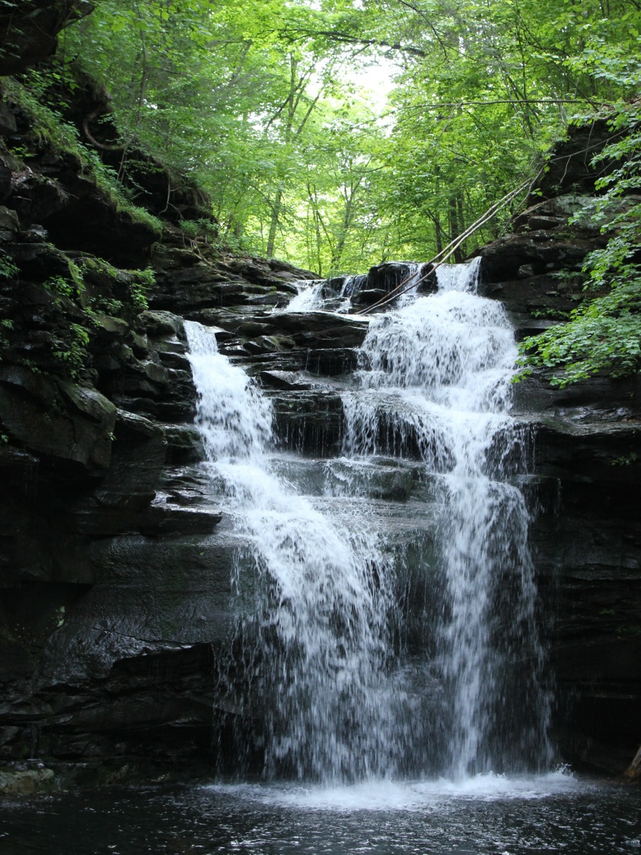
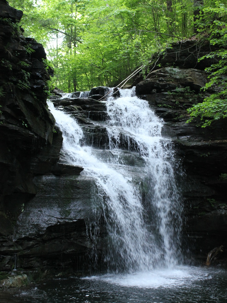
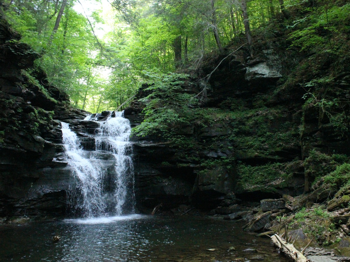
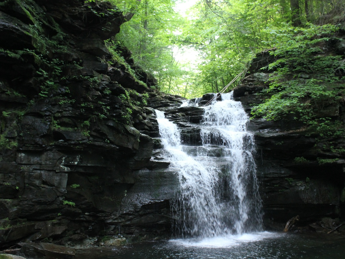
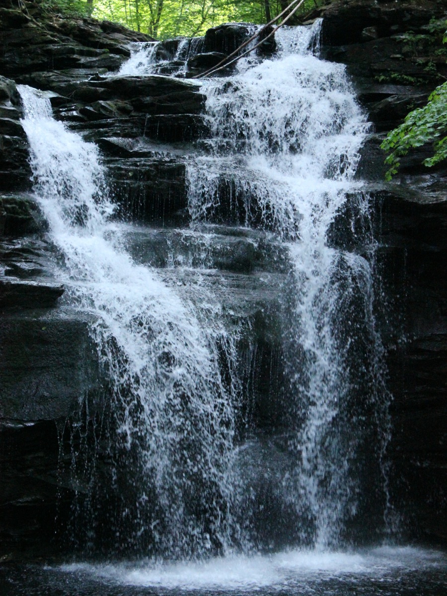
Big Falls is a wild 25' falls on Heberly Run located in State Game Lands 13. This is the largest falls on Heberly Run, hence the name. The waterfall is located in a deep gorge, about a half mile from where Heberly Run joins the East Branch of Fishing Creek.
Reaching this waterfall is a bit of a challenge. Actually it is not too hard except for the last 100 yards or so. A forest road follows along side Heberly Run, but it passes high above Big Falls. You can hear the falls from the road, but you cannot see it. To see the falls you have to scramble down a steep, wooded slope. To add to the challenge there is loose rock and mucky sections to contend with. This is not a hike for the very young or old.
Big Falls is only 3.5 miles away from Ganoga Falls as the crow flies. I visited both falls on the same day. There were at least 50 people at Ganoga Falls when I was there, and probably that many people visited it every hour that day. Nobody else was at Big Falls, and perhaps nobody else had been there all day.
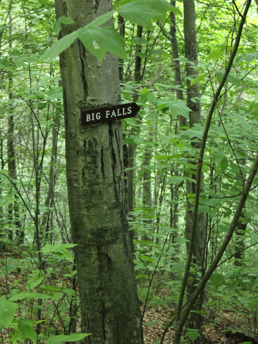
The falls are located along Grassy Hollow Road. This is a rough road, but makes for easy hiking. Grassy Hollow Road is gated at times. From the gate, hike .6 miles. You can hear the falls from the road, but you cannot see them from the road. Fortunately someone has hung a sign on a tree letting you know where to leave the road.
To reach the trailhead from Route 118, head west from Red Rock for 4.6 miles and take Central Road north. That is the name of the road according to Google maps, but I do not recall seeing an actual road sign that said 'Central'. Follow this winding road for about 1.7 miles and take a right onto Jamison City Road. Follow this road for 1.0 mile. At this point you will find Market Street on your right, which crosses a bridge. This is the road to Sullivan Falls. Do not turn on to Market Street, but continue straight. The pavement will soon run out, and the road gets a bit rough. The gate is another 1.2 miles way. There is a parking area at the end, but there is another one a bit earlier, which you might want to stop at if you do not have a rugged vehicle.
If you are already at Ricketts Glen, from the main park entrance, head north on Route 487 and take the first road on your left. This is just a few hundred feet north of the park, and the road sign says "Sullivan Falls Road". Follow this road for for 3.4 miles, taking a right to cross the bridge. This is Market Street. Take the next right, and follow it to the trailhead.
Nearby Falls
The much easier to visit Twin Falls is .7 miles upstream, and Lewis Falls ia another .4 miles beyond that. The larger 36' Sullivan Falls is a five mile drive away, but less than a mile away as the crow flies. It is possible to hike up Heberly Run, and then hike down Sullivan Run and see 8 or so falls of various sizes. Ganoga Falls and the many falls of Ricketts Glen are a 5 mile drive away.
Photo Gallery
 |
 |
 |
 |
 Sign marking the falls |
 Start of the hike |
This page has been accessed
27905 times.
Last Modified:
Sunday, 16-Aug-2015 11:11:31 MDT.